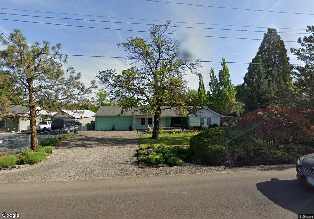
1575 Roberts Rd Medford, OR 97504
Estimated Value: $409,000 - $472,000
3
Beds
1
Bath
1,959
Sq Ft
$221/Sq Ft
Est. Value
About This Home
This home is located at 1575 Roberts Rd, Medford, OR 97504 and is currently estimated at $432,090, approximately $220 per square foot. 1575 Roberts Rd is a home located in Jackson County with nearby schools including Wilson Elementary School, Hedrick Middle School, and North Medford High School.
Ownership History
Date
Name
Owned For
Owner Type
Purchase Details
Closed on
Jun 7, 2011
Sold by
Ringo Alan C and Ringo Virginia A
Bought by
Ringo Alan Clay and Ringo Virginia Anne
Current Estimated Value
Purchase Details
Closed on
Jun 17, 2003
Sold by
Ringo Alan C and Ringo Virginia
Bought by
Ringo Alan C and Ringo Virginia A
Home Financials for this Owner
Home Financials are based on the most recent Mortgage that was taken out on this home.
Original Mortgage
$40,350
Interest Rate
5.53%
Mortgage Type
Unknown
Create a Home Valuation Report for This Property
The Home Valuation Report is an in-depth analysis detailing your home's value as well as a comparison with similar homes in the area
Home Values in the Area
Average Home Value in this Area
Purchase History
| Date | Buyer | Sale Price | Title Company |
|---|---|---|---|
| Ringo Alan Clay | -- | None Available | |
| Ringo Alan C | -- | First American Title Ins Co |
Source: Public Records
Mortgage History
| Date | Status | Borrower | Loan Amount |
|---|---|---|---|
| Closed | Ringo Alan C | $40,350 |
Source: Public Records
Tax History Compared to Growth
Tax History
| Year | Tax Paid | Tax Assessment Tax Assessment Total Assessment is a certain percentage of the fair market value that is determined by local assessors to be the total taxable value of land and additions on the property. | Land | Improvement |
|---|---|---|---|---|
| 2025 | $3,285 | $226,500 | $107,980 | $118,520 |
| 2024 | $3,285 | $219,910 | $104,840 | $115,070 |
| 2023 | $3,184 | $213,510 | $101,790 | $111,720 |
| 2022 | $3,107 | $213,510 | $101,790 | $111,720 |
| 2021 | $3,027 | $207,300 | $98,830 | $108,470 |
| 2020 | $2,963 | $201,270 | $95,960 | $105,310 |
| 2019 | $2,892 | $189,720 | $90,460 | $99,260 |
| 2018 | $2,818 | $184,200 | $87,830 | $96,370 |
| 2017 | $2,768 | $184,200 | $87,830 | $96,370 |
| 2016 | $2,786 | $173,640 | $82,800 | $90,840 |
| 2015 | $2,678 | $173,640 | $82,800 | $90,840 |
| 2014 | $2,631 | $163,680 | $78,040 | $85,640 |
Source: Public Records
Map
Nearby Homes
- 1588 Nordic Ct
- 1448 Carolyn Cir
- 1512 Nordic Ct
- 2217 Jubilant Ave
- 2481 Northcrest Cir
- 1744 Concord Way
- 3626 Ford Dr
- 1220 Morrow Rd
- 1212 Morrow Rd
- 1202 Morrow Rd Unit A
- 2058 Roberts Rd
- 2000 Brookhurst St Unit 2
- 2000 Brookhurst St Unit 1
- 2010 Crater Lake Ave
- 2424 Crater Lake Ave
- 2009 Grandview Ave
- 2076 Roberts Rd Unit TL2000
- 2076 Roberts Rd
- 2030 Brookhurst St Unit 28
- 1215 Covina Ave
- 1565 Roberts Rd
- 1593 Roberts Rd
- 2201 Fairbanks St
- 1516 Westin Heights Ln
- 2209 Fairbanks St
- 1702 Yukon Ave
- 1599 Roberts Rd
- 1519 Westin Heights Ln
- 1555 Roberts Rd
- 1512 Westin Heights Ln
- 2081 Serenity Dr
- 2217 Fairbanks St
- 1710 Yukon St
- 1710 Yukon Ave
- 1508 Westin Heights Ln
- 1601 Roberts Rd
- 1580 Roberts Rd
- 2080 Serenity Dr
- 1515 Westin Heights Ln
- 2061 Serenity Dr