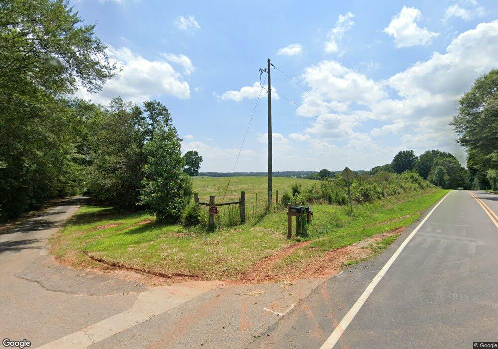
1576 Sanford Rd Nicholson, GA 30565
Estimated Value: $338,000 - $498,389
--
Bed
3
Baths
3,468
Sq Ft
$119/Sq Ft
Est. Value
About This Home
This home is located at 1576 Sanford Rd, Nicholson, GA 30565 and is currently estimated at $411,597, approximately $118 per square foot. 1576 Sanford Rd is a home located in Jackson County with nearby schools including East Jackson Middle School and East Jackson Comprehensive High School.
Ownership History
Date
Name
Owned For
Owner Type
Purchase Details
Closed on
May 20, 2021
Sold by
Palmer John M
Bought by
Palmer Real Property Llc
Current Estimated Value
Purchase Details
Closed on
Feb 3, 2011
Sold by
Palmer Teresa E
Bought by
Palmer Teresa E
Home Financials for this Owner
Home Financials are based on the most recent Mortgage that was taken out on this home.
Original Mortgage
$254,000
Interest Rate
4.76%
Mortgage Type
New Conventional
Purchase Details
Closed on
Sep 22, 1998
Sold by
Palmer John
Bought by
Palmer John Mark
Create a Home Valuation Report for This Property
The Home Valuation Report is an in-depth analysis detailing your home's value as well as a comparison with similar homes in the area
Home Values in the Area
Average Home Value in this Area
Purchase History
| Date | Buyer | Sale Price | Title Company |
|---|---|---|---|
| Palmer Real Property Llc | -- | -- | |
| Palmer Teresa E | -- | -- | |
| Palmer John Mark | -- | -- |
Source: Public Records
Mortgage History
| Date | Status | Borrower | Loan Amount |
|---|---|---|---|
| Previous Owner | Palmer Teresa E | $254,000 |
Source: Public Records
Tax History Compared to Growth
Tax History
| Year | Tax Paid | Tax Assessment Tax Assessment Total Assessment is a certain percentage of the fair market value that is determined by local assessors to be the total taxable value of land and additions on the property. | Land | Improvement |
|---|---|---|---|---|
| 2024 | $2,772 | $110,240 | $22,200 | $88,040 |
| 2023 | $2,772 | $109,080 | $22,200 | $86,880 |
| 2022 | $2,692 | $94,400 | $7,520 | $86,880 |
| 2021 | $2,649 | $93,880 | $7,520 | $86,360 |
| 2020 | $2,903 | $93,880 | $7,520 | $86,360 |
| 2019 | $2,947 | $93,880 | $7,520 | $86,360 |
| 2018 | $3,154 | $98,960 | $7,520 | $91,440 |
| 2017 | $3,167 | $98,547 | $7,020 | $91,527 |
| 2016 | $3,374 | $107,262 | $7,020 | $100,242 |
| 2015 | $3,488 | $107,262 | $7,020 | $100,242 |
| 2014 | $2,986 | $92,880 | $9,486 | $83,394 |
| 2013 | -- | $92,880 | $9,486 | $83,394 |
Source: Public Records
Map
Nearby Homes
- 24 Quail Ridge Dr
- 573 Sanford Dr
- 5044 U S 441
- 520 Old Athens Dr
- 7 Red Rose Rd
- 9 Red Rose Rd
- 5111 U S 441
- 5246 Us-441 S
- 0 Birch St Unit 7627498
- 719 Old Athens Dr
- 0 Berea Rd Unit 10622565
- 10 Red Rose Rd
- 0 Sanford Oak Ct Unit TRACT 11
- 0 Sanford Oak Ct Unit TRACT 12
- 322 Cedar Tree Ln
- 620 Ivy Creek Dr
- 742 Harmony Gates Dr
- 690 Harmony Gates Dr
- 0 Jefferson Dr Unit 7635823
- 0 Jefferson Dr Unit 10588928
- 0 Us Hwy 441 and Hwy 334 Unit 8455463
- 00 Hwy 334 Us Hwy 441 Hwy
- 0 US Hwy 441 & Hwy 334 Unit 6068436
- Hwy 441 Us Hwy 441 & Hwy 334
- 0 Cooper Farm Road (Tract 1) Unit 8424216
- 0 Cooper Farm Road (Tract D) Unit 8424192
- 0 Highway 441 Rd S Unit 8315446
- 0 Highway 441 Rd S Unit 5955807
- 0 Treemont Unit 5953602
- 0 Brockton Rd Unit 5933018
- 0 Brockton Rd Unit 8286422
- Tr 10 Chandler Bridge Rd
- 0 Highway 441 Rd S Unit 7374325
- 0 Highway 441 Rd S Unit 7579108
- 0 Whispering Falls Subdivision Unit 8043196
- 0 Brockton Rd Unit 548 8045559
- 0 Brockton Rd Unit 8050242
- 0 Brockton Rd Unit 546 8050053
- 0 Brockton Rd Unit 565 8056945
- 0 Brockton Rd Unit 547 8056806
