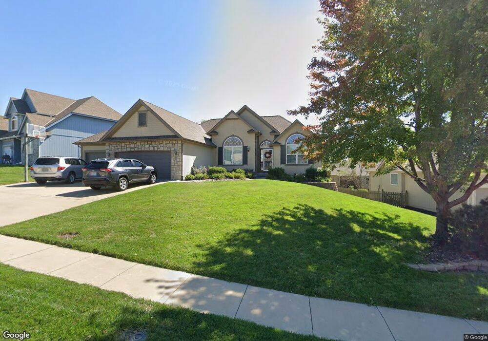
1577 Bernadine Dr Liberty, MO 64068
Estimated Value: $424,503 - $465,000
3
Beds
3
Baths
1,932
Sq Ft
$228/Sq Ft
Est. Value
About This Home
This home is located at 1577 Bernadine Dr, Liberty, MO 64068 and is currently estimated at $440,126, approximately $227 per square foot. 1577 Bernadine Dr is a home located in Clay County with nearby schools including Alexander Doniphan Elementary School, Liberty Middle School, and Liberty High School.
Ownership History
Date
Name
Owned For
Owner Type
Purchase Details
Closed on
Dec 15, 2022
Sold by
Bahr John B and Bahr Melissa L
Bought by
John And Melissa Bahr Trust
Current Estimated Value
Purchase Details
Closed on
Apr 5, 2007
Sold by
Havel Craig E and Havel Janice J
Bought by
Bahr John B and Bahr Melissa L
Home Financials for this Owner
Home Financials are based on the most recent Mortgage that was taken out on this home.
Original Mortgage
$105,900
Interest Rate
6.15%
Mortgage Type
Purchase Money Mortgage
Purchase Details
Closed on
Jul 1, 2005
Sold by
K & D Builders Inc
Bought by
Havel Craig E and Havel Janice J
Purchase Details
Closed on
Feb 2, 2005
Sold by
South Liberty Development Llc
Bought by
K & D Builders Inc
Home Financials for this Owner
Home Financials are based on the most recent Mortgage that was taken out on this home.
Original Mortgage
$150,000
Interest Rate
5.8%
Mortgage Type
Purchase Money Mortgage
Create a Home Valuation Report for This Property
The Home Valuation Report is an in-depth analysis detailing your home's value as well as a comparison with similar homes in the area
Home Values in the Area
Average Home Value in this Area
Purchase History
| Date | Buyer | Sale Price | Title Company |
|---|---|---|---|
| John And Melissa Bahr Trust | -- | -- | |
| Bahr John B | -- | Multiple | |
| Havel Craig E | -- | Source One Title | |
| K & D Builders Inc | -- | Source One Title |
Source: Public Records
Mortgage History
| Date | Status | Borrower | Loan Amount |
|---|---|---|---|
| Previous Owner | Bahr John B | $105,900 | |
| Previous Owner | K & D Builders Inc | $150,000 |
Source: Public Records
Tax History Compared to Growth
Tax History
| Year | Tax Paid | Tax Assessment Tax Assessment Total Assessment is a certain percentage of the fair market value that is determined by local assessors to be the total taxable value of land and additions on the property. | Land | Improvement |
|---|---|---|---|---|
| 2025 | $4,688 | $69,540 | -- | -- |
| 2024 | $4,688 | $60,950 | -- | -- |
| 2023 | $4,767 | $60,950 | $0 | $0 |
| 2022 | $4,163 | $52,550 | $0 | $0 |
| 2021 | $4,130 | $52,554 | $7,980 | $44,574 |
| 2020 | $4,092 | $48,890 | $0 | $0 |
| 2019 | $4,091 | $48,890 | $0 | $0 |
| 2018 | $3,955 | $46,400 | $0 | $0 |
| 2017 | $3,780 | $46,400 | $6,650 | $39,750 |
| 2016 | $3,780 | $44,760 | $6,650 | $38,110 |
| 2015 | $3,780 | $44,760 | $6,650 | $38,110 |
| 2014 | $3,723 | $43,740 | $7,220 | $36,520 |
Source: Public Records
Map
Nearby Homes
- 1991 Harvest Rd
- 1841 Vintage Ln
- 1852 Vintage Ln
- 1845 Arbor Trail
- 1836 Green Meadow Dr
- 1912 Longview Dr
- 1985 Longview Dr
- 1916 Longview Dr
- 1989 Longview Dr
- 1975 Harvest Rd
- 1979 Harvest Rd
- 1971 Harvest Rd
- 1856 Arbor Trail
- 2188 Heritage Ct
- 1205 Blackberry Dr
- 2153 Black Walnut Dr
- 2152 Black Walnut Dr
- 2157 Black Walnut Dr
- 1733 Welleslay Ln
- 1537 Canterbury Ln
- 1601 Bernadine Dr
- 1573 Bernadine Dr
- 1910 Parkside Dr
- 1900 Parkside Dr
- 1920 Parkside Dr
- 1699 Bernadine Dr
- 1576 Bernadine Dr
- 1600 Bernadine Dr
- 1566 Bernadine Dr
- 1590 Bernadine Dr
- 1926 Parkside Dr
- 1650 Bernadine Dr
- 1841 Buckingham Dr
- 1837 Buckingham Dr
- 1660 Bernadine Dr
- 1575 Carriage Ct
- 1571 Carriage Ct
- 1579 Carriage Ct
- 1909 Parkside Dr
- 1833 Buckingham Dr