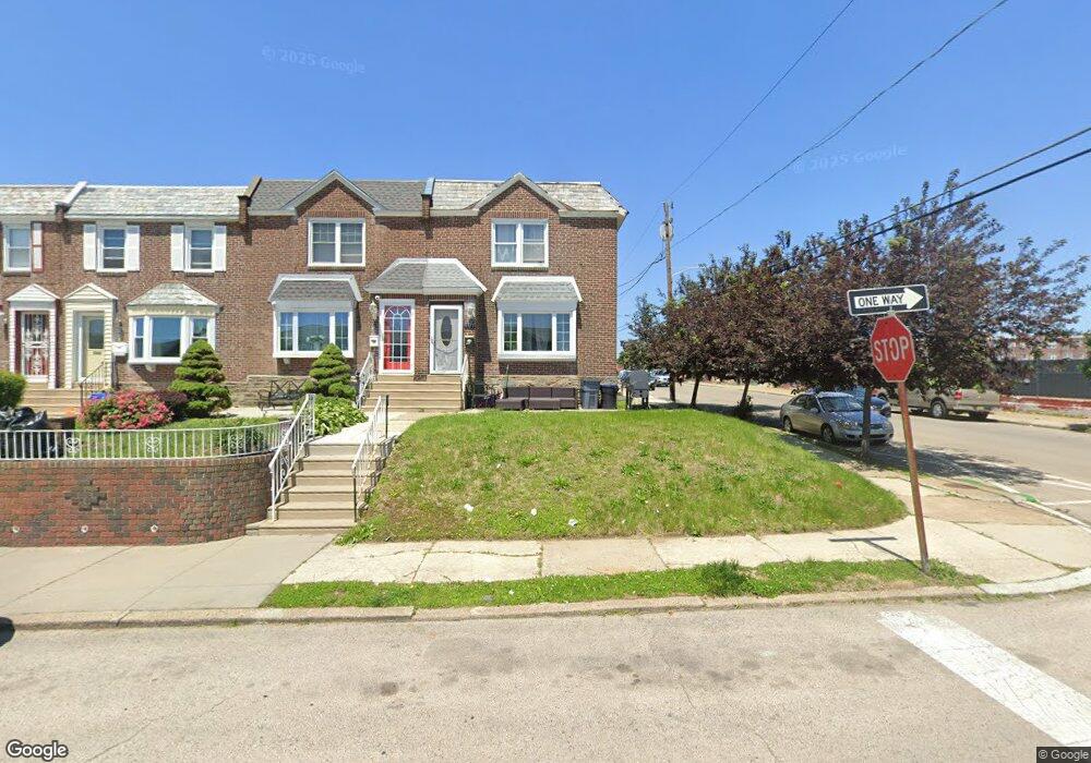
1577 Beverly Rd Philadelphia, PA 19138
West Oak Lane NeighborhoodEstimated Value: $248,673 - $273,000
4
Beds
1
Bath
1,522
Sq Ft
$170/Sq Ft
Est. Value
About This Home
This home is located at 1577 Beverly Rd, Philadelphia, PA 19138 and is currently estimated at $258,168, approximately $169 per square foot. 1577 Beverly Rd is a home located in Philadelphia County with nearby schools including Anna B. Day School, Martin Luther King High School, and West Oak Lane Charter School.
Ownership History
Date
Name
Owned For
Owner Type
Purchase Details
Closed on
Jun 27, 2002
Sold by
Foster Frederica L
Bought by
Grant Shawn
Current Estimated Value
Home Financials for this Owner
Home Financials are based on the most recent Mortgage that was taken out on this home.
Original Mortgage
$91,179
Outstanding Balance
$38,954
Interest Rate
6.82%
Mortgage Type
FHA
Estimated Equity
$219,214
Create a Home Valuation Report for This Property
The Home Valuation Report is an in-depth analysis detailing your home's value as well as a comparison with similar homes in the area
Home Values in the Area
Average Home Value in this Area
Purchase History
| Date | Buyer | Sale Price | Title Company |
|---|---|---|---|
| Grant Shawn | $91,900 | Chicago Title Insurance Co |
Source: Public Records
Mortgage History
| Date | Status | Borrower | Loan Amount |
|---|---|---|---|
| Open | Grant Shawn | $91,179 |
Source: Public Records
Tax History Compared to Growth
Tax History
| Year | Tax Paid | Tax Assessment Tax Assessment Total Assessment is a certain percentage of the fair market value that is determined by local assessors to be the total taxable value of land and additions on the property. | Land | Improvement |
|---|---|---|---|---|
| 2025 | $2,844 | $239,099 | $47,820 | $191,279 |
| 2024 | $2,844 | $239,099 | $47,820 | $191,279 |
| 2023 | $2,844 | $203,199 | $40,640 | $162,559 |
| 2022 | $1,820 | $183,200 | $40,640 | $142,560 |
| 2021 | $2,100 | $0 | $0 | $0 |
| 2020 | $2,100 | $0 | $0 | $0 |
| 2019 | $2,192 | $0 | $0 | $0 |
| 2018 | $1,989 | $0 | $0 | $0 |
| 2017 | $1,989 | $0 | $0 | $0 |
| 2016 | $1,779 | $0 | $0 | $0 |
| 2015 | $1,703 | $0 | $0 | $0 |
| 2014 | -- | $142,100 | $17,171 | $124,929 |
| 2012 | -- | $16,032 | $3,753 | $12,279 |
Source: Public Records
Map
Nearby Homes
- 1544 Beverly Rd
- 1559 E Pastorius St
- 1537 Beverly Rd
- 1521 E Walnut Ln
- 1544 E Tulpehocken St
- 6635 Hollis St
- 1505 Beverly Rd
- 7243 Mansfield Ave
- 6661 Cornelius St
- 7258 Mansfield Ave
- 1416-20 E Tulpehocken St
- 7349 E Walnut Ln
- 7277 E Walnut Ln
- 6620 Cornelius St
- 6332 E Wister St
- 6824 Rodney St
- 1762 Mohican St
- 1827 E Pastorius St
- 1821 E Tulpehocken St
- 1822 Nolan St
- 1575 Beverly Rd
- 1571 Beverly Rd
- 1569 Beverly Rd
- 1572 E Pastorius St
- 1567 Beverly Rd
- 1570 E Pastorius St
- 1568 E Pastorius St
- 1566 E Pastorius St
- 1565 Beverly Rd
- 1564 E Pastorius St
- 1563 Beverly Rd
- 1554 Beverly Rd
- 1562 E Pastorius St
- 1552 Beverly Rd
- 1550 Beverly Rd
- 1560 E Pastorius St
- 1548 Beverly Rd
- 1561 Beverly Rd
- 1546 Beverly Rd
- 1558 E Pastorius St