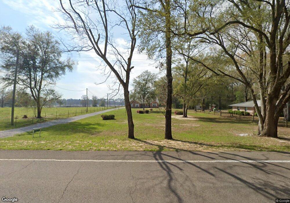
15771 State Highway 83 N Defuniak Springs, FL 32433
Estimated Value: $262,627 - $457,000
3
Beds
2
Baths
1,604
Sq Ft
$207/Sq Ft
Est. Value
About This Home
This home is located at 15771 State Highway 83 N, Defuniak Springs, FL 32433 and is currently estimated at $332,542, approximately $207 per square foot. 15771 State Highway 83 N is a home located in Walton County with nearby schools including Paxton School.
Ownership History
Date
Name
Owned For
Owner Type
Purchase Details
Closed on
Aug 16, 2019
Sold by
Arnold Austin and Arnold Destiny
Bought by
Lawrence George and Lawrence Marie
Current Estimated Value
Purchase Details
Closed on
Aug 16, 2018
Sold by
Lawrence Bryan V and Lawrence George Lawrence
Bought by
Arnold Austin and Arnold Destiny
Home Financials for this Owner
Home Financials are based on the most recent Mortgage that was taken out on this home.
Original Mortgage
$80,808
Interest Rate
4.53%
Purchase Details
Closed on
Feb 8, 2007
Sold by
Schofield Richard and Schofield Rebecca V
Bought by
Lawrence George C and Lawrence Marie
Create a Home Valuation Report for This Property
The Home Valuation Report is an in-depth analysis detailing your home's value as well as a comparison with similar homes in the area
Home Values in the Area
Average Home Value in this Area
Purchase History
| Date | Buyer | Sale Price | Title Company |
|---|---|---|---|
| Lawrence George | -- | Westcor Land Title Ins Co | |
| Arnold Austin | $80,000 | -- | |
| Lawrence George C | -- | None Available |
Source: Public Records
Mortgage History
| Date | Status | Borrower | Loan Amount |
|---|---|---|---|
| Previous Owner | Arnold Austin | $80,808 | |
| Previous Owner | Arnold Austin | -- |
Source: Public Records
Tax History Compared to Growth
Tax History
| Year | Tax Paid | Tax Assessment Tax Assessment Total Assessment is a certain percentage of the fair market value that is determined by local assessors to be the total taxable value of land and additions on the property. | Land | Improvement |
|---|---|---|---|---|
| 2024 | $75 | $104,889 | -- | -- |
| 2023 | $75 | $101,834 | $0 | $0 |
| 2022 | $75 | $98,868 | $0 | $0 |
| 2021 | $75 | $95,988 | $0 | $0 |
| 2020 | $75 | $93,132 | $3,750 | $89,382 |
| 2019 | $532 | $91,109 | $0 | $0 |
| 2018 | $519 | $89,410 | $0 | $0 |
| 2017 | $509 | $88,146 | $0 | $0 |
| 2016 | $498 | $86,333 | $0 | $0 |
| 2015 | $501 | $85,733 | $0 | $0 |
| 2014 | $504 | $85,253 | $0 | $0 |
Source: Public Records
Map
Nearby Homes
- 258 Briar Rd
- Tract#6201 W County Hwy 181 Unit Nat B-01
- Tract#6201 W Co Hwy 181 Nat B-01
- 139 Acres Yorkey Rd
- Tract#6201 8 Mile Cemetery Rd Unit 2
- Tract#6201 Doyle Morgan Rd
- 261 Wilkerson Rd
- 601 Oak Grove Rd
- Parcel B Adams Dr
- 7257 State Highway 153
- 6455 County Highway 0605
- 1921 Adams Dr
- 0 County Highway 0605
- 6235 State Highway 2 E
- xx Wallace Rd
- 0000 No Name
- 91 North St
- 5676 State Highway 2 W
- LOTS 52&53 Co 183b
- 510 Railroad Ave
- 15801 Florida 83
- 15801 State Highway 83
- 15849 State Highway 83 N
- 15853 State Highway 83 N
- 15895 State Highway 83
- 15975 State Highway 83
- 15965 State Highway 83 N
- 16127 State Highway 83 N
- 116 Punch Bowl Rd
- 319 Punch Bowl Rd
- 6092 County Highway 181 E
- 326 Punch Bowl Rd
- 15229 State Highway 83
- 72ac. Ford Hill Rd
- 551 Punch Bowl Rd
- 707 Punch Bowl Rd
- 634 Punch Bowl Rd
- 636 Punch Bowl Rd
- 861 Punch Bowl Rd
