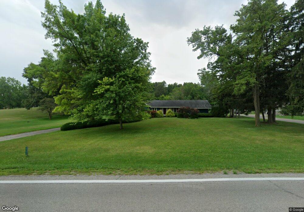
15777 State Route 2 Wauseon, OH 43567
Estimated Value: $322,000 - $387,000
4
Beds
3
Baths
2,536
Sq Ft
$136/Sq Ft
Est. Value
About This Home
This home is located at 15777 State Route 2, Wauseon, OH 43567 and is currently estimated at $346,097, approximately $136 per square foot. 15777 State Route 2 is a home located in Fulton County with nearby schools including Wauseon Primary School, Wauseon Elementary School, and Wauseon Middle School.
Ownership History
Date
Name
Owned For
Owner Type
Purchase Details
Closed on
Jun 3, 2020
Sold by
Behnfeldt Douglas M and Behnfeldt Susan A
Bought by
Behnfeldt Douglas M and Douglas M Behnfeldt Trust
Current Estimated Value
Purchase Details
Closed on
May 14, 1996
Sold by
Gauthier Georgia J
Bought by
Behnfeldt Douglas M and Behnfeldt Susan
Home Financials for this Owner
Home Financials are based on the most recent Mortgage that was taken out on this home.
Original Mortgage
$120,000
Outstanding Balance
$6,701
Interest Rate
7.78%
Mortgage Type
New Conventional
Estimated Equity
$339,396
Purchase Details
Closed on
Jan 1, 1990
Bought by
Gauthier Georgia J
Create a Home Valuation Report for This Property
The Home Valuation Report is an in-depth analysis detailing your home's value as well as a comparison with similar homes in the area
Purchase History
| Date | Buyer | Sale Price | Title Company |
|---|---|---|---|
| Behnfeldt Douglas M | -- | None Available | |
| Behnfeldt Douglas M | $150,000 | -- | |
| Gauthier Georgia J | -- | -- |
Source: Public Records
Mortgage History
| Date | Status | Borrower | Loan Amount |
|---|---|---|---|
| Open | Behnfeldt Douglas M | $120,000 |
Source: Public Records
Tax History
| Year | Tax Paid | Tax Assessment Tax Assessment Total Assessment is a certain percentage of the fair market value that is determined by local assessors to be the total taxable value of land and additions on the property. | Land | Improvement |
|---|---|---|---|---|
| 2024 | $4,629 | $94,190 | $9,310 | $84,880 |
| 2023 | $4,651 | $94,190 | $9,310 | $84,880 |
| 2022 | $4,231 | $73,050 | $7,770 | $65,280 |
| 2021 | $4,463 | $73,050 | $7,770 | $65,280 |
| 2020 | $4,062 | $73,050 | $7,770 | $65,280 |
| 2019 | $3,525 | $63,210 | $7,560 | $55,650 |
| 2018 | $3,073 | $63,210 | $7,560 | $55,650 |
| 2017 | $3,026 | $63,210 | $7,560 | $55,650 |
| 2016 | $2,934 | $54,640 | $7,560 | $47,080 |
| 2015 | $2,748 | $54,640 | $7,560 | $47,080 |
| 2014 | $2,740 | $54,640 | $7,560 | $47,080 |
| 2013 | $3,195 | $58,810 | $7,880 | $50,930 |
Source: Public Records
Map
Nearby Homes
- 940 Fairway Ln
- 744 Fairway Dr Unit 29
- 744 Fairway Dr Unit 26
- 594 Douglas Dr
- 749 Parkside Dr
- 420 Clover Ln
- 263 W Chestnut St
- 252 W Chestnut St
- 231 W Chestnut St
- 212 Jefferson St
- 203 E Oak St
- 316 E Oak St
- 351 E Walnut St
- 1338 N Park Ln
- 635 E Leggett St
- 14578 U S 20a
- 460 Airport Hwy
- 760 Airport Hwy
- 1066 Seneca Dr
- 1062 Seneca Dr
- 15795 State Route 2
- 15790 State Route 2
- 15790 Ohio 2
- 15831 State Route 2
- 15831 St Rt 2
- 15723 State Route 2
- 15851 State Route 2
- 15724 State Route 2
- 15726 County Road E
- 15639 State Route 2
- 15800 County Road E
- 15919 State Route 2
- 5150 County Road 16
- 15608 State Route 2
- 15601 State Route 2
- 15971 State Route 2
- 15656 County Road E
- 15551 State Route 2
- 15554 State Route 2
- 0 Co Rd 16
Your Personal Tour Guide
Ask me questions while you tour the home.