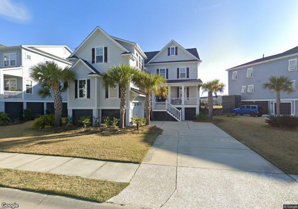
1578 Red Tide Rd Mount Pleasant, SC 29466
Estimated Value: $1,450,000 - $1,555,000
5
Beds
4
Baths
3,704
Sq Ft
$406/Sq Ft
Est. Value
About This Home
This home is located at 1578 Red Tide Rd, Mount Pleasant, SC 29466 and is currently estimated at $1,505,150, approximately $406 per square foot. 1578 Red Tide Rd is a home located in Charleston County with nearby schools including Mamie Whitesides Elementary School, Moultrie Middle School, and Wando High School.
Ownership History
Date
Name
Owned For
Owner Type
Purchase Details
Closed on
Feb 28, 2023
Sold by
Mary Elizabeth Mullaney Living Trust
Bought by
Pheasant Lane Trust
Current Estimated Value
Purchase Details
Closed on
Aug 15, 2018
Sold by
Mullaney Marybeth
Bought by
Mullaney Mary Elizabeth and Mary Elizabeth Mullaney Living Trust
Purchase Details
Closed on
Dec 19, 2017
Sold by
D R Horton Inc
Bought by
Mullaney Marybeth
Home Financials for this Owner
Home Financials are based on the most recent Mortgage that was taken out on this home.
Original Mortgage
$617,696
Interest Rate
3.95%
Mortgage Type
New Conventional
Create a Home Valuation Report for This Property
The Home Valuation Report is an in-depth analysis detailing your home's value as well as a comparison with similar homes in the area
Home Values in the Area
Average Home Value in this Area
Purchase History
| Date | Buyer | Sale Price | Title Company |
|---|---|---|---|
| Pheasant Lane Trust | $1,180,000 | None Listed On Document | |
| Mullaney Mary Elizabeth | -- | None Available | |
| Mullaney Marybeth | $772,120 | None Available |
Source: Public Records
Mortgage History
| Date | Status | Borrower | Loan Amount |
|---|---|---|---|
| Previous Owner | Mullaney Marybeth | $617,696 |
Source: Public Records
Tax History Compared to Growth
Tax History
| Year | Tax Paid | Tax Assessment Tax Assessment Total Assessment is a certain percentage of the fair market value that is determined by local assessors to be the total taxable value of land and additions on the property. | Land | Improvement |
|---|---|---|---|---|
| 2024 | $4,480 | $47,200 | $0 | $0 |
| 2023 | $4,480 | $28,530 | $0 | $0 |
| 2022 | $2,600 | $28,530 | $0 | $0 |
| 2021 | $2,862 | $28,530 | $0 | $0 |
| 2020 | $2,931 | $28,530 | $0 | $0 |
| 2019 | $3,125 | $30,800 | $0 | $0 |
| 2017 | $146 | $10,800 | $0 | $0 |
Source: Public Records
Map
Nearby Homes
- 1617 Prince Edward St
- 1536 Keshi Pearl Dr
- 1613 Fort Palmetto Cir
- 1663 Omni Blvd
- 2242 Dewees Creek Dr
- 1784 Omni Blvd
- 2130 Oyster Reef Ln
- 1486 Diamond Blvd
- 1478 Diamond Blvd
- 1688 Farmers Way
- 1509 W Palmetto Fort Dr
- 3116 Sandy Pearl Way
- 1684 Farmers Way
- 2280 Minifarm Way Unit 529
- 1515 N Lakeshore Dr
- 1509 Fig Vine Ct
- 1754 Cultivation Ln Unit 513
- 3104 Sandy Pearl Way
- 1751 Cultivation Ln Unit 498
- 1494 N Lakeshore Dr
- 1574 Red Tide Rd
- 1584 Red Tide Rd
- 1572 Red Tide Rd
- 1590 Red Tide Rd
- 1577 Red Tide Rd
- 1568 Red Tide Rd
- 1581 Red Tide Rd
- 1573 Red Tide Rd
- 1585 Red Tide Rd
- 1594 Red Tide Rd
- 2274 Hamlin Sound Cir
- 2276 Hamlin Sound Cir
- 2270 Hamlin Sound Cir
- 2268 Hamlin Sound Cir
- 2278 Hamlin Sound Cir
- 1565 Red Tide Rd
- 2266 Hamlin Sound Cir
- 2280 Hamlin Sound Cir
- 1589 Red Tide Rd
- 1598 Red Tide Rd