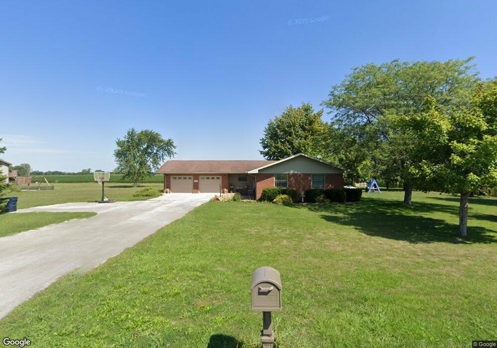
15784 Road S Columbus Grove, OH 45830
Estimated Value: $249,000 - $419,000
--
Bed
2
Baths
1,578
Sq Ft
$191/Sq Ft
Est. Value
About This Home
This home is located at 15784 Road S, Columbus Grove, OH 45830 and is currently estimated at $300,961, approximately $190 per square foot. 15784 Road S is a home located in Putnam County with nearby schools including Columbus Grove Elementary School, Columbus Grove Middle School, and Columbus Grove High School.
Ownership History
Date
Name
Owned For
Owner Type
Purchase Details
Closed on
Jun 26, 2018
Sold by
Burgei Mark A and Burgei Loretta L
Bought by
Kohls Andrew A and Kohls Rachel M
Current Estimated Value
Home Financials for this Owner
Home Financials are based on the most recent Mortgage that was taken out on this home.
Original Mortgage
$156,000
Outstanding Balance
$135,197
Interest Rate
4.5%
Mortgage Type
New Conventional
Estimated Equity
$165,764
Purchase Details
Closed on
Dec 14, 2017
Sold by
Beining James P and Wannemacher Janice M
Bought by
Burgei Mark A and Burgei Loretta L
Home Financials for this Owner
Home Financials are based on the most recent Mortgage that was taken out on this home.
Original Mortgage
$300,000
Interest Rate
4.46%
Mortgage Type
Credit Line Revolving
Create a Home Valuation Report for This Property
The Home Valuation Report is an in-depth analysis detailing your home's value as well as a comparison with similar homes in the area
Home Values in the Area
Average Home Value in this Area
Purchase History
| Date | Buyer | Sale Price | Title Company |
|---|---|---|---|
| Kohls Andrew A | $195,000 | None Available | |
| Burgei Mark A | $275,000 | None Available |
Source: Public Records
Mortgage History
| Date | Status | Borrower | Loan Amount |
|---|---|---|---|
| Open | Kohls Andrew A | $156,000 | |
| Previous Owner | Burgei Mark A | $300,000 |
Source: Public Records
Tax History Compared to Growth
Tax History
| Year | Tax Paid | Tax Assessment Tax Assessment Total Assessment is a certain percentage of the fair market value that is determined by local assessors to be the total taxable value of land and additions on the property. | Land | Improvement |
|---|---|---|---|---|
| 2024 | $2,215 | $72,960 | $7,980 | $64,980 |
| 2023 | $2,356 | $57,960 | $6,030 | $51,930 |
| 2022 | $2,128 | $57,961 | $6,031 | $51,930 |
| 2021 | $2,161 | $57,780 | $6,030 | $51,750 |
| 2020 | $2,141 | $46,040 | $5,100 | $40,940 |
| 2019 | $1,899 | $52,500 | $6,030 | $46,470 |
| 2018 | $1,895 | $52,500 | $6,030 | $46,470 |
| 2017 | $1,630 | $52,500 | $6,030 | $46,470 |
| 2016 | $1,630 | $46,040 | $5,100 | $40,940 |
| 2015 | $1,638 | $46,040 | $5,100 | $40,940 |
| 2014 | $1,654 | $46,040 | $5,100 | $40,940 |
| 2013 | $1,681 | $46,040 | $5,100 | $40,940 |
Source: Public Records
Map
Nearby Homes
- 148 S Water St
- 147 Elm St
- 15105 Road 15m
- 4150 W Lincoln Hwy
- 11059 Ottawa Rd
- 2525 W Lincoln Hwy
- 308 Delphos Rd
- 209 Willow Bend Dr
- 205 S Broadway St
- 204 S Broadway St
- 17736 Road 20p
- 106 Carnation St
- 20501 U S 224
- 6585 Ottawa Rd
- 300 Sweaney Ave
- 309 Wall St
- 201 Wall St
- 220 Parklane Dr
- 6585 Huffer Rd
- 5550 Hartman Rd
- 15846 Road S
- 15894 Road S
- 18951 State Route 115
- 19099 State Route 115
- 15378 Road S
- 19189 State Route 115
- 16224 Road S
- 16193 Road S
- 18657 State Route 115
- 18526 State Route 115
- 19514 State Route 115
- 18567 State Route 115
- 15234 Road S
- 19398 State Route 115
- 19314 Township Road 16-S
- 19314 Road 16s
- 16372 Road S
- 18417 State Route 115