Estimated Value: $390,723 - $687,000
--
Bed
--
Bath
--
Sq Ft
6,360
Sq Ft Lot
About This Home
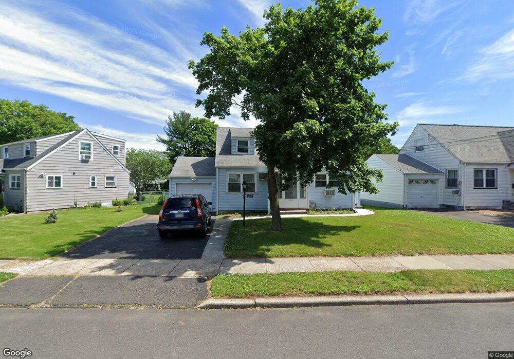
This home is located at 1579 Barton Rd, Union, NJ 07083 and is currently estimated at $551,431. 1579 Barton Rd is a home located in Union County with nearby schools including Livingston Elementary School, Union High School, and St Michael Parish School.
Ownership History
Date
Name
Owned For
Owner Type
Purchase Details
Closed on
Apr 24, 2015
Sold by
Demovic Michael T and Demovic Michele C
Bought by
Demovic Michael T and Demovic Michele C
Current Estimated Value
Home Financials for this Owner
Home Financials are based on the most recent Mortgage that was taken out on this home.
Original Mortgage
$198,039
Outstanding Balance
$142,378
Interest Rate
3.75%
Mortgage Type
FHA
Estimated Equity
$409,053
Purchase Details
Closed on
Mar 18, 2011
Sold by
Remstein Neil and Remstein Savina
Bought by
Demovic Michael T and Cicchetto Michele
Home Financials for this Owner
Home Financials are based on the most recent Mortgage that was taken out on this home.
Original Mortgage
$209,524
Interest Rate
4.25%
Mortgage Type
FHA
Create a Home Valuation Report for This Property
The Home Valuation Report is an in-depth analysis detailing your home's value as well as a comparison with similar homes in the area
Home Values in the Area
Average Home Value in this Area
Purchase History
| Date | Buyer | Sale Price | Title Company |
|---|---|---|---|
| Demovic Michael T | -- | Attorney | |
| Demovic Michael T | $230,500 | Chicago Title Insurance Co |
Source: Public Records
Mortgage History
| Date | Status | Borrower | Loan Amount |
|---|---|---|---|
| Open | Demovic Michael T | $198,039 | |
| Closed | Demovic Michael T | $209,524 |
Source: Public Records
Tax History Compared to Growth
Tax History
| Year | Tax Paid | Tax Assessment Tax Assessment Total Assessment is a certain percentage of the fair market value that is determined by local assessors to be the total taxable value of land and additions on the property. | Land | Improvement |
|---|---|---|---|---|
| 2025 | $10,237 | $45,800 | $20,500 | $25,300 |
| 2024 | $9,924 | $45,800 | $20,500 | $25,300 |
| 2023 | $9,924 | $45,800 | $20,500 | $25,300 |
| 2022 | $9,580 | $45,800 | $20,500 | $25,300 |
| 2021 | $9,347 | $45,800 | $20,500 | $25,300 |
| 2020 | $9,161 | $45,800 | $20,500 | $25,300 |
| 2019 | $9,038 | $45,800 | $20,500 | $25,300 |
| 2018 | $8,884 | $45,800 | $20,500 | $25,300 |
| 2017 | $8,752 | $45,800 | $20,500 | $25,300 |
| 2016 | $8,539 | $45,800 | $20,500 | $25,300 |
| 2015 | $8,397 | $45,800 | $20,500 | $25,300 |
| 2014 | $8,209 | $45,800 | $20,500 | $25,300 |
Source: Public Records
Map
Nearby Homes
- 1040 Cranbrook Rd
- 1267 Erhardt St
- 631 Golf Terrace
- 152 Glenwood Ct
- 1848 Portsmouth Way
- 1370 Beverly Rd
- 843 Boyd Ave
- 142 Eastern Pkwy
- 1764 Colgate Place
- 1239 Victor Ave
- 112 Apple Tree Ln
- 365 Broadwell Ave
- 1393 Cornell Place
- 286 Mclean Place
- 987 Floyd Terrace
- 1893 Arbor Ln
- 378 Burroughs Terrace
- 1322 Marcella Dr
- 1263 Coolidge Ave
- 926 Floyd Terrace
- 1575 Barton Rd
- 1585 Barton Rd
- 1031 Field Rd
- 1571 Barton Rd
- 1584 Barton Rd
- 1035 Field Rd
- 1567 Barton Rd
- 1580 Barton Rd
- 1576 Barton Rd
- 1570 Barton Rd
- 1013 Field Rd
- 1563 Barton Rd
- 1039 Field Rd
- 1070 Cranbrook Rd
- 1066 Cranbrook Rd
- 1074 Cranbrook Rd
- 1026 Field Rd
- 1020 Field Rd
- 1566 Barton Rd
- 1062 Cranbrook Rd