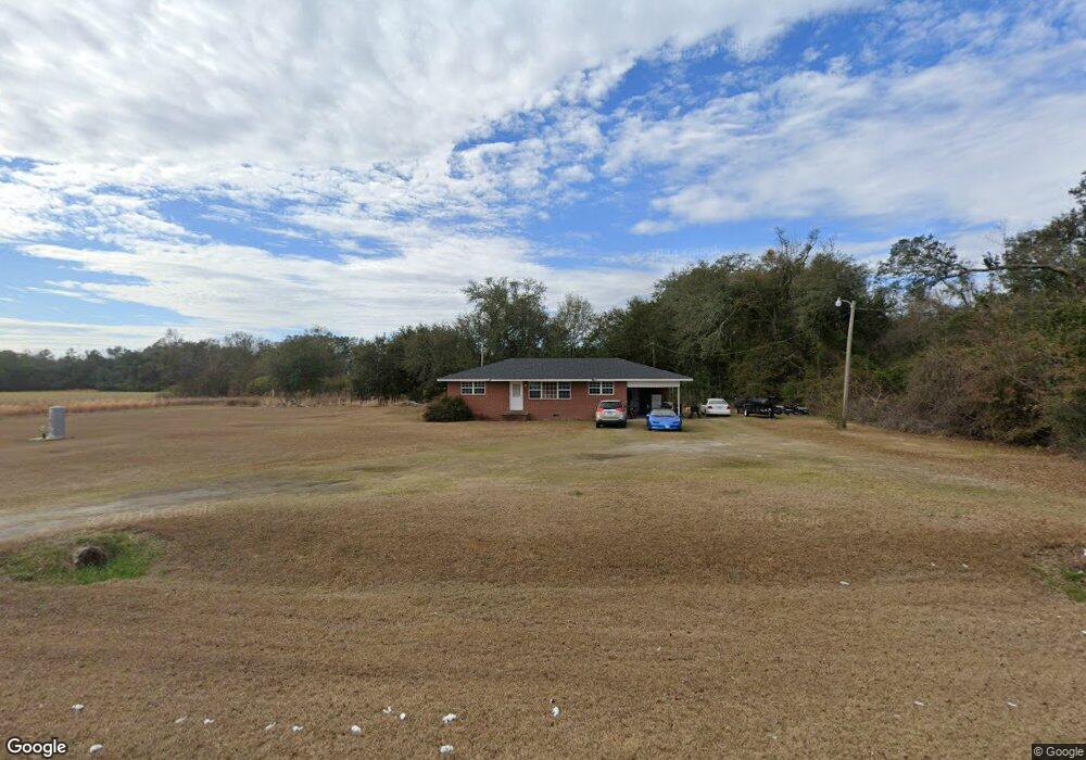
1579 Ga Highway 39 Donalsonville, GA 39845
Estimated Value: $112,000 - $160,000
3
Beds
1
Bath
1,232
Sq Ft
$103/Sq Ft
Est. Value
About This Home
This home is located at 1579 Ga Highway 39, Donalsonville, GA 39845 and is currently estimated at $126,676, approximately $102 per square foot. 1579 Ga Highway 39 is a home located in Miller County with nearby schools including Miller County Elementary School, Miller County Middle School, and Miller County High School.
Ownership History
Date
Name
Owned For
Owner Type
Purchase Details
Closed on
Jan 9, 2004
Sold by
Centex Home Equity Co
Bought by
Brown Willie A and Brown Tyrone B
Current Estimated Value
Purchase Details
Closed on
Jul 23, 2003
Sold by
Vanhousen Billy Joe
Bought by
Centex Home Equity Co
Purchase Details
Closed on
Sep 28, 1999
Sold by
Vanhousen Billy Joe
Bought by
Vanhousen Billy Joe
Purchase Details
Closed on
Jan 9, 1998
Sold by
Barber Linda Jo Moulton
Bought by
Vanhousen Billy Joe
Purchase Details
Closed on
Dec 9, 1988
Sold by
Hill Aubrey L Estate
Bought by
Barber Linda Jo Moulton
Create a Home Valuation Report for This Property
The Home Valuation Report is an in-depth analysis detailing your home's value as well as a comparison with similar homes in the area
Home Values in the Area
Average Home Value in this Area
Purchase History
| Date | Buyer | Sale Price | Title Company |
|---|---|---|---|
| Brown Willie A | $49,900 | -- | |
| Centex Home Equity Co | $79,000 | -- | |
| Vanhousen Billy Joe | -- | -- | |
| Vanhousen Billy Joe | -- | -- | |
| Barber Linda Jo Moulton | -- | -- |
Source: Public Records
Tax History Compared to Growth
Tax History
| Year | Tax Paid | Tax Assessment Tax Assessment Total Assessment is a certain percentage of the fair market value that is determined by local assessors to be the total taxable value of land and additions on the property. | Land | Improvement |
|---|---|---|---|---|
| 2024 | $1,369 | $40,715 | $1,102 | $39,613 |
| 2023 | $1,063 | $29,860 | $1,102 | $28,758 |
| 2022 | $974 | $25,458 | $1,102 | $24,356 |
| 2021 | $964 | $25,458 | $1,102 | $24,356 |
| 2020 | $964 | $25,458 | $1,102 | $24,356 |
| 2019 | $966 | $25,458 | $1,102 | $24,356 |
| 2018 | $947 | $25,684 | $1,102 | $24,582 |
| 2017 | $947 | $25,684 | $1,102 | $24,582 |
| 2016 | $1,028 | $27,864 | $1,102 | $26,762 |
| 2015 | -- | $23,850 | $2,800 | $21,050 |
| 2014 | -- | $23,850 | $2,800 | $21,050 |
| 2013 | -- | $23,849 | $2,800 | $21,049 |
Source: Public Records
Map
Nearby Homes
- 1068 Georgia 39
- Grady Cobb Rd
- 394 Bush Dairy Rd
- 210 W Crawford St
- 308 E Carr St
- 307 S Morris Ave
- 202 W 4th St
- lot 564 Martin Dr
- 403 S Newcombe Ave
- lot 565 Martin Dr
- 1645 Georgia 91
- 755 Mayhaw Rd
- 508 S Tennille Ave
- 816 E 6th St
- 1203 S Morris Ave
- 300 W 13th St
- 5552 Georgia 39
- 1282 Millard Ln
- 5611 Sweetwater Ave
- 5660 Carter Dr
- 1565 Ga Highway 39
- 1539 Ga Highway 39
- 1653 Ga Highway 39
- 1520 Ga Highway 39
- 1471 Ga Highway 39
- 1650 Ga Highway 39
- 1693 Ga Highway 39
- 1489 Ga Highway 39
- 447 Stegall Rd
- 3840 Pool Rd
- 597 Stegall Rd
- 1492 Shingler Rd
- 1468 Shingler Rd
- 4427 Pool Rd
- 1438 Shingler Rd
- 54 Bridges Rd
- 628 Stegall Rd
- 4495 Pool Rd
- 18 Moulton Rd
- 1849 Ga Highway 39