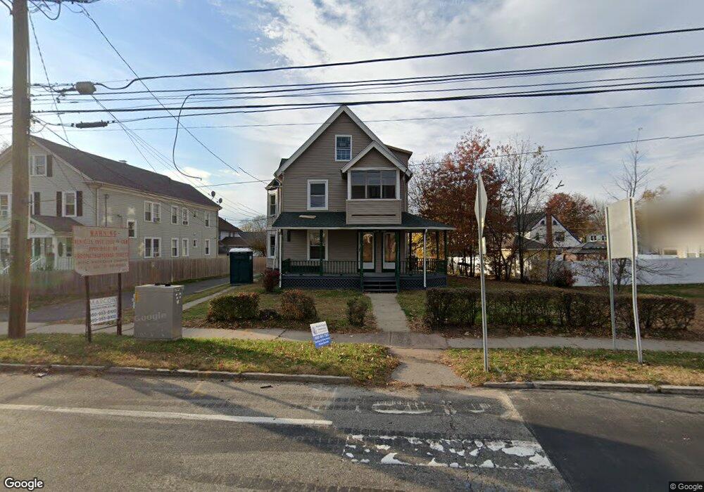
1579 Main St Unit 1ST F East Hartford, CT 06108
Estimated Value: $228,000 - $442,000
6
Beds
3
Baths
3,477
Sq Ft
$107/Sq Ft
Est. Value
About This Home
This home is located at 1579 Main St Unit 1ST F, East Hartford, CT 06108 and is currently estimated at $370,333, approximately $106 per square foot. 1579 Main St Unit 1ST F is a home located in Hartford County with nearby schools including Anna E. Norris School, East Hartford Middle School, and East Hartford High School.
Ownership History
Date
Name
Owned For
Owner Type
Purchase Details
Closed on
Jul 22, 2010
Sold by
Papageorgiou Harry and Papageorgiou Elizabeth
Bought by
1579 Main Street Llc
Current Estimated Value
Purchase Details
Closed on
Feb 10, 2010
Sold by
Harris Shontel
Bought by
Deutsche Bank Natl T C
Purchase Details
Closed on
Nov 2, 2005
Sold by
Brathwaite Ertha A
Bought by
Harris Shontel
Home Financials for this Owner
Home Financials are based on the most recent Mortgage that was taken out on this home.
Original Mortgage
$200,000
Interest Rate
8.75%
Purchase Details
Closed on
Apr 1, 2002
Sold by
Guimond Rene and Huimond Lucille G
Bought by
Brathwaite Ertha A
Create a Home Valuation Report for This Property
The Home Valuation Report is an in-depth analysis detailing your home's value as well as a comparison with similar homes in the area
Home Values in the Area
Average Home Value in this Area
Purchase History
| Date | Buyer | Sale Price | Title Company |
|---|---|---|---|
| 1579 Main Street Llc | -- | -- | |
| Papageorgiou Harry | $127,900 | -- | |
| Deutsche Bank Natl T C | -- | -- | |
| Harris Shontel | $250,000 | -- | |
| Brathwaite Ertha A | $150,000 | -- |
Source: Public Records
Mortgage History
| Date | Status | Borrower | Loan Amount |
|---|---|---|---|
| Open | Brathwaite Ertha A | $159,600 | |
| Previous Owner | Brathwaite Ertha A | $200,000 | |
| Previous Owner | Brathwaite Ertha A | $50,000 |
Source: Public Records
Tax History Compared to Growth
Tax History
| Year | Tax Paid | Tax Assessment Tax Assessment Total Assessment is a certain percentage of the fair market value that is determined by local assessors to be the total taxable value of land and additions on the property. | Land | Improvement |
|---|---|---|---|---|
| 2025 | $11,285 | $245,860 | $41,980 | $203,880 |
| 2024 | $9,027 | $205,150 | $41,980 | $163,170 |
| 2023 | $8,727 | $205,150 | $41,980 | $163,170 |
| 2022 | $8,411 | $205,150 | $41,980 | $163,170 |
| 2021 | $7,103 | $143,940 | $31,800 | $112,140 |
| 2020 | $7,185 | $143,940 | $31,800 | $112,140 |
| 2019 | $7,069 | $143,940 | $31,800 | $112,140 |
| 2018 | $6,860 | $143,940 | $31,800 | $112,140 |
| 2017 | $6,772 | $143,940 | $31,800 | $112,140 |
| 2016 | $6,664 | $145,310 | $33,480 | $111,830 |
| 2015 | $6,664 | $145,310 | $33,480 | $111,830 |
| 2014 | $6,597 | $145,310 | $33,480 | $111,830 |
Source: Public Records
Map
Nearby Homes
- 1589 Main St
- 59 Tolland St
- 52 Burnside Ave
- 181 Burnside Ave
- 98 Olmsted St
- 85R Olmsted St
- 10 Kenyon Place
- 265 Burnside Ave
- 11 Westbrook St
- 62 Wells Ave
- 47 Elm St
- 67 Laurel St
- 30 Oakwood St
- 39 Tiffany Rd
- 41 Bissell St
- 32 Columbus St
- 279 Prospect St
- 116 Michael Ave Unit 118
- 453 Burnside Ave
- 110 Goodwin St