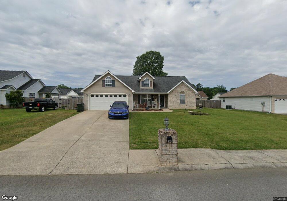
158 Bunker Dr Rossville, GA 30741
Westside NeighborhoodEstimated Value: $288,000 - $320,000
3
Beds
2
Baths
1,410
Sq Ft
$210/Sq Ft
Est. Value
About This Home
This home is located at 158 Bunker Dr, Rossville, GA 30741 and is currently estimated at $296,693, approximately $210 per square foot. 158 Bunker Dr is a home located in Catoosa County with nearby schools including Battlefield Primary School, Battlefield Elementary School, and Lakeview Middle School.
Ownership History
Date
Name
Owned For
Owner Type
Purchase Details
Closed on
Feb 7, 2006
Sold by
Stout David M
Bought by
Suttles Brian J
Current Estimated Value
Home Financials for this Owner
Home Financials are based on the most recent Mortgage that was taken out on this home.
Original Mortgage
$135,865
Outstanding Balance
$75,942
Interest Rate
6.08%
Mortgage Type
New Conventional
Estimated Equity
$220,751
Create a Home Valuation Report for This Property
The Home Valuation Report is an in-depth analysis detailing your home's value as well as a comparison with similar homes in the area
Home Values in the Area
Average Home Value in this Area
Purchase History
| Date | Buyer | Sale Price | Title Company |
|---|---|---|---|
| Suttles Brian J | $138,000 | -- |
Source: Public Records
Mortgage History
| Date | Status | Borrower | Loan Amount |
|---|---|---|---|
| Open | Suttles Brian J | $135,865 | |
| Closed | Suttles Brian J | $135,865 |
Source: Public Records
Tax History Compared to Growth
Tax History
| Year | Tax Paid | Tax Assessment Tax Assessment Total Assessment is a certain percentage of the fair market value that is determined by local assessors to be the total taxable value of land and additions on the property. | Land | Improvement |
|---|---|---|---|---|
| 2024 | $2,759 | $108,376 | $14,000 | $94,376 |
| 2023 | $2,267 | $84,350 | $14,000 | $70,350 |
| 2022 | $1,850 | $69,498 | $14,000 | $55,498 |
| 2021 | $1,752 | $69,498 | $14,000 | $55,498 |
| 2020 | $1,788 | $60,539 | $12,000 | $48,539 |
| 2019 | $1,695 | $60,539 | $12,000 | $48,539 |
| 2018 | $1,835 | $58,539 | $10,000 | $48,539 |
| 2017 | $1,587 | $54,329 | $9,500 | $44,829 |
| 2016 | $1,554 | $51,123 | $9,500 | $41,623 |
| 2015 | -- | $51,123 | $9,500 | $41,623 |
| 2014 | -- | $47,894 | $8,900 | $38,994 |
| 2013 | -- | $47,894 | $8,900 | $38,994 |
Source: Public Records
Map
Nearby Homes
- 132 Holli Ln
- 199 Mitchell Ln
- 2 Janet Ln
- 301 Dogwood Ln
- 300 Dogwood Ln
- 129 Cedar Grove Ln
- 2237 Cloud Springs Rd
- 114 Clara Lee Dr
- 0 Battlefield Pkwy Unit 129870
- 162 Huntley Meadows Dr
- 127 Huntley Meadows Dr
- 51 Poppy Ln
- 490 Lakeshore Cove Dr Unit 10
- 490 Lakeshore Cove Dr
- 17 Southshore Dr
- 302 Huntley Meadows Dr
- 530 Winchester Dr
- 518 Winchester Dr
- 398 Winchester Dr
- 385 Winchester Dr