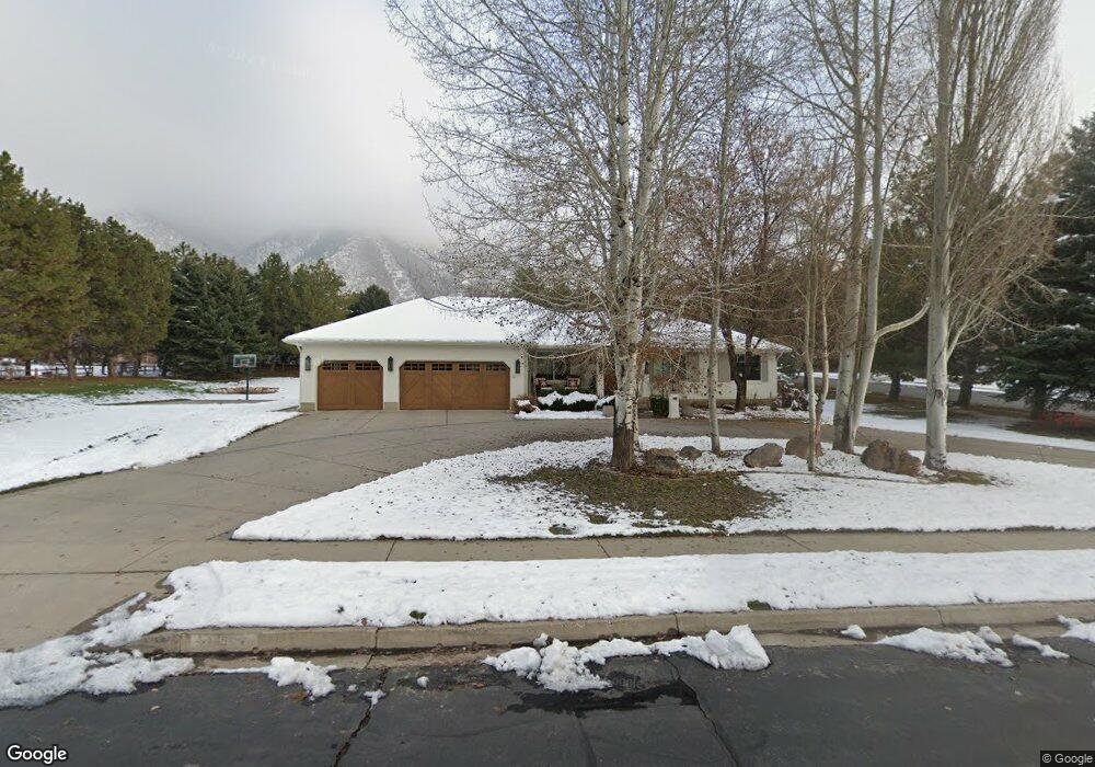
158 N Meadowbrook Dr Alpine, UT 84004
Estimated Value: $1,260,020 - $1,362,000
3
Beds
2
Baths
4,000
Sq Ft
$331/Sq Ft
Est. Value
About This Home
This home is located at 158 N Meadowbrook Dr, Alpine, UT 84004 and is currently estimated at $1,323,673, approximately $330 per square foot. 158 N Meadowbrook Dr is a home located in Utah County with nearby schools including Alpine School, Timberline Middle School, and Lone Peak High School.
Ownership History
Date
Name
Owned For
Owner Type
Purchase Details
Closed on
Oct 19, 2009
Sold by
Pitcher Family I Limited Partnership
Bought by
Pitcher Diana N
Current Estimated Value
Purchase Details
Closed on
Jul 19, 1996
Sold by
Wickel Robert and Wickel Linda
Bought by
Andersen Roger W and Andersen Shauna P
Home Financials for this Owner
Home Financials are based on the most recent Mortgage that was taken out on this home.
Original Mortgage
$125,000
Interest Rate
8.3%
Create a Home Valuation Report for This Property
The Home Valuation Report is an in-depth analysis detailing your home's value as well as a comparison with similar homes in the area
Home Values in the Area
Average Home Value in this Area
Purchase History
| Date | Buyer | Sale Price | Title Company |
|---|---|---|---|
| Pitcher Diana N | -- | Security Title & Abstract | |
| Andersen Roger W | -- | -- |
Source: Public Records
Mortgage History
| Date | Status | Borrower | Loan Amount |
|---|---|---|---|
| Previous Owner | Andersen Roger W | $125,000 |
Source: Public Records
Tax History
| Year | Tax Paid | Tax Assessment Tax Assessment Total Assessment is a certain percentage of the fair market value that is determined by local assessors to be the total taxable value of land and additions on the property. | Land | Improvement |
|---|---|---|---|---|
| 2025 | $6,212 | $754,435 | -- | -- |
| 2024 | $5,687 | $724,020 | $0 | $0 |
| 2023 | $5,687 | $711,590 | $0 | $0 |
| 2022 | $6,149 | $747,230 | $0 | $0 |
| 2021 | $5,171 | $976,100 | $577,500 | $398,600 |
| 2020 | $5,000 | $923,600 | $525,000 | $398,600 |
| 2019 | $4,672 | $901,000 | $525,000 | $376,000 |
| 2018 | $4,219 | $804,000 | $440,000 | $364,000 |
| 2017 | $3,819 | $387,200 | $0 | $0 |
| 2016 | $3,896 | $368,280 | $0 | $0 |
| 2015 | $4,118 | $368,280 | $0 | $0 |
| 2014 | $3,898 | $344,850 | $0 | $0 |
Source: Public Records
Map
Nearby Homes
- 887 E Village Way
- 1063 E Alpine Dr
- 202 E Alpine Dr
- 76 N Bald Mountain Dr
- 196 Holly Dr
- 475 Grove Dr
- 986 N Sunbrook Cir
- 48 N 100 E
- 512 Eastridge Cir
- 1263 E Chapman Ct
- 35 Sledhill Cir Unit 2
- 30 S Main St
- 381 E Watkins Cir Unit 28
- 250 S Main St Unit 20
- 250 S Main St Unit 7
- 13062 N Prospector Way Unit 41
- 463 Heritage Hills Dr
- 151 Glacier Lily Dr
- 682 Healey Blvd
- 382 E Heritage Hills Dr
- 1055 E Meadow Cir Unit 14A
- 1055 E Meadow Cir
- 198 N Meadowbrook Dr
- 1012 E Meadow Cir
- 177 N Meadowbrook Dr
- 110 N Meadowbrook Dr
- 125 Meadowbrook Dr
- 1052 E Meadow Cir
- 115 N Meadowbrook Dr
- 1076 E Brook Cir
- 235 N Meadowbrook Dr
- 1070 E Meadow Cir
- 76 N Meadowbrook Dr
- 97 N Meadowbrook Dr
- 252 N Meadowbrook Dr
- 45 N Lone Peak Dr
- 1098 E Brook Cir
- 1077 E Brook Cir
- 65 N Lone Peak Dr
- 7 N Village Ct
Your Personal Tour Guide
Ask me questions while you tour the home.