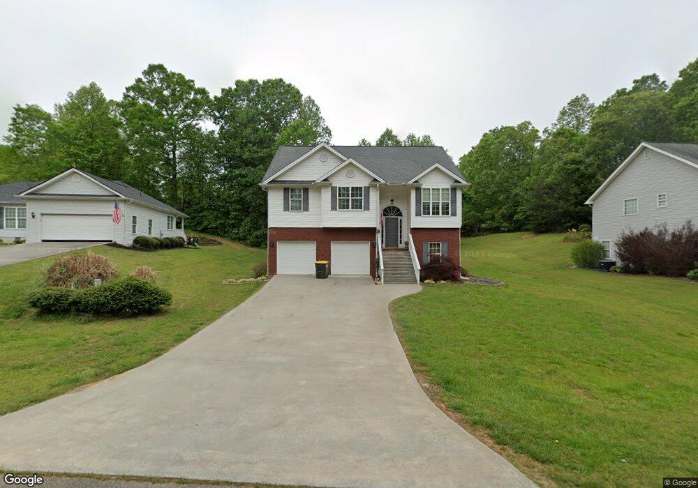
158 Rockwind Way Demorest, GA 30535
Estimated Value: $302,000 - $343,000
3
Beds
2
Baths
1,526
Sq Ft
$210/Sq Ft
Est. Value
About This Home
This home is located at 158 Rockwind Way, Demorest, GA 30535 and is currently estimated at $321,093, approximately $210 per square foot. 158 Rockwind Way is a home located in Habersham County with nearby schools including Demorest Elementary School, Wilbanks Middle School, and Habersham Success Academy.
Ownership History
Date
Name
Owned For
Owner Type
Purchase Details
Closed on
Aug 1, 2007
Sold by
Not Provided
Bought by
Cossar Todd and Cossar Laura Denise
Current Estimated Value
Purchase Details
Closed on
May 23, 2005
Sold by
Moorland Properties Inc
Bought by
Pritchett Larry D
Home Financials for this Owner
Home Financials are based on the most recent Mortgage that was taken out on this home.
Original Mortgage
$115,760
Interest Rate
5.74%
Mortgage Type
New Conventional
Create a Home Valuation Report for This Property
The Home Valuation Report is an in-depth analysis detailing your home's value as well as a comparison with similar homes in the area
Home Values in the Area
Average Home Value in this Area
Purchase History
| Date | Buyer | Sale Price | Title Company |
|---|---|---|---|
| Cossar Todd | $147,000 | -- | |
| Pritchett Larry D | $144,700 | -- |
Source: Public Records
Mortgage History
| Date | Status | Borrower | Loan Amount |
|---|---|---|---|
| Previous Owner | Pritchett Larry D | $115,760 | |
| Previous Owner | Pritchett Larry D | $28,940 |
Source: Public Records
Tax History Compared to Growth
Tax History
| Year | Tax Paid | Tax Assessment Tax Assessment Total Assessment is a certain percentage of the fair market value that is determined by local assessors to be the total taxable value of land and additions on the property. | Land | Improvement |
|---|---|---|---|---|
| 2025 | $3,174 | $131,406 | $10,000 | $121,406 |
| 2024 | $3,139 | $120,944 | $10,000 | $110,944 |
| 2023 | $2,537 | $101,464 | $10,000 | $91,464 |
| 2022 | $2,301 | $88,232 | $10,000 | $78,232 |
| 2021 | $1,879 | $72,396 | $10,000 | $62,396 |
| 2020 | $1,655 | $61,536 | $8,000 | $53,536 |
| 2019 | $1,657 | $61,536 | $8,000 | $53,536 |
| 2018 | $1,644 | $61,536 | $8,000 | $53,536 |
| 2017 | $1,411 | $52,532 | $4,000 | $48,532 |
| 2016 | $1,370 | $131,330 | $4,000 | $48,532 |
| 2015 | -- | $131,330 | $4,000 | $48,532 |
| 2014 | $1,339 | $127,530 | $4,000 | $47,012 |
| 2013 | -- | $51,012 | $4,000 | $47,012 |
Source: Public Records
Map
Nearby Homes
- 243 Charlie Batson Dr
- 1040 Cannon Bridge Rd
- 1046 Cannon Bridge Rd
- 1052 Cannon Bridge Rd
- 1058 Cannon Bridge Rd
- 191 Roberts Way
- 189 Legacy Dr
- Plan 1709 at Habersham Meadows
- Plan 1902 at Habersham Meadows
- Plan 2604 at Habersham Meadows
- Plan 1602-2 at Habersham Meadows
- Plan 3119 at Habersham Meadows
- Plan 2628 at Habersham Meadows
- Plan 2131 at Habersham Meadows
- Plan 2100 at Habersham Meadows
- Plan 2408 at Habersham Meadows
- Plan 3105 at Habersham Meadows
- Plan 2121 at Habersham Meadows
- Plan 1643 at Habersham Meadows
- Plan 2307 at Habersham Meadows
- 164 Rockwind Way
- 152 Rockwind Way
- 152 Rockwind Way Unit 12
- 230 Stonebrook Dr
- 276 Stonebrook Dr
- 216 Stonebrook Dr
- 155 Rockwind Way
- 178 Rockwind Way
- 268 Stonebrook Dr
- 145 Rockwind Way
- 0 Rockwind Way
- 0 Stonebrook Dr Unit 8722049
- 0 Stonebrook Dr Unit 3008114
- 0 Stonebrook Dr Unit 3042360
- 0 Stonebrook Dr Unit 3129275
- 0 Stonebrook Dr Unit 3171103
- 0 Stonebrook Dr Unit 3188719
- 0 Stonebrook Dr Unit 3197615
- 0 Stonebrook Dr Unit 3271165
- 0 Stonebrook Dr Unit 3281200