Estimated Value: $378,655 - $397,000
3
Beds
2
Baths
2,511
Sq Ft
$154/Sq Ft
Est. Value
About This Home
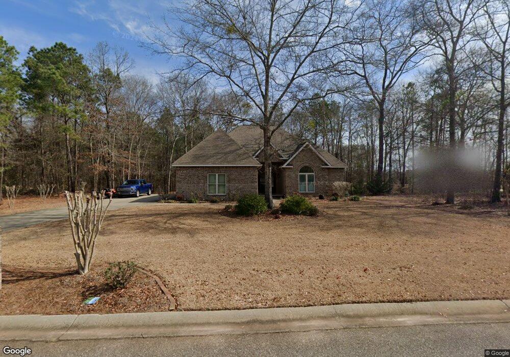
This home is located at 158 Sterling Dr, Byron, GA 31008 and is currently estimated at $387,914, approximately $154 per square foot. 158 Sterling Dr is a home with nearby schools including Kay Road Elementary School, Fort Valley Middle School, and Peach County High School.
Ownership History
Date
Name
Owned For
Owner Type
Purchase Details
Closed on
Aug 20, 2010
Sold by
Bob Holcomb & Associates Inc
Bought by
Collins Charles E and Collins Karen L
Current Estimated Value
Purchase Details
Closed on
Aug 12, 2010
Sold by
State Bank And Trust Company
Bought by
Bob Holcomb And Associates Inc
Purchase Details
Closed on
May 21, 2010
Sold by
Security Bank Of Houston County
Bought by
State Bank And Trust Company
Purchase Details
Closed on
Jul 7, 2009
Sold by
Ncw Inc
Bought by
Security Bank Of Houston County
Purchase Details
Closed on
Oct 8, 2004
Bought by
Ncw Inc
Create a Home Valuation Report for This Property
The Home Valuation Report is an in-depth analysis detailing your home's value as well as a comparison with similar homes in the area
Home Values in the Area
Average Home Value in this Area
Purchase History
| Date | Buyer | Sale Price | Title Company |
|---|---|---|---|
| Collins Charles E | $10,000 | -- | |
| Bob Holcomb And Associates Inc | -- | -- | |
| State Bank And Trust Company | -- | -- | |
| Security Bank Of Houston County | -- | -- | |
| Ncw Inc | -- | -- |
Source: Public Records
Tax History Compared to Growth
Tax History
| Year | Tax Paid | Tax Assessment Tax Assessment Total Assessment is a certain percentage of the fair market value that is determined by local assessors to be the total taxable value of land and additions on the property. | Land | Improvement |
|---|---|---|---|---|
| 2024 | $3,554 | $127,520 | $18,000 | $109,520 |
| 2023 | $3,501 | $124,480 | $18,000 | $106,480 |
| 2022 | $2,904 | $109,880 | $12,800 | $97,080 |
| 2021 | $2,633 | $86,320 | $6,000 | $80,320 |
| 2020 | $2,649 | $80,320 | $6,000 | $74,320 |
| 2019 | $2,661 | $80,320 | $6,000 | $74,320 |
| 2018 | $2,674 | $80,320 | $6,000 | $74,320 |
| 2017 | $2,686 | $80,320 | $6,000 | $74,320 |
| 2016 | $2,627 | $78,800 | $4,480 | $74,320 |
| 2015 | -- | $78,800 | $4,480 | $74,320 |
| 2014 | $2,698 | $78,800 | $4,480 | $74,320 |
| 2013 | -- | $78,800 | $4,480 | $74,320 |
Source: Public Records
Map
Nearby Homes
- 245 Sterling Dr
- 24C Sterling Dr
- 19C Crown Ct
- 800 John E Sullivan Rd
- 3355 Housers Mill Rd
- 211 Serenity Ct
- 109 Early Dr
- 115 Early Dr
- 119 Early Dr
- 108 Early Dr
- 111 Early Dr
- 0 Housers Mill Rd Unit 5515996
- 167 Erin Ct
- 199 Red Tail Cir
- 219 Rowland Cir
- 107 Red Tail Cir
- 109 Red Tail Cir
- 120 Hawks Place
- 53.91 Acres Anna Marie Circle (Autumn Cove Subdivision)
- 98 Sterling Dr
- 202 Sterling Dr
- 145 Sterling Dr
- 135 Sterling Dr
- 76 Sterling Dr
- 214 Sterling Dr
- 0 Sterling Dr Unit 25C 8127040
- 0 Sterling Dr Unit 215026
- 0 Sterling Dr Unit M155550
- 0 Sterling Dr Unit 8789806
- 0 Sterling Dr Unit 202795
- 32 Sterling Dr
- 0 Mystic Cir Unit 13C 7002232
- 244 Mystic Cir
- 34 Mystic Cir
- 34 Mystic Cir
- 22 Mystic Cir
- 33 Mystic Cir
- 9 Mystic Cir
- 13 Mystic Cir