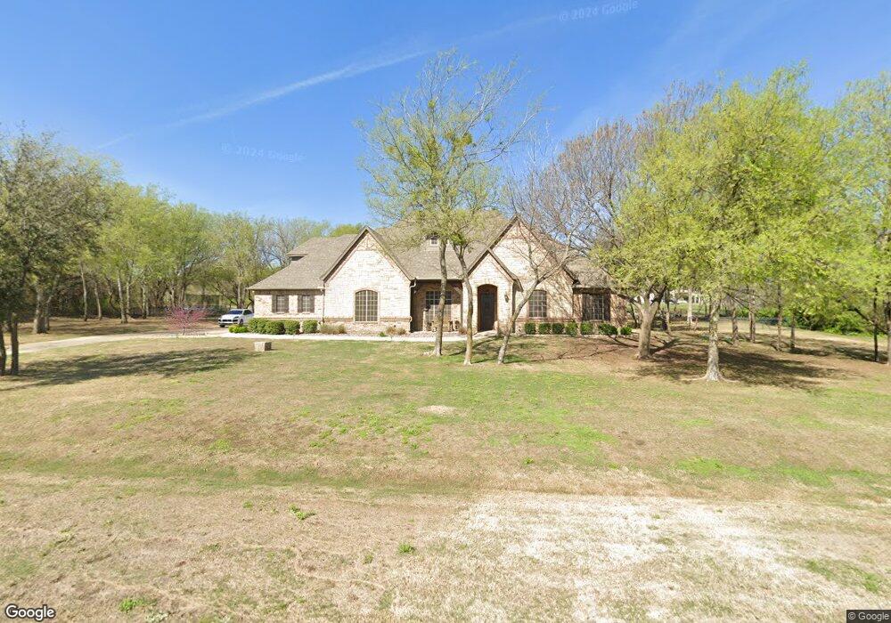
158 Top Flight Dr Weatherford, TX 76087
Estimated Value: $912,000 - $1,104,000
4
Beds
5
Baths
4,544
Sq Ft
$219/Sq Ft
Est. Value
About This Home
This home is located at 158 Top Flight Dr, Weatherford, TX 76087 and is currently estimated at $995,919, approximately $219 per square foot. 158 Top Flight Dr is a home located in Parker County with nearby schools including Brock Intermediate School, Brock Junior High School, and Brock High School.
Ownership History
Date
Name
Owned For
Owner Type
Purchase Details
Closed on
Sep 8, 2023
Sold by
Cates Erica and Cates Chris
Bought by
Neverneverland Llc
Current Estimated Value
Purchase Details
Closed on
Jul 28, 2022
Sold by
Ilene Manuel Lois
Bought by
Cates Erica and Cates Chris
Home Financials for this Owner
Home Financials are based on the most recent Mortgage that was taken out on this home.
Original Mortgage
$750,000
Interest Rate
5.81%
Mortgage Type
Credit Line Revolving
Purchase Details
Closed on
Mar 17, 2021
Sold by
Davis James C and Davis Christina M
Bought by
Cates Erica and Cates Chris
Home Financials for this Owner
Home Financials are based on the most recent Mortgage that was taken out on this home.
Original Mortgage
$543,790
Interest Rate
2.75%
Mortgage Type
New Conventional
Purchase Details
Closed on
Nov 23, 2016
Sold by
Mdb Enterprises Inc
Bought by
Davis James C and Davis Christina M
Home Financials for this Owner
Home Financials are based on the most recent Mortgage that was taken out on this home.
Original Mortgage
$300,000
Interest Rate
3.47%
Mortgage Type
New Conventional
Purchase Details
Closed on
Nov 21, 2014
Sold by
Pavillion Bank
Bought by
Mdb Enterprises Inc
Home Financials for this Owner
Home Financials are based on the most recent Mortgage that was taken out on this home.
Original Mortgage
$360,000
Interest Rate
3.99%
Mortgage Type
Construction
Purchase Details
Closed on
Jan 12, 2010
Sold by
Pavillion Bank
Bought by
Davis James C and Davis Christina M
Purchase Details
Closed on
Nov 16, 2009
Sold by
Goff Development Corp
Bought by
Davis James C and Davis Christina M
Purchase Details
Closed on
Jan 20, 2003
Sold by
Canyon West Development Co Ltd
Bought by
Davis James C and Davis Christina M
Purchase Details
Closed on
Aug 7, 2001
Sold by
Mickle Wesley J
Bought by
Davis James C and Davis Christina M
Create a Home Valuation Report for This Property
The Home Valuation Report is an in-depth analysis detailing your home's value as well as a comparison with similar homes in the area
Home Values in the Area
Average Home Value in this Area
Purchase History
| Date | Buyer | Sale Price | Title Company |
|---|---|---|---|
| Neverneverland Llc | -- | None Listed On Document | |
| Cates Erica | -- | New Title Company Name | |
| Cates Erica | -- | Providence Title Company | |
| Davis James C | -- | Providence Title Company | |
| Mdb Enterprises Inc | -- | Capital Title | |
| Pavillion Bank | -- | Capital Title | |
| Davis James C | -- | -- | |
| Davis James C | -- | -- | |
| Davis James C | -- | -- | |
| Davis James C | -- | -- |
Source: Public Records
Mortgage History
| Date | Status | Borrower | Loan Amount |
|---|---|---|---|
| Previous Owner | Cates Erica | $750,000 | |
| Previous Owner | Cates Erica | $543,790 | |
| Previous Owner | Davis James C | $300,000 | |
| Previous Owner | Mdb Enterprises Inc | $360,000 |
Source: Public Records
Tax History Compared to Growth
Tax History
| Year | Tax Paid | Tax Assessment Tax Assessment Total Assessment is a certain percentage of the fair market value that is determined by local assessors to be the total taxable value of land and additions on the property. | Land | Improvement |
|---|---|---|---|---|
| 2025 | $16,364 | $888,980 | $130,000 | $758,980 |
| 2024 | $16,364 | $884,530 | $130,000 | $754,530 |
| 2023 | $16,364 | $612,720 | $0 | $0 |
| 2022 | $5,654 | $278,510 | $40,000 | $238,510 |
| 2021 | $11,516 | $557,020 | $80,000 | $477,020 |
| 2020 | $10,122 | $467,630 | $75,000 | $392,630 |
| 2019 | $10,899 | $467,630 | $75,000 | $392,630 |
| 2018 | $10,432 | $445,620 | $60,000 | $385,620 |
| 2017 | $10,252 | $445,620 | $60,000 | $385,620 |
| 2016 | $9,743 | $423,490 | $60,000 | $363,490 |
| 2015 | $1,113 | $49,000 | $49,000 | $0 |
| 2014 | $459 | $20,000 | $20,000 | $0 |
Source: Public Records
Map
Nearby Homes
- 150 Top Flight Dr
- 1060 Kessler Rd
- 234 Trail Ridge
- 113 Laser Ln
- 125 Summer Stone Ct
- 123 Club House Dr
- 873 Canyon Creek Ln
- 313 Canyon Creek Cir
- 101 Trail Ridge
- 120 Trail Ridge
- 162 Pinnacle Peak Ln
- 197 Pinnacle Peak Ln
- 205 Pinnacle Peak Ln
- 393 Canyon Creek Cir
- 788 W Canyon Creek Ln
- TBA Old Brock Rd
- 833 N Savage Creek Ln
- 0 Quanah Hill Rd Unit 23872058
- 151 Canyon Creek Ct
- 673 E Canyon Creek Ln
- 154 Top Flight Dr
- 166 Top Flight Dr
- 130 Top Flight Dr
- 165 Brock Springs Trail
- 142 Top Flight Dr
- 175 Brock Springs Trail
- 126 Top Flight Dr
- 137 Top Flight Dr
- TBD Top Flight Dr
- L19 B1 Top Flight Dr
- L18 B1 Top Flight Dr
- 188 Top Flight Dr
- 184 Top Flight Dr
- Lot 10 Top Flight Dr
- 133 Top Flight Dr
- 122 Top Flight Dr
- 1044 Kessler Rd
- 155 Brock Springs Trail
- 173 Summer Stone Ct
- 176 Brock Springs Trail