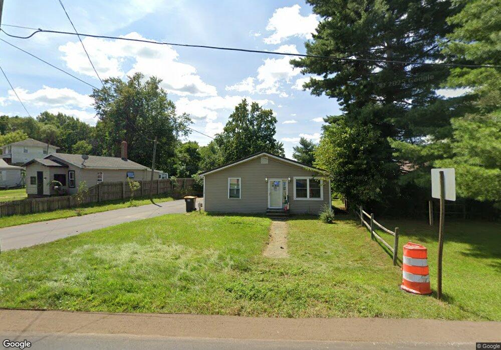
158 W St Joe St Hillsdale, MI 49242
Estimated Value: $112,000 - $185,000
3
Beds
1
Bath
1,421
Sq Ft
$113/Sq Ft
Est. Value
About This Home
This home is located at 158 W St Joe St, Hillsdale, MI 49242 and is currently estimated at $160,877, approximately $113 per square foot. 158 W St Joe St is a home located in Hillsdale County with nearby schools including Bailey Early Childhood Center, Gier Elementary School, and Davis Middle School.
Ownership History
Date
Name
Owned For
Owner Type
Purchase Details
Closed on
Jul 12, 2022
Sold by
Shaner Gerald F and Shaner Y
Bought by
Shaner Gerald F and Mcgee Terra
Current Estimated Value
Home Financials for this Owner
Home Financials are based on the most recent Mortgage that was taken out on this home.
Original Mortgage
$107,500
Outstanding Balance
$102,859
Interest Rate
5.78%
Estimated Equity
$58,018
Purchase Details
Closed on
Dec 22, 1998
Sold by
Shaner Gerald
Bought by
Shaner Gerald and Shaner Laura
Create a Home Valuation Report for This Property
The Home Valuation Report is an in-depth analysis detailing your home's value as well as a comparison with similar homes in the area
Home Values in the Area
Average Home Value in this Area
Purchase History
| Date | Buyer | Sale Price | Title Company |
|---|---|---|---|
| Shaner Gerald F | -- | -- | |
| Shaner Gerald F | -- | -- | |
| Shaner Gerald | -- | -- |
Source: Public Records
Mortgage History
| Date | Status | Borrower | Loan Amount |
|---|---|---|---|
| Open | Shaner Gerald F | $107,500 |
Source: Public Records
Tax History Compared to Growth
Tax History
| Year | Tax Paid | Tax Assessment Tax Assessment Total Assessment is a certain percentage of the fair market value that is determined by local assessors to be the total taxable value of land and additions on the property. | Land | Improvement |
|---|---|---|---|---|
| 2025 | $1,869 | $60,300 | $0 | $0 |
| 2024 | $1,433 | $76,100 | $0 | $0 |
| 2023 | $1,379 | $61,100 | $0 | $0 |
| 2022 | $1,254 | $63,500 | $0 | $0 |
| 2021 | $1,225 | $61,100 | $0 | $0 |
| 2020 | $1,164 | $49,700 | $0 | $0 |
| 2019 | $1,128 | $44,600 | $0 | $0 |
| 2018 | $1,052 | $45,600 | $0 | $0 |
| 2017 | $1,017 | $34,300 | $0 | $0 |
| 2016 | $930 | $31,000 | $0 | $0 |
| 2015 | $776 | $31,000 | $0 | $0 |
| 2013 | -- | $28,560 | $0 | $0 |
| 2012 | -- | $27,730 | $0 | $0 |
Source: Public Records
Map
Nearby Homes
- 178 Griswold St
- 243 Auseon Ct
- 245 Auseon Ct
- 235 Auseon Ct
- 233 Auseon Ct
- 106 E Sharp St
- 63 S Broad St
- 76 Budlong St
- 134 S Howell St
- 90 S Howell St
- 185 E Carleton Rd
- 3091-1 S Hillsdale Rd
- 1136 Lochaven Cir
- 56 Waldron St
- 172 S Manning St
- 30 & 40 Logan St
- 60 Logan St
- 1140 Lochaven Cir Unit 10B
- 1160 Lochaven Cir
- 95 S West St
- 158 W Saint Joe St
- 156 W Saint Joe St
- 172 W Saint Joe St
- 174 W Saint Joe St
- 0 Griswold St
- 162 Griswold St
- 145 Griswold St
- 143 Griswold St
- 166 Griswold St
- 163 Griswold St
- 141 Griswold St Unit 12
- 141 Griswold St
- 141 Griswold St
- 11 Barnard St
- 19 Baw Beese Trail
- 139 Griswold St
- 167 Griswold St
- 1415 Griswold St
- 13 Barnard St
- 137 Griswold St