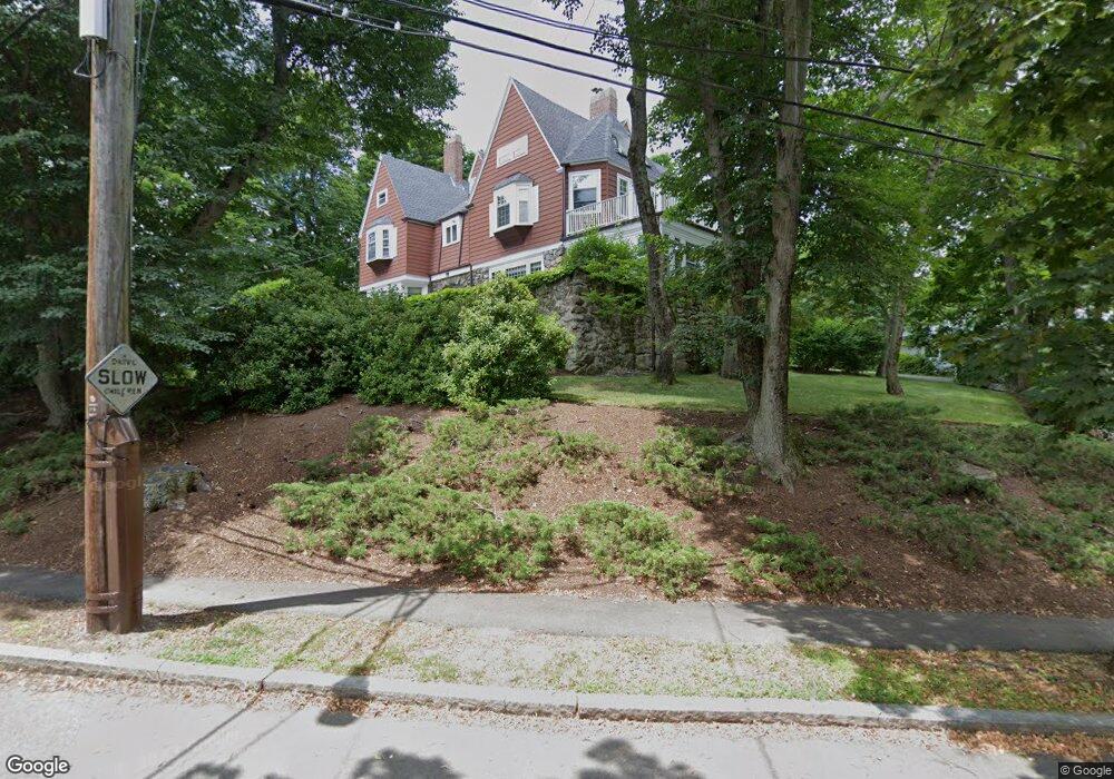
158 Wolcott Rd Chestnut Hill, MA 02467
South Brookline NeighborhoodEstimated Value: $2,659,000 - $3,079,482
5
Beds
5
Baths
4,279
Sq Ft
$671/Sq Ft
Est. Value
About This Home
This home is located at 158 Wolcott Rd, Chestnut Hill, MA 02467 and is currently estimated at $2,873,121, approximately $671 per square foot. 158 Wolcott Rd is a home located in Norfolk County with nearby schools including Baker School, Brookline High School, and Mount Alvernia Academy.
Ownership History
Date
Name
Owned For
Owner Type
Purchase Details
Closed on
Nov 10, 1983
Bought by
Rubenstein Mitchell H and Gordon Susan R
Current Estimated Value
Create a Home Valuation Report for This Property
The Home Valuation Report is an in-depth analysis detailing your home's value as well as a comparison with similar homes in the area
Home Values in the Area
Average Home Value in this Area
Purchase History
| Date | Buyer | Sale Price | Title Company |
|---|---|---|---|
| Rubenstein Mitchell H | $260,000 | -- |
Source: Public Records
Mortgage History
| Date | Status | Borrower | Loan Amount |
|---|---|---|---|
| Open | Rubenstein Mitchell H | $299,000 | |
| Closed | Rubenstein Mitchell H | $299,000 | |
| Closed | Rubenstein Mitchell H | $255,000 |
Source: Public Records
Tax History Compared to Growth
Tax History
| Year | Tax Paid | Tax Assessment Tax Assessment Total Assessment is a certain percentage of the fair market value that is determined by local assessors to be the total taxable value of land and additions on the property. | Land | Improvement |
|---|---|---|---|---|
| 2025 | $30,020 | $3,041,500 | $1,094,400 | $1,947,100 |
| 2024 | $28,611 | $2,928,500 | $1,052,300 | $1,876,200 |
| 2023 | $28,190 | $2,827,500 | $852,900 | $1,974,600 |
| 2022 | $27,439 | $2,692,700 | $812,200 | $1,880,500 |
| 2021 | $25,374 | $2,589,200 | $781,000 | $1,808,200 |
| 2020 | $23,579 | $2,495,100 | $710,000 | $1,785,100 |
| 2019 | $22,266 | $2,376,300 | $676,200 | $1,700,100 |
| 2018 | $20,434 | $2,160,000 | $673,800 | $1,486,200 |
| 2017 | $19,884 | $2,012,500 | $635,800 | $1,376,700 |
| 2016 | $19,598 | $1,880,800 | $594,200 | $1,286,600 |
| 2015 | $18,773 | $1,757,800 | $555,300 | $1,202,500 |
| 2014 | $18,901 | $1,659,400 | $503,900 | $1,155,500 |
Source: Public Records
Map
Nearby Homes
- 171 Shaw Rd
- 646 Newton St Unit 2
- 18 Wolcott Rd
- 34 Lagrange St
- 65 Lagrange St
- 16 Alberta Rd
- 69 Princeton Rd
- 72 Wallis Rd
- 50-56 Broadlawn Park Unit 221
- 56 Broadlawn Park Unit 512
- 1069 W Roxbury Pkwy
- 50 Bellingham Rd
- 24 Westgate Rd Unit 2
- 28 Westgate Rd Unit 3
- 64 Bryon Rd Unit 1
- 21 Westgate Rd Unit 6
- 173 South St
- 40 Westgate Rd Unit 5
- 23 Westgate Rd Unit 6
- 208 South St
- 157 Wolcott Rd
- 161 Wolcott Rd
- 171 Wolcott Rd
- 151 Wolcott Rd
- 172 Wolcott Rd
- 136 Wolcott Rd
- 168 Shaw Rd
- 124 Wolcott Rd
- 33 Wolcott Rd
- 33 Wolcott Road Extension
- 118 Wolcott Rd
- 21 Wolcott Road Extension
- 158 Shaw Rd
- 158 Shaw Rd
- 158 Shaw Rd Unit 1
- 112 Wolcott Rd
- 192 Wallis Rd
- 161 Shaw Rd
- 190 Wolcott Rd
- 186 Wallis Rd