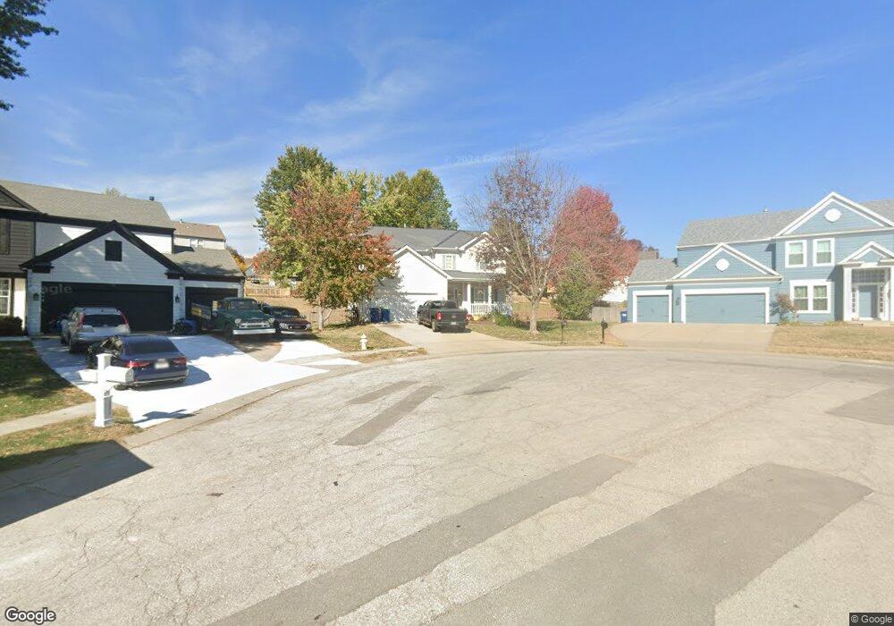
1580 Columbine Ct Liberty, MO 64068
Estimated Value: $389,719 - $426,000
4
Beds
3
Baths
2,206
Sq Ft
$183/Sq Ft
Est. Value
About This Home
This home is located at 1580 Columbine Ct, Liberty, MO 64068 and is currently estimated at $403,430, approximately $182 per square foot. 1580 Columbine Ct is a home located in Clay County with nearby schools including Manor Hill Elementary School, Liberty Middle School, and Liberty High School.
Ownership History
Date
Name
Owned For
Owner Type
Purchase Details
Closed on
Apr 10, 2006
Sold by
Crosen John M and Crosen Kimberly A
Bought by
Mcgowan Ricky D and Mcgowan Nesha I
Current Estimated Value
Home Financials for this Owner
Home Financials are based on the most recent Mortgage that was taken out on this home.
Original Mortgage
$157,520
Outstanding Balance
$90,312
Interest Rate
6.32%
Mortgage Type
Fannie Mae Freddie Mac
Estimated Equity
$313,118
Purchase Details
Closed on
Apr 25, 2003
Sold by
Mcbride & Son Homes Kansas City Llc
Bought by
Crosen John M and Crosen Kimberly A
Home Financials for this Owner
Home Financials are based on the most recent Mortgage that was taken out on this home.
Original Mortgage
$164,000
Interest Rate
5%
Create a Home Valuation Report for This Property
The Home Valuation Report is an in-depth analysis detailing your home's value as well as a comparison with similar homes in the area
Home Values in the Area
Average Home Value in this Area
Purchase History
| Date | Buyer | Sale Price | Title Company |
|---|---|---|---|
| Mcgowan Ricky D | -- | Metropolitan Title & Escrow | |
| Crosen John M | -- | Stewart Title |
Source: Public Records
Mortgage History
| Date | Status | Borrower | Loan Amount |
|---|---|---|---|
| Open | Mcgowan Ricky D | $157,520 | |
| Previous Owner | Crosen John M | $164,000 |
Source: Public Records
Tax History Compared to Growth
Tax History
| Year | Tax Paid | Tax Assessment Tax Assessment Total Assessment is a certain percentage of the fair market value that is determined by local assessors to be the total taxable value of land and additions on the property. | Land | Improvement |
|---|---|---|---|---|
| 2025 | $3,969 | $57,820 | -- | -- |
| 2024 | $3,969 | $51,600 | -- | -- |
| 2023 | $4,036 | $51,600 | $0 | $0 |
| 2022 | $3,604 | $45,490 | $0 | $0 |
| 2021 | $3,575 | $45,486 | $7,600 | $37,886 |
| 2020 | $3,548 | $42,390 | $0 | $0 |
| 2019 | $3,547 | $42,390 | $0 | $0 |
| 2018 | $3,271 | $38,380 | $0 | $0 |
| 2017 | $3,161 | $38,380 | $5,700 | $32,680 |
| 2016 | $3,161 | $37,430 | $5,700 | $31,730 |
| 2015 | $3,161 | $37,430 | $5,700 | $31,730 |
| 2014 | $3,028 | $35,570 | $5,320 | $30,250 |
Source: Public Records
Map
Nearby Homes
- 1588 Columbine Ct
- 1505 Glen Brook Ln
- 1030 Maple Woods Dr
- 753 Todd Ct
- 977 Wellington Way
- McKinley Plan at Homestead of Liberty - Homestead
- Monroe Plan at Homestead of Liberty - Homestead
- Chestnut Plan at Homestead of Liberty - Homestead
- The Brooklyn Plan at Homestead of Liberty - Homestead
- Cypress Plan at Homestead of Liberty - Homestead
- The Linden Plan at Homestead of Liberty - Homestead
- Spruce Plan at Homestead of Liberty - Homestead
- Ashton Plan at Homestead of Liberty - Homestead
- Meg Plan at Homestead of Liberty - Homestead
- The Hillsdale Plan at Homestead of Liberty - Homestead
- The Maple Plan at Homestead of Liberty - Homestead
- Redbud Plan at Homestead of Liberty - Homestead
- Hawthorn II Plan at Homestead of Liberty - Homestead
- The Sycamore Plan at Homestead of Liberty - Homestead
- 2188 Heritage Ct
- 1584 Columbine Ct
- 1576 Columbine Ct
- 1575 Maple Woods Dr
- 1579 Maple Woods Dr
- 1049 Fox Run Terrace
- 1571 Maple Woods Dr
- 1583 Maple Woods Dr
- 1045 Fox Run Terrace
- 1581 Columbine Ct
- 1585 Columbine Ct
- 1589 Columbine Ct
- 1592 Columbine Ct
- 1587 Maple Woods Dr
- 1041 Fox Run Terrace
- 1593 Columbine Ct
- 1572 Maple Woods Dr
- 1576 Maple Woods Dr
- 1050 Fox Run Terrace
- 1568 Maple Woods Dr
- 1580 Maple Woods Dr