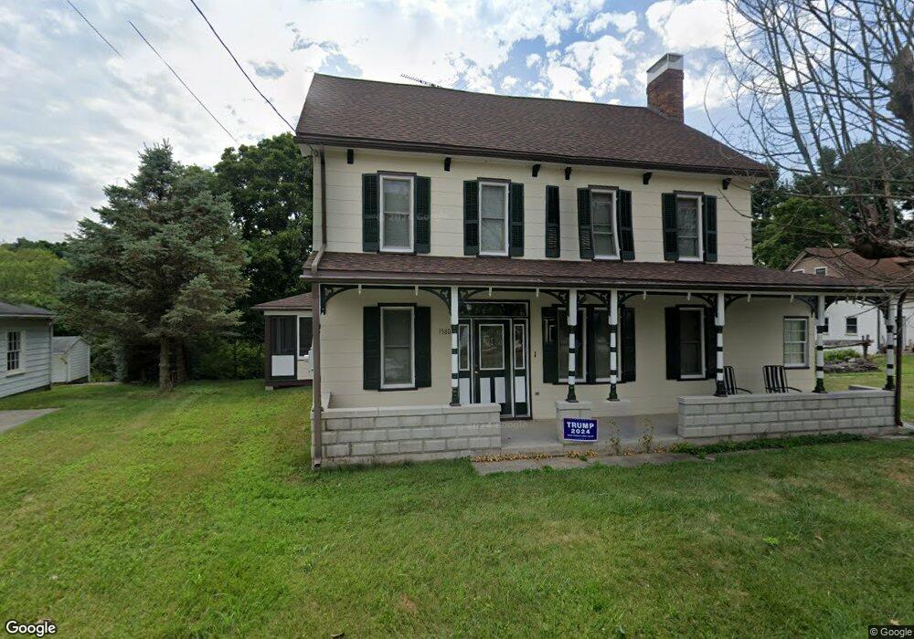
1580 Jacobs Mill Rd Hanover, PA 17331
Estimated Value: $290,126 - $416,000
4
Beds
1
Bath
2,754
Sq Ft
$133/Sq Ft
Est. Value
About This Home
This home is located at 1580 Jacobs Mill Rd, Hanover, PA 17331 and is currently estimated at $367,532, approximately $133 per square foot. 1580 Jacobs Mill Rd is a home located in York County with nearby schools including Spring Grove Area Middle School, Spring Grove Area High School, and Hope Christian School Of Hanover.
Ownership History
Date
Name
Owned For
Owner Type
Purchase Details
Closed on
Mar 22, 2000
Sold by
Strausbaugh Edwin D
Bought by
Strausbaugh Tracey S
Current Estimated Value
Purchase Details
Closed on
Dec 9, 1997
Sold by
Strausbaugh Edwin D and Strausbaugh Tracey S
Bought by
Strausbaugh Edwin D
Purchase Details
Closed on
Nov 2, 1990
Bought by
Strausbaugh Edwin D and Strausbaugh Tracey S
Create a Home Valuation Report for This Property
The Home Valuation Report is an in-depth analysis detailing your home's value as well as a comparison with similar homes in the area
Home Values in the Area
Average Home Value in this Area
Purchase History
| Date | Buyer | Sale Price | Title Company |
|---|---|---|---|
| Strausbaugh Tracey S | -- | -- | |
| Strausbaugh Edwin D | -- | -- | |
| Strausbaugh Edwin D | -- | -- |
Source: Public Records
Tax History Compared to Growth
Tax History
| Year | Tax Paid | Tax Assessment Tax Assessment Total Assessment is a certain percentage of the fair market value that is determined by local assessors to be the total taxable value of land and additions on the property. | Land | Improvement |
|---|---|---|---|---|
| 2025 | $4,532 | $134,880 | $45,060 | $89,820 |
| 2024 | $4,484 | $134,880 | $45,060 | $89,820 |
| 2023 | $4,484 | $134,880 | $45,060 | $89,820 |
| 2022 | $4,484 | $134,880 | $45,060 | $89,820 |
| 2021 | $4,291 | $134,880 | $45,060 | $89,820 |
| 2020 | $4,291 | $134,880 | $45,060 | $89,820 |
| 2019 | $4,200 | $134,880 | $45,060 | $89,820 |
| 2018 | $4,144 | $134,880 | $45,060 | $89,820 |
| 2017 | $4,016 | $134,880 | $45,060 | $89,820 |
| 2016 | -- | $134,880 | $45,060 | $89,820 |
| 2015 | $2,713 | $134,880 | $45,060 | $89,820 |
| 2014 | $2,713 | $134,880 | $45,060 | $89,820 |
Source: Public Records
Map
Nearby Homes
- 1621 Spring St
- 1844 Liberty Rd
- 1315 Moulstown Rd N
- 1063 Porters Rd
- 1233 Glatco Lodge Rd
- 1098 Porters Rd
- 6170 York Rd
- 0 Moulstown Rd N Unit PAYK2082362
- 799 Laurel Woods Ln
- 1342 Marburg Rd
- 5931 York Rd
- 7877 Gnatstown Rd
- 1329 Broadway
- 1440 Broadway
- 125 Northview Dr
- 6 Amanda Ave
- 961 Beaver Creek Rd
- 1010 Marietta Ave
- 1120 Hoff Rd
- 706 Grant Dr
- 1586 Jacobs Mill Rd
- 1579 Jacobs Mill Rd
- 1587 Jacobs Mill Rd
- 1574 Trolley Rd
- 1555 Jacobs Mill Rd
- 1553 Jacobs Mill Rd
- 1580 Trolley Rd
- 1551 Jacobs Mill Rd
- 1547 Jacobs Mill Rd
- 1594 Trolley Rd
- 1594 Trolley Rd Unit 1
- 1594 Trolley Rd Unit 3
- 1588 Trolley Rd
- 1586 Trolley Rd
- 1597 Jacobs Mill Rd
- 1588 Trolley Rd
- 1601 Jacobs Mill Rd
- 1539 Jacobs Mill Rd
- 1525 Jacobs Mill Rd
- 1517 Jacobs Mill Rd