Estimated Value: $353,894 - $515,000
--
Bed
--
Bath
1,394
Sq Ft
$337/Sq Ft
Est. Value
About This Home
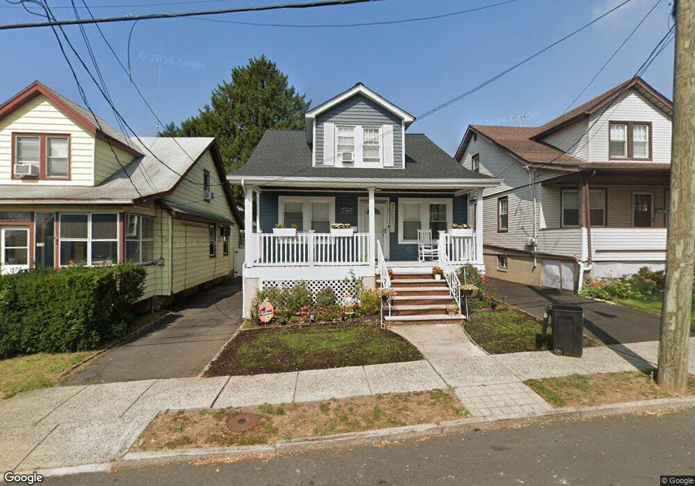
This home is located at 1580 Porter Rd, Union, NJ 07083 and is currently estimated at $469,724, approximately $336 per square foot. 1580 Porter Rd is a home located in Union County with nearby schools including Franklin Elementary School, Burnet Middle School, and Union High School.
Ownership History
Date
Name
Owned For
Owner Type
Purchase Details
Closed on
May 7, 2020
Sold by
Aristilde Evens
Bought by
Williams Maurice and Hall Shuquawana
Current Estimated Value
Home Financials for this Owner
Home Financials are based on the most recent Mortgage that was taken out on this home.
Original Mortgage
$304,486
Outstanding Balance
$269,817
Interest Rate
3.3%
Mortgage Type
FHA
Estimated Equity
$199,907
Purchase Details
Closed on
Sep 26, 2019
Sold by
Cadet Florence and Aristilde Evens
Bought by
Aristilde Evens
Purchase Details
Closed on
Aug 28, 2003
Sold by
Baptiste Michael
Bought by
Aristilde Extraivoof and Aristilde Sadira
Home Financials for this Owner
Home Financials are based on the most recent Mortgage that was taken out on this home.
Original Mortgage
$193,000
Interest Rate
6.22%
Create a Home Valuation Report for This Property
The Home Valuation Report is an in-depth analysis detailing your home's value as well as a comparison with similar homes in the area
Home Values in the Area
Average Home Value in this Area
Purchase History
| Date | Buyer | Sale Price | Title Company |
|---|---|---|---|
| Williams Maurice | $315,000 | Montgomery Hills Ttl Svcs Ll | |
| Aristilde Evens | -- | None Available | |
| Aristilde Extraivoof | $260,000 | -- |
Source: Public Records
Mortgage History
| Date | Status | Borrower | Loan Amount |
|---|---|---|---|
| Open | Williams Maurice | $304,486 | |
| Previous Owner | Aristilde Extraivoof | $193,000 |
Source: Public Records
Tax History Compared to Growth
Tax History
| Year | Tax Paid | Tax Assessment Tax Assessment Total Assessment is a certain percentage of the fair market value that is determined by local assessors to be the total taxable value of land and additions on the property. | Land | Improvement |
|---|---|---|---|---|
| 2025 | $8,963 | $40,100 | $14,000 | $26,100 |
| 2024 | $8,689 | $40,100 | $14,000 | $26,100 |
| 2023 | $8,689 | $40,100 | $14,000 | $26,100 |
| 2022 | $8,387 | $40,100 | $14,000 | $26,100 |
| 2021 | $8,184 | $40,100 | $14,000 | $26,100 |
| 2020 | $8,021 | $40,100 | $14,000 | $26,100 |
| 2019 | $7,913 | $40,100 | $14,000 | $26,100 |
| 2018 | $7,778 | $40,100 | $14,000 | $26,100 |
| 2017 | $7,663 | $40,100 | $14,000 | $26,100 |
| 2016 | $7,476 | $40,100 | $14,000 | $26,100 |
| 2015 | $7,352 | $40,100 | $14,000 | $26,100 |
| 2014 | $7,188 | $40,100 | $14,000 | $26,100 |
Source: Public Records
Map
Nearby Homes
- 1584 Andrew St
- 1589 Edmund Terrace
- 1630 Andrew St
- 1672 Edmund Terrace
- 1683 Van Ness Terrace
- 2105 Melrose Pkwy
- 6 Field Rd
- 2220 Morrison Ave
- 1396 Orange Ave
- 2043-2045 Ostwood Terrace
- 2225 Stecher Ave
- 29 Schaefer Rd
- 1481 Walker Ave
- 1707 Burnet Ave
- 1517 Lindy Terrace
- 74 Hughes St
- 188 Burnett Ave
- 1552 Elaine Terrace
- 2144 Tyler St
- 61 Concord Ave
- 1580 Porter Rd Unit one
- 1582 Porter Rd
- 1578 Porter Rd
- 1584 Porter Rd
- 1576 Porter Rd
- 1581 Andrew St
- 1575 Andrew St
- 1583 Andrew St
- 1574 Porter Rd
- 1586 Porter Rd
- 1573 Andrew St
- 1585 Andrew St
- 1573 Andrew St N
- 1571 Andrew St
- 1587 Andrew St
- 1579 Porter Rd
- 1587 Andrew St
- 1585 Porter Rd
- 1575 Porter Rd
- 1569 Andrew St