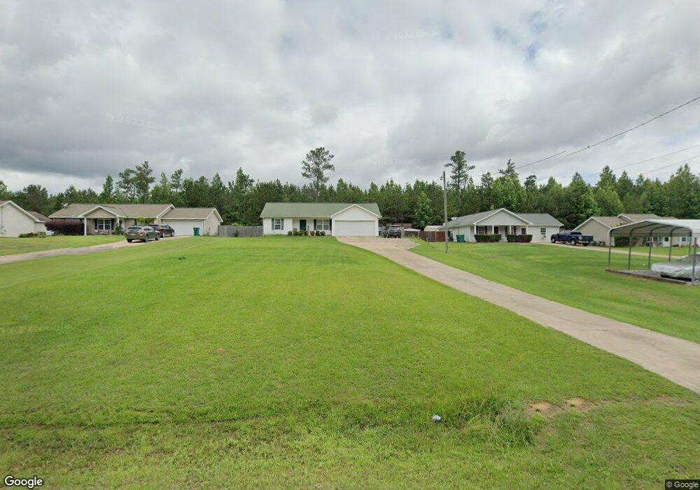
15802 Wire Rd Cottondale, AL 35453
Estimated Value: $196,000 - $232,000
3
Beds
1
Bath
1,127
Sq Ft
$191/Sq Ft
Est. Value
About This Home
This home is located at 15802 Wire Rd, Cottondale, AL 35453 and is currently estimated at $215,287, approximately $191 per square foot. 15802 Wire Rd is a home located in Tuscaloosa County with nearby schools including Vance Elementary School, Brookwood Middle School, and Brookwood High School.
Ownership History
Date
Name
Owned For
Owner Type
Purchase Details
Closed on
Sep 20, 2019
Sold by
Williamson Cyndee
Bought by
Honeycutt Dalton C
Current Estimated Value
Home Financials for this Owner
Home Financials are based on the most recent Mortgage that was taken out on this home.
Original Mortgage
$140,000
Outstanding Balance
$121,559
Interest Rate
3.5%
Mortgage Type
New Conventional
Estimated Equity
$93,728
Purchase Details
Closed on
Jan 27, 2009
Sold by
Billy Fields Building Inc
Bought by
Williamson Michael A
Home Financials for this Owner
Home Financials are based on the most recent Mortgage that was taken out on this home.
Original Mortgage
$118,338
Interest Rate
5.24%
Create a Home Valuation Report for This Property
The Home Valuation Report is an in-depth analysis detailing your home's value as well as a comparison with similar homes in the area
Purchase History
| Date | Buyer | Sale Price | Title Company |
|---|---|---|---|
| Honeycutt Dalton C | $140,000 | -- | |
| Williamson Michael A | $121,935 | -- |
Source: Public Records
Mortgage History
| Date | Status | Borrower | Loan Amount |
|---|---|---|---|
| Open | Honeycutt Dalton C | $140,000 | |
| Previous Owner | Williamson Michael A | $118,338 | |
| Previous Owner | Williamson Michael A | $3,597 |
Source: Public Records
Tax History
| Year | Tax Paid | Tax Assessment Tax Assessment Total Assessment is a certain percentage of the fair market value that is determined by local assessors to be the total taxable value of land and additions on the property. | Land | Improvement |
|---|---|---|---|---|
| 2024 | $600 | $33,800 | $6,000 | $27,800 |
| 2023 | $548 | $32,300 | $6,000 | $26,300 |
| 2022 | $460 | $29,020 | $6,000 | $23,020 |
| 2021 | $465 | $29,280 | $6,000 | $23,280 |
| 2020 | $425 | $13,580 | $3,000 | $10,580 |
| 2019 | $425 | $13,580 | $3,000 | $10,580 |
| 2018 | $425 | $13,580 | $3,000 | $10,580 |
| 2017 | $390 | $0 | $0 | $0 |
| 2016 | $397 | $0 | $0 | $0 |
| 2015 | $397 | $0 | $0 | $0 |
| 2014 | -- | $12,800 | $3,000 | $9,800 |
Source: Public Records
Map
Nearby Homes
- 15632 Hagler Dr
- 16414 Highway 11 N
- 10464 Nicole St
- 14853 Kepple Loop
- 10617 Austin Loop
- 10432 Nicole St
- 16670 Laney Ln
- 14583 Ole Oak Dr
- 14365 Wire Rd
- 10488 Rolling Valley Dr
- 17043 Annawood Ln
- 10392 Hi Rd
- 10463 Beulah Lake Ln
- 1 Brant Ward Rd
- 14304 Hargrove Rd E
- 11312 Covered Bridge Rd
- 11316 Covered Bridge Rd
- 0 Daimler Benz Blvd
- 11453 Cedar Glades Dr
- 11428 Cedar Glades Dr
- 15796 Wire Rd
- 15808 Wire Rd
- 15814 Wire Rd
- 15790 Wire Rd
- 15820 Wire Rd
- 15826 Wire Rd
- 15836 Wire Rd
- 15842 Wire Rd
- 11277 Youngblood Dr
- 15848 Wire Rd
- 15832 Wire Rd
- 15709 Wire Rd
- 11325 Wire Rd
- 15677 Wire Rd
- 15655 Wire Rd
- 15635 Wire Rd
- 15613 Wire Rd
- 15610 Wire Rd
- 15832 Thomas Chapel Rd
- 16440 Southern Pines Spur
Your Personal Tour Guide
Ask me questions while you tour the home.