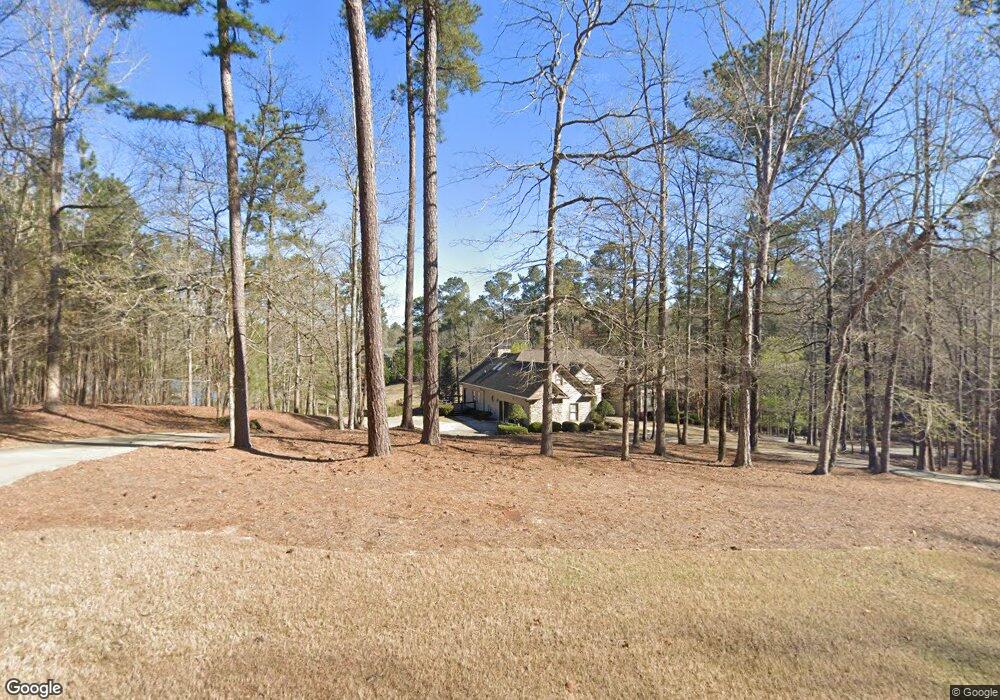
1581 A P Roper Rd Greensboro, GA 30642
Estimated Value: $1,013,821 - $1,919,000
--
Bed
3
Baths
2,531
Sq Ft
$587/Sq Ft
Est. Value
About This Home
This home is located at 1581 A P Roper Rd, Greensboro, GA 30642 and is currently estimated at $1,486,205, approximately $587 per square foot. 1581 A P Roper Rd is a home located in Greene County with nearby schools including Greene County High School.
Ownership History
Date
Name
Owned For
Owner Type
Purchase Details
Closed on
Sep 17, 2021
Sold by
Harden Marcia S
Bought by
Marcia Susan Harden Rev Trust
Current Estimated Value
Purchase Details
Closed on
Oct 2, 2007
Sold by
Harden Marcia S
Bought by
Harden Marcia
Purchase Details
Closed on
Mar 6, 2003
Sold by
Ga Power - and 04 Ac
Bought by
Harden Mark C and Harden Marcia S
Purchase Details
Closed on
Apr 5, 2000
Sold by
Bourke Brian J
Bought by
Ga Power - and 04 Ac
Purchase Details
Closed on
Mar 14, 1997
Sold by
Roper Robert A
Bought by
Bourke Brian J
Purchase Details
Closed on
Jan 1, 1986
Sold by
Lake Oconee Inc
Bought by
Roper Robert A
Purchase Details
Closed on
Jan 1, 1983
Bought by
Lake Oconee Inc
Create a Home Valuation Report for This Property
The Home Valuation Report is an in-depth analysis detailing your home's value as well as a comparison with similar homes in the area
Home Values in the Area
Average Home Value in this Area
Purchase History
| Date | Buyer | Sale Price | Title Company |
|---|---|---|---|
| Marcia Susan Harden Rev Trust | -- | -- | |
| Marcia Susan Harden Rev Trust | -- | -- | |
| Harden Marcia | -- | -- | |
| Harden Mark C | $469,900 | -- | |
| Ga Power - | -- | -- | |
| Bourke Brian J | $35,000 | -- | |
| Roper Robert A | -- | -- | |
| Lake Oconee Inc | -- | -- |
Source: Public Records
Tax History Compared to Growth
Tax History
| Year | Tax Paid | Tax Assessment Tax Assessment Total Assessment is a certain percentage of the fair market value that is determined by local assessors to be the total taxable value of land and additions on the property. | Land | Improvement |
|---|---|---|---|---|
| 2024 | $6,542 | $409,080 | $55,080 | $354,000 |
| 2023 | $6,337 | $396,440 | $55,080 | $341,360 |
| 2022 | $4,738 | $261,280 | $55,080 | $206,200 |
| 2021 | $4,578 | $234,600 | $53,400 | $181,200 |
| 2020 | $5,088 | $238,800 | $48,600 | $190,200 |
| 2019 | $5,235 | $238,800 | $48,600 | $190,200 |
| 2018 | $5,221 | $238,800 | $48,600 | $190,200 |
| 2017 | $4,850 | $236,966 | $48,600 | $188,366 |
| 2016 | $4,842 | $236,966 | $48,600 | $188,366 |
| 2015 | $4,829 | $236,966 | $48,600 | $188,366 |
| 2014 | $4,627 | $221,246 | $48,600 | $172,646 |
Source: Public Records
Map
Nearby Homes
- 1071 Westchester Dr
- 1611 Lighthouse Cir
- 2031 Pine Valley Ct
- 2660 Club Dr
- 1010 Plum Orchard Rd
- 1101 Shoal Creek Ct
- 1031 Hawks Bill Dr
- 2700 Club Dr
- 2541 Club Dr
- 1991 Armour Bridge Rd
- 1107 Wharfside Ct
- 1113 Wharfside Ct
- 1390 Winged Foot Dr
- 1131 Pinehurst Dr
- 1001 Shoal Creek Ct
- 1260 Armour Rd
- 2390 Club Dr
- 1010 Troon Ct
- 1321 Swift Creek
- P Roper Rd SE
- P Roper Rd SE Unit 38
- 1631 A P Roper Rd
- 1021 Sweetwater Rd
- 1641 A P Roper Rd
- 1001 Sweetwater Dr
- 1071 Old Rock Rd
- 1651 A P Roper Rd
- 1661 A P Roper Rd
- 1051 Old Rock Rd
- 1120 Old Rock Rd
- 1901 A P Roper Rd
- 1081 Old Rock Rd
- 1671 A P Roper Rd
- 1921 A P Roper Rd
- 1931 A P Roper Rd
- 1961 A P Roper Rd
- 1881 A P Roper Rd
- 1861 A P Roper Rd
- 0 Greymoss Rd Unit 7009621