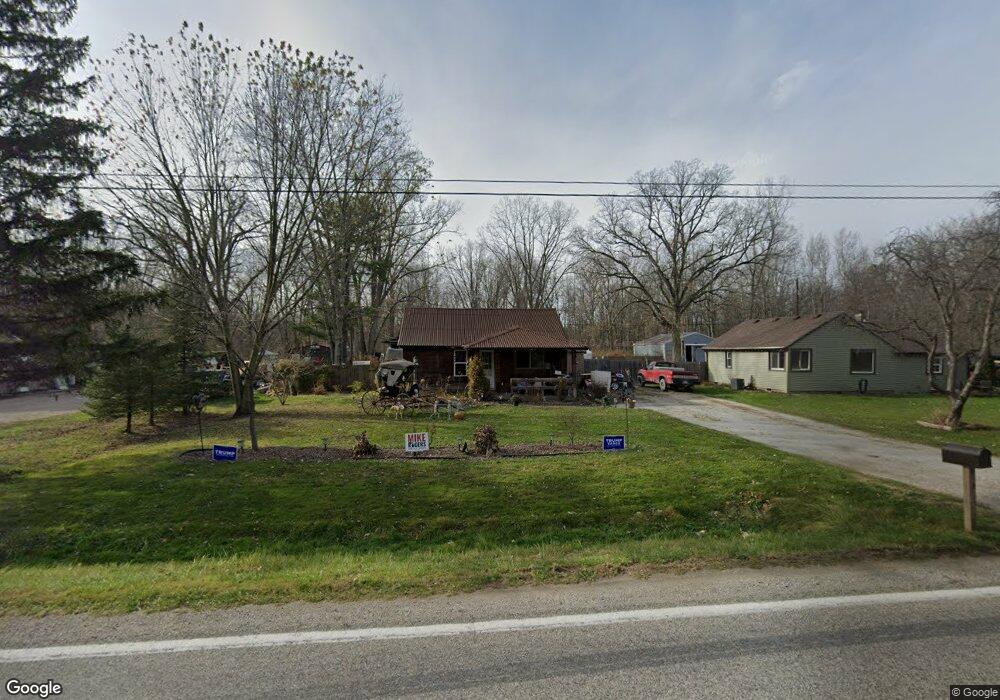
1581 Richman Rd Kimball, MI 48074
Estimated Value: $121,000 - $164,000
2
Beds
1
Bath
1,022
Sq Ft
$143/Sq Ft
Est. Value
About This Home
This home is located at 1581 Richman Rd, Kimball, MI 48074 and is currently estimated at $146,630, approximately $143 per square foot. 1581 Richman Rd is a home located in St. Clair County with nearby schools including Kimball Elementary School, Central Middle School, and Port Huron High School.
Ownership History
Date
Name
Owned For
Owner Type
Purchase Details
Closed on
Nov 12, 2020
Sold by
Good Walter
Bought by
Good Walter and Simcina Lisa
Current Estimated Value
Purchase Details
Closed on
Oct 21, 2009
Sold by
Secretary Of Housing & Urban Development
Bought by
Good Walter
Purchase Details
Closed on
Jul 13, 2009
Sold by
Citimortgage Inc
Bought by
The Secretary Of Housing & Urban Develop
Purchase Details
Closed on
Dec 11, 2008
Sold by
Reliford Michael A and Reliford Kelly K
Bought by
Citimortage Inc
Create a Home Valuation Report for This Property
The Home Valuation Report is an in-depth analysis detailing your home's value as well as a comparison with similar homes in the area
Home Values in the Area
Average Home Value in this Area
Purchase History
| Date | Buyer | Sale Price | Title Company |
|---|---|---|---|
| Good Walter | -- | None Available | |
| Good Walter | $16,200 | None Available | |
| The Secretary Of Housing & Urban Develop | -- | None Available | |
| Citimortage Inc | $54,445 | None Available |
Source: Public Records
Tax History Compared to Growth
Tax History
| Year | Tax Paid | Tax Assessment Tax Assessment Total Assessment is a certain percentage of the fair market value that is determined by local assessors to be the total taxable value of land and additions on the property. | Land | Improvement |
|---|---|---|---|---|
| 2025 | $829 | $48,400 | $0 | $0 |
| 2024 | $454 | $44,800 | $0 | $0 |
| 2023 | $416 | $42,100 | $0 | $0 |
| 2022 | $716 | $36,800 | $0 | $0 |
| 2021 | $646 | $31,100 | $0 | $0 |
| 2020 | $646 | $31,500 | $31,500 | $0 |
| 2019 | $634 | $28,700 | $0 | $0 |
| 2018 | $609 | $28,200 | $0 | $0 |
| 2017 | $597 | $25,600 | $0 | $0 |
| 2016 | $333 | $25,600 | $0 | $0 |
| 2015 | -- | $25,100 | $25,100 | $0 |
| 2014 | -- | $23,400 | $23,400 | $0 |
| 2013 | -- | $25,400 | $0 | $0 |
Source: Public Records
Map
Nearby Homes
- 1533 Richman Rd
- 1900 Burns Rd
- 1688 Sturdevant Rd
- 1371 Sturdevant Rd
- 1261 Sturdevant Rd
- 6417 Dove Rd
- 0 Sparling Rd Unit 2210034403
- VL Lambs Rd
- 7710 Sparling Rd
- 1671 Ditty Rd
- 0 Sparling Unit 20230091288
- 8067 Lambs Rd
- 6928 Smiths Creek Rd
- 00 Griswold Rd
- 355 Henry St
- 8237 Lambs Rd
- I-69 vac Taylor Dr
- 2019 Edward Ln E
- 1876 Morningstar Ave
- 6928 Lapeer Rd
- 1589 Richman Rd
- 1597 Richman Rd
- 1565 Richman Rd
- 1605 Richman Rd
- 1557 Richman Rd
- 1613 Richman Rd
- 1549 Richman Rd
- 1621 Richman Rd
- 1541 Richman Rd
- 1532 Richman Rd
- 1625 Richman Rd
- 1522 Richman Rd
- 1629 Richman Rd
- 1525 Richman Rd
- 1512 Richman Rd
- 1635 Richman Rd
- 1630 Richman Rd
- 1636 Richman Rd
- 1517 Richman Rd
- 1502 Richman Rd