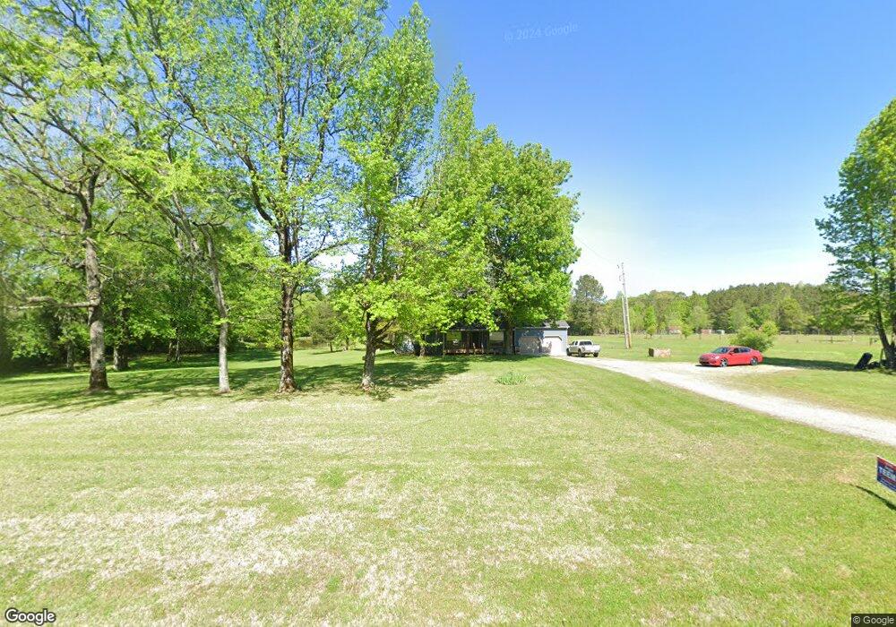
1582 Highway 151 La Fayette, GA 30728
Estimated Value: $288,000 - $302,000
--
Bed
2
Baths
1,775
Sq Ft
$167/Sq Ft
Est. Value
About This Home
This home is located at 1582 Highway 151, La Fayette, GA 30728 and is currently estimated at $297,273, approximately $167 per square foot. 1582 Highway 151 is a home located in Walker County with nearby schools including Rock Spring Elementary School and Lafayette High School.
Ownership History
Date
Name
Owned For
Owner Type
Purchase Details
Closed on
Jul 28, 1997
Sold by
Melba T Powell
Bought by
Price Ronald D and Price Deborah L
Current Estimated Value
Purchase Details
Closed on
Sep 1, 1977
Sold by
Denton C W
Bought by
Melba T Powell
Purchase Details
Closed on
May 1, 1976
Sold by
Hollingsworth Rodney A and Hollingsworth Wf J
Bought by
Denton C W
Purchase Details
Closed on
May 23, 1972
Bought by
Hollingsworth Rodney A and Hollingsworth Wf J
Create a Home Valuation Report for This Property
The Home Valuation Report is an in-depth analysis detailing your home's value as well as a comparison with similar homes in the area
Home Values in the Area
Average Home Value in this Area
Purchase History
| Date | Buyer | Sale Price | Title Company |
|---|---|---|---|
| Price Ronald D | $18,000 | -- | |
| Melba T Powell | -- | -- | |
| Denton C W | -- | -- | |
| Hollingsworth Rodney A | -- | -- |
Source: Public Records
Tax History Compared to Growth
Tax History
| Year | Tax Paid | Tax Assessment Tax Assessment Total Assessment is a certain percentage of the fair market value that is determined by local assessors to be the total taxable value of land and additions on the property. | Land | Improvement |
|---|---|---|---|---|
| 2024 | $2,476 | $111,662 | $25,838 | $85,824 |
| 2023 | $2,322 | $102,075 | $20,507 | $81,568 |
| 2022 | $2,295 | $93,129 | $22,473 | $70,656 |
| 2021 | $2,220 | $81,385 | $22,473 | $58,912 |
| 2020 | $2,000 | $70,253 | $22,473 | $47,780 |
| 2019 | $2,035 | $70,253 | $22,473 | $47,780 |
| 2018 | $1,859 | $70,253 | $22,473 | $47,780 |
| 2017 | $2,229 | $70,253 | $22,473 | $47,780 |
| 2016 | $1,800 | $70,253 | $22,473 | $47,780 |
| 2015 | $1,841 | $67,682 | $19,164 | $48,518 |
| 2014 | $1,722 | $67,682 | $19,164 | $48,518 |
| 2013 | -- | $67,682 | $19,164 | $48,518 |
Source: Public Records
Map
Nearby Homes
- 1052 Huffman Rd
- 7606 Highway 95
- 0 Alabama Hwy Unit 1520958
- 0 Alabama Hwy Unit 21222630
- 0 Alabama Hwy Unit TRACT 3 10244950
- 201 Van Dell Dr
- Old Alabama Hwy Ga-151
- 3255 Colbert Hollow Rd
- 533 Van Dell Dr
- 134 Farm View Cir
- 200 Cattail Dr
- 72 Brutis Dr
- 4934 N Jimmy Dr
- 176 Turkey Ridge Rd
- 4177 S Jimmy Dr
- 0 Colbert Hollow Rd Unit 1513202
- 0 Temperance Hall Rd Unit 10506446
- 0 Temperance Hall Rd Unit 1510568
- 1934 Round Pond Rd
- 6280 Georgia 151
- 1670 Highway 151
- 1670 Georgia 151
- 1537 Highway 151
- 1528 Highway 151
- 1528 Georgia 151
- 129 Burkett Dr
- 1778 Highway 151
- 82 Burkett Dr
- 1617 Highway 151
- 1617 Hwy 151
- 1877 Highway 151
- 1884 Highway 151
- 1363 Highway 151
- 1991 Highway 151
- 1991 Georgia 151
- 649 Cooper Rd
- 649 Cooper Rd
- 1060 Highway 151
- 684 Cooper Rd
- 2225 Highway 151