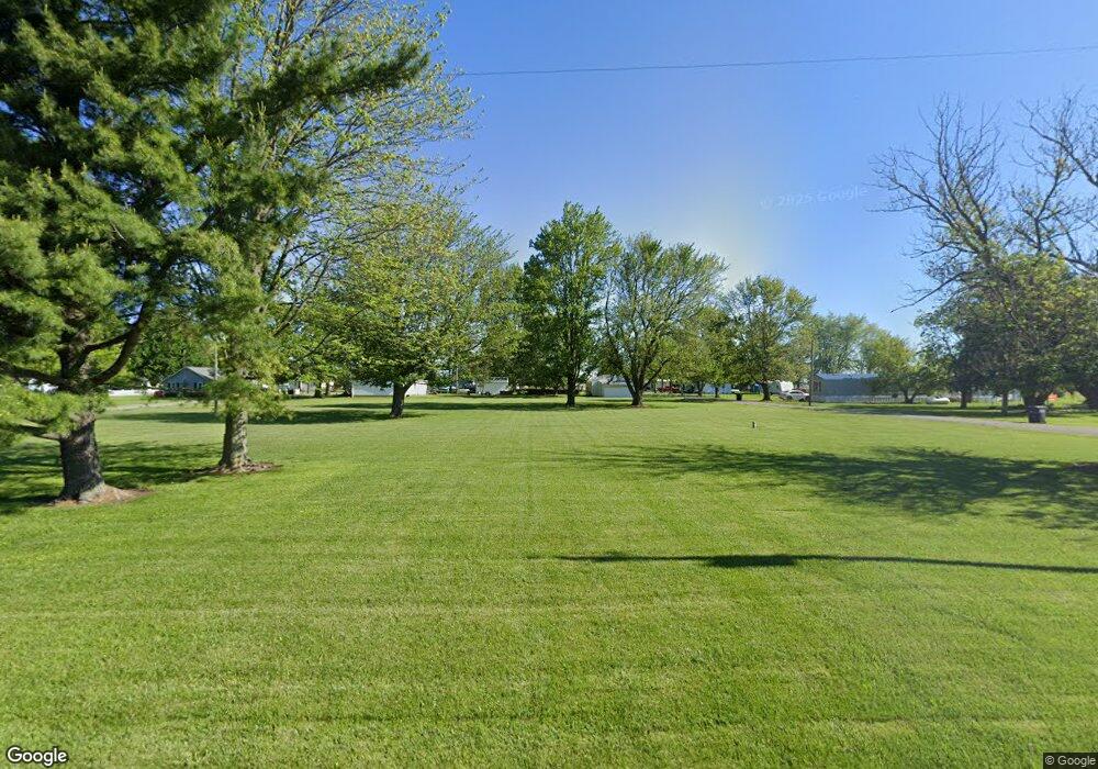
15825 3rd St Paulding, OH 45879
Estimated Value: $23,000 - $86,000
Studio
1
Bath
--
Sq Ft
0.69
Acres
About This Home
This home is located at 15825 3rd St, Paulding, OH 45879 and is currently estimated at $54,500. 15825 3rd St is a home located in Paulding County with nearby schools including Wayne Trace High School.
Ownership History
Date
Name
Owned For
Owner Type
Purchase Details
Closed on
Mar 24, 2023
Sold by
Cotterman Gary and Cotterman Gary
Bought by
Cotterman Randy L and Cotterman Crystal K
Current Estimated Value
Purchase Details
Closed on
Mar 10, 2020
Sold by
Paulding County Land Reutilization Corp
Bought by
Cotterman Gary
Purchase Details
Closed on
Sep 11, 2018
Sold by
Paulding County
Bought by
Paulding County Land Reutilization Corpo
Purchase Details
Closed on
Jul 6, 2004
Sold by
Seibert Eva J
Bought by
Pratt Albert R Jr Lif Est Seibert Eva J
Purchase Details
Closed on
Feb 26, 2004
Sold by
Pratt Albert P
Bought by
Pratt Albert R Jr Lif Est Seibert Eva J
Purchase Details
Closed on
Jul 25, 1996
Bought by
Pratt Albert R Jr Lif Est Seibert Eva J
Create a Home Valuation Report for This Property
The Home Valuation Report is an in-depth analysis detailing your home's value as well as a comparison with similar homes in the area
Purchase History
| Date | Buyer | Sale Price | Title Company |
|---|---|---|---|
| Cotterman Randy L | $250 | -- | |
| Cotterman Gary | -- | None Available | |
| Paulding County Land Reutilization Corpo | -- | None Available | |
| Pratt Albert R Jr Lif Est Seibert Eva J | -- | -- | |
| Pratt Albert R Jr Lif Est Seibert Eva J | -- | -- | |
| Pratt Albert R Jr Lif Est Seibert Eva J | -- | -- |
Source: Public Records
Tax History
| Year | Tax Paid | Tax Assessment Tax Assessment Total Assessment is a certain percentage of the fair market value that is determined by local assessors to be the total taxable value of land and additions on the property. | Land | Improvement |
|---|---|---|---|---|
| 2024 | $144 | $2,490 | $2,490 | $0 |
| 2023 | $131 | $2,490 | $2,490 | $0 |
| 2022 | $131 | $2,490 | $2,490 | $0 |
| 2021 | $15 | $2,490 | $2,490 | $0 |
| 2020 | $15 | $2,490 | $2,490 | $0 |
| 2019 | $15 | $2,490 | $2,490 | $0 |
| 2018 | $15 | $2,490 | $2,490 | $0 |
| 2017 | $112 | $2,490 | $2,490 | $0 |
| 2016 | $109 | $2,490 | $2,490 | $0 |
| 2015 | $108 | $2,490 | $2,490 | $0 |
| 2014 | $109 | $2,490 | $2,490 | $0 |
| 2013 | $201 | $3,960 | $3,080 | $880 |
Source: Public Records
Map
Nearby Homes
- 0 Road 72
- 14255 Road 126
- 225 2nd St
- 701 E Wayne St
- 300 S Williams St
- 301 N Main St
- 308 N Main St
- 520 W Wayne St
- 402 N Williams St
- 714 W Wayne St
- 720 W Wayne St
- 606 Lincoln Ave
- 717 W Harrison St
- 741 Tom Tim Dr
- 516 N Williams St
- 614 W Jackson St
- 215 N Dewitt St
- 120 S Grant St
- 726 N Main St
- 829 Greenbriar Ave
- 15830 3rd St
- 7100 Broughton St
- 7630 Grubb St
- 7866 Broughton Pike
- 7874 Broughton Pike
- 7848 Broughton Pike
- 7848 Broughton Pike
- 7605 Grubb St
- 7436 Broughton St
- 7832 Broughton Pike
- 7902 Broughton Pike
- 7712 Grubb St
- 7922 Broughton Pike
- 7582 Broughton St
- 7763 Grubb St
- 7909 Broughton Pike
- 7688 Broughton St
- 7936 Broughton Pike
- 7936 Broughton Pike
- 7803 Broughton Pike
