
Landlord's Agent in 2017
Lindsay Hymson
Compass
(347) 352-0989
1 in this area
20 Total Sales
Estimated Value: $2,153,453 - $2,213,000
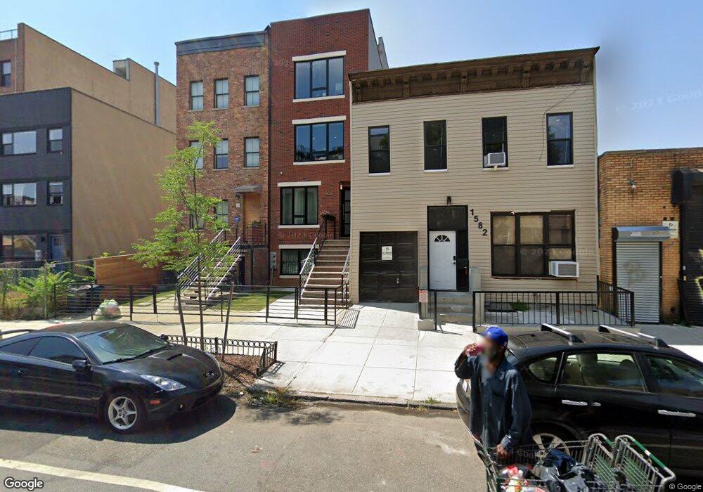
At approx 2,000 square ft, this apartment is a suburban oasis in Brooklyn! This expertly designed, pet-friendly, 2 bedroom / 2 bath sun-drenched duplex features an enormous open living room / kitchen and a huge private backyard with deck perfect for outdoor dining. Outfitted with central AC and Heat, bespoke custom finishes such as loft-like triple hung windows, five inch wide solid oak floors, Carrara marble kitchen counter tops, custom iron work, 3 massive walk-in closets, washer/dryer, over-sized bathrooms, high ceilings, and state of the art separate utilities. Newly fenced in front yard. A short walk from Utica A/C express or C Kingston Throop local. The apartment is tenant occupied and 24hrs notice is needed to show. Wonderful home-owners looking for equally wonderful tenants!
We collect this data history from publicly available records. To have your information removed, we recommend requesting removal directly through your county’s website.
We collect this data history from publicly available records. To have your information removed, we recommend requesting removal directly through your county’s website.
| Date | Buyer | Sale Price | Title Company |
|---|---|---|---|
| $1,345,000 | -- | ||
| $77,770 | -- |
We collect this data history from publicly available records. To have your information removed, we recommend requesting removal directly through your county’s website.
| Date | Status | Borrower | Loan Amount |
|---|---|---|---|
| Open | $36,784 | ||
| Open | $1,076,000 | ||
| Closed | $350,000 |
We collect this data history from publicly available records. To have your information removed, we recommend requesting removal directly through your county’s website.
| Date | Event | Price | List to Sale | Price per Sq Ft |
|---|---|---|---|---|
| 09/06/2017 09/06/17 | Rented | -- | -- | -- |
| 09/06/2017 09/06/17 | For Rent | $3,250 | -- | -- |
We collect this data history from publicly available records. To have your information removed, we recommend requesting removal directly through your county’s website.
| Year | Tax Paid | Tax Assessment Tax Assessment Total Assessment is a certain percentage of the fair market value that is determined by local assessors to be the total taxable value of land and additions on the property. | Land | Improvement |
|---|---|---|---|---|
| 2026 | $13,883 | $133,380 | $25,860 | $107,520 |
| 2025 | $13,778 | $131,580 | $25,860 | $105,720 |
| 2024 | $13,778 | $103,920 | $25,860 | $78,060 |
| 2023 | $13,144 | $127,500 | $25,860 | $101,640 |
| 2022 | $12,189 | $121,560 | $25,860 | $95,700 |
| 2021 | $12,122 | $93,840 | $25,860 | $67,980 |
| 2020 | $6,026 | $94,920 | $25,860 | $69,060 |
| 2019 | $11,959 | $91,560 | $25,860 | $65,700 |
| 2018 | $10,994 | $53,932 | $12,800 | $41,132 |
| 2017 | $10,372 | $50,880 | $14,867 | $36,013 |
| 2016 | $12,178 | $60,916 | $18,821 | $42,095 |
| 2015 | $371 | $2,902 | $2,902 | $0 |
| 2014 | $371 | $2,898 | $2,898 | $0 |
Landlord's Agent in 2017
Lindsay Hymson
Compass
(347) 352-0989
1 in this area
20 Total Sales
Source: Real Estate Board of New York (REBNY)
MLS Number: RLS10110667
APN: 01340-0031
Disclaimer: Certain information contained herein is derived from information provided by parties other than Homes.com. All information provided is deemed reliable, but is not guaranteed to be accurate and should be independently verified.
![]() This information is not verified for authenticity or accuracy and is not guaranteed and may not reflect all real estate activity in the market. ©2026 The Real Estate Board of New York, Inc., All rights reserved.
This information is not verified for authenticity or accuracy and is not guaranteed and may not reflect all real estate activity in the market. ©2026 The Real Estate Board of New York, Inc., All rights reserved.
RLS Data display by Homes.com LLC
Ask me questions while you tour the home.