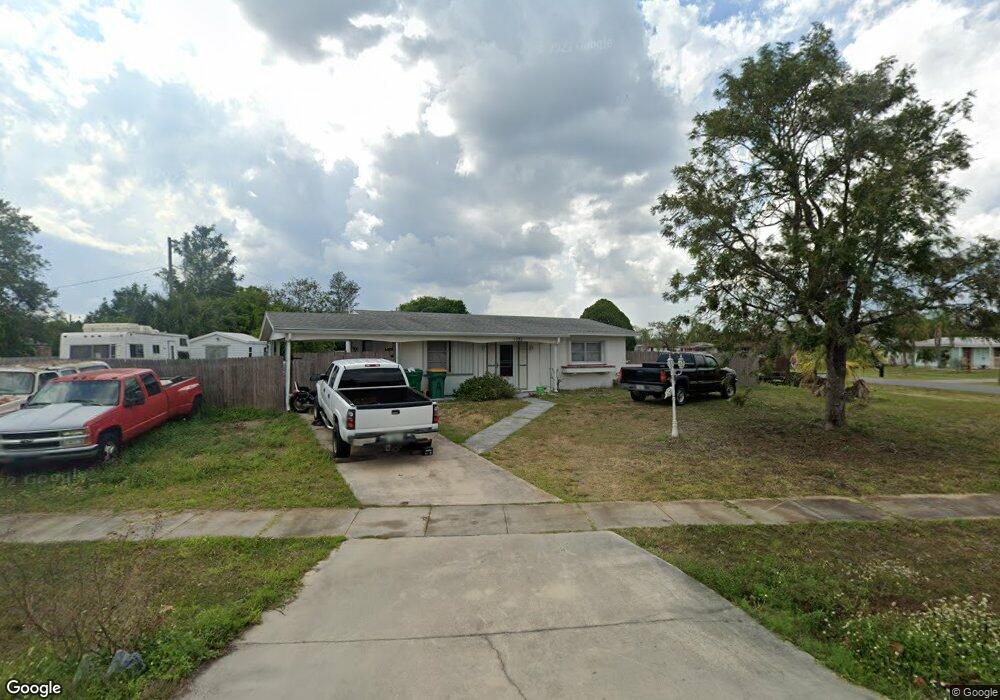
1583 Page St Port Charlotte, FL 33952
Estimated Value: $167,000 - $195,000
2
Beds
1
Bath
996
Sq Ft
$179/Sq Ft
Est. Value
About This Home
This home is located at 1583 Page St, Port Charlotte, FL 33952 and is currently estimated at $178,317, approximately $179 per square foot. 1583 Page St is a home located in Charlotte County with nearby schools including Neil Armstrong Elementary School, Port Charlotte Middle School, and Port Charlotte High School.
Ownership History
Date
Name
Owned For
Owner Type
Purchase Details
Closed on
Oct 6, 2016
Sold by
Boyden William
Bought by
Schneider Jessica and Neider Brandon
Current Estimated Value
Home Financials for this Owner
Home Financials are based on the most recent Mortgage that was taken out on this home.
Original Mortgage
$81,987
Outstanding Balance
$65,287
Interest Rate
3.25%
Mortgage Type
FHA
Estimated Equity
$113,030
Purchase Details
Closed on
Mar 10, 2011
Sold by
Martin Wayne
Bought by
Boyden William
Create a Home Valuation Report for This Property
The Home Valuation Report is an in-depth analysis detailing your home's value as well as a comparison with similar homes in the area
Home Values in the Area
Average Home Value in this Area
Purchase History
| Date | Buyer | Sale Price | Title Company |
|---|---|---|---|
| Schneider Jessica | $85,000 | Stewart Title Co | |
| Boyden William | $70,000 | Stewart Title Company |
Source: Public Records
Mortgage History
| Date | Status | Borrower | Loan Amount |
|---|---|---|---|
| Open | Schneider Jessica | $81,987 |
Source: Public Records
Tax History Compared to Growth
Tax History
| Year | Tax Paid | Tax Assessment Tax Assessment Total Assessment is a certain percentage of the fair market value that is determined by local assessors to be the total taxable value of land and additions on the property. | Land | Improvement |
|---|---|---|---|---|
| 2023 | $1,194 | $60,902 | $0 | $0 |
| 2022 | $1,144 | $59,128 | $0 | $0 |
| 2021 | $1,141 | $57,406 | $0 | $0 |
| 2020 | $1,107 | $56,613 | $0 | $0 |
| 2019 | $1,042 | $55,340 | $0 | $0 |
| 2018 | $961 | $54,308 | $0 | $0 |
| 2017 | $955 | $53,191 | $4,462 | $48,729 |
| 2016 | $573 | $28,759 | $0 | $0 |
| 2015 | $547 | $28,559 | $0 | $0 |
| 2014 | $523 | $28,332 | $0 | $0 |
Source: Public Records
Map
Nearby Homes
- 22268 Montrose Ave
- 22236 Montrose Ave
- 1534 Paxton Terrace
- 22193 Breezeswept Ave
- 22240 Midway Blvd
- 1512 Upshaw Terrace
- 1528 Upshaw Terrace
- 1483 Paxton Terrace
- 22343 Lasalle Rd
- 22187 Lasalle Rd
- 22295 Midway Blvd
- 22239 Midway Blvd
- 1488 Upshaw Terrace
- 22163 Lasalle Rd
- 22341 Midway Blvd
- 1420 Hayworth Rd
- 22307 Alcorn Ave
- 1396 Hayworth Rd
- 1717 Alton Rd
- 2142 Gerard Ct
- 22267 Montrose Ave
- 22264 Laramore Ave
- 22287 Montrose Ave
- 22259 Montrose Ave
- 22295 Montrose Ave
- 22254 Laramore Ave
- 1567 Page St
- 22251 Montrose Ave
- 1568 Page St
- 22260 Montrose Ave
- 22246 Laramore Ave
- 22292 Laramore Ave
- 22296 Montrose Ave
- 22252 Montrose Ave
- 22269 Breezeswept Ave
- 22243 Montrose Ave
- 22261 Avenue
- 22303 Montrose Ave
- 22261 Breezeswept Ave
- 22238 Laramore Ave