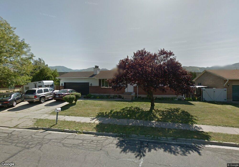
1583 Sorrento Dr Woods Cross, UT 84087
Estimated Value: $485,000 - $513,138
5
Beds
2
Baths
2,456
Sq Ft
$203/Sq Ft
Est. Value
About This Home
This home is located at 1583 Sorrento Dr, Woods Cross, UT 84087 and is currently estimated at $499,035, approximately $203 per square foot. 1583 Sorrento Dr is a home located in Davis County with nearby schools including Woods Cross Elementary School, South Davis Junior High School, and Woods Cross High School.
Ownership History
Date
Name
Owned For
Owner Type
Purchase Details
Closed on
Jul 8, 2025
Sold by
Call Brookeh V and Call Michael S
Bought by
Utah Department Of Transportation
Current Estimated Value
Purchase Details
Closed on
Mar 2, 2015
Sold by
Mceaneney Tamera
Bought by
Terry Jacqueline and Terry Matthew
Purchase Details
Closed on
May 26, 2000
Sold by
Bickle Gordon L and Bickle Mira
Bought by
Mceaneney James P and Mceaneney Tamera
Home Financials for this Owner
Home Financials are based on the most recent Mortgage that was taken out on this home.
Original Mortgage
$100,000
Interest Rate
8.18%
Create a Home Valuation Report for This Property
The Home Valuation Report is an in-depth analysis detailing your home's value as well as a comparison with similar homes in the area
Home Values in the Area
Average Home Value in this Area
Purchase History
| Date | Buyer | Sale Price | Title Company |
|---|---|---|---|
| Utah Department Of Transportation | -- | None Listed On Document | |
| Terry Jacqueline | -- | First American Title | |
| Mceaneney James P | -- | Bonneville Title Company Inc |
Source: Public Records
Mortgage History
| Date | Status | Borrower | Loan Amount |
|---|---|---|---|
| Previous Owner | Mceaneney James P | $100,000 |
Source: Public Records
Tax History Compared to Growth
Tax History
| Year | Tax Paid | Tax Assessment Tax Assessment Total Assessment is a certain percentage of the fair market value that is determined by local assessors to be the total taxable value of land and additions on the property. | Land | Improvement |
|---|---|---|---|---|
| 2025 | $2,922 | $254,100 | $113,369 | $140,731 |
| 2024 | $2,813 | $250,800 | $121,213 | $129,587 |
| 2023 | $2,694 | $447,000 | $160,874 | $286,126 |
| 2022 | $2,698 | $248,600 | $69,900 | $178,700 |
| 2021 | $2,384 | $349,000 | $102,699 | $246,301 |
| 2020 | $1,759 | $251,000 | $97,789 | $153,211 |
| 2019 | $1,748 | $246,000 | $91,108 | $154,892 |
| 2018 | $1,612 | $225,000 | $89,565 | $135,435 |
| 2016 | $1,312 | $99,770 | $38,596 | $61,174 |
| 2015 | $1,222 | $89,760 | $38,596 | $51,164 |
| 2014 | $1,411 | $107,618 | $38,596 | $69,022 |
| 2013 | -- | $91,482 | $21,811 | $69,671 |
Source: Public Records
Map
Nearby Homes