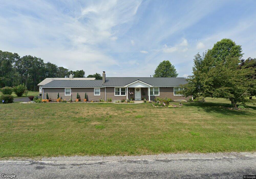
15832 Sawmill Rd Stewartstown, PA 17363
Estimated Value: $323,000 - $355,000
3
Beds
2
Baths
1,288
Sq Ft
$260/Sq Ft
Est. Value
About This Home
This home is located at 15832 Sawmill Rd, Stewartstown, PA 17363 and is currently estimated at $334,731, approximately $259 per square foot. 15832 Sawmill Rd is a home located in York County with nearby schools including South Eastern Intermediate School, South Eastern Middle School, and Kennard-Dale High School.
Ownership History
Date
Name
Owned For
Owner Type
Purchase Details
Closed on
May 25, 2016
Sold by
Wilt Andrew T and Wilt Jennifer L
Bought by
Godfrey Lee O and Godfrey Pauline M
Current Estimated Value
Purchase Details
Closed on
Jul 6, 2012
Sold by
Bankert Dennis L
Bought by
Wilt Andrew T and Wilt Jennifer L
Home Financials for this Owner
Home Financials are based on the most recent Mortgage that was taken out on this home.
Original Mortgage
$160,000
Interest Rate
3.78%
Mortgage Type
Purchase Money Mortgage
Purchase Details
Closed on
Jan 29, 1975
Bought by
Bankert Dennis L and Bankert Sandra F
Create a Home Valuation Report for This Property
The Home Valuation Report is an in-depth analysis detailing your home's value as well as a comparison with similar homes in the area
Home Values in the Area
Average Home Value in this Area
Purchase History
| Date | Buyer | Sale Price | Title Company |
|---|---|---|---|
| Godfrey Lee O | -- | None Available | |
| Wilt Andrew T | $167,500 | None Available | |
| Bankert Dennis L | $6,000 | -- |
Source: Public Records
Mortgage History
| Date | Status | Borrower | Loan Amount |
|---|---|---|---|
| Previous Owner | Wilt Andrew T | $160,000 |
Source: Public Records
Tax History Compared to Growth
Tax History
| Year | Tax Paid | Tax Assessment Tax Assessment Total Assessment is a certain percentage of the fair market value that is determined by local assessors to be the total taxable value of land and additions on the property. | Land | Improvement |
|---|---|---|---|---|
| 2025 | $4,435 | $151,040 | $57,720 | $93,320 |
| 2024 | $4,435 | $151,040 | $57,720 | $93,320 |
| 2023 | $4,435 | $151,040 | $57,720 | $93,320 |
| 2022 | $4,435 | $151,040 | $57,720 | $93,320 |
| 2021 | $4,284 | $151,040 | $57,720 | $93,320 |
| 2020 | $4,284 | $151,040 | $57,720 | $93,320 |
| 2019 | $4,268 | $151,040 | $57,720 | $93,320 |
| 2018 | $4,268 | $151,040 | $57,720 | $93,320 |
| 2017 | $4,268 | $151,040 | $57,720 | $93,320 |
| 2016 | $0 | $151,040 | $57,720 | $93,320 |
| 2015 | -- | $151,040 | $57,720 | $93,320 |
| 2014 | -- | $151,040 | $57,720 | $93,320 |
Source: Public Records
Map
Nearby Homes
- Lot #1 Bowman School Rd
- 13859 Ebaugh Rd
- 0 Bridgeview Rd Unit PAYK2080146
- 13846 Ridge Rd
- 4389 Hess Rd
- 23 Clear Run Dr
- 4303 Forbes Dr
- 180 Patterson Dr Unit 50
- 103 Hershey Cir
- 160 Patterson Dr Unit 48
- 150 Patterson Dr Unit 47
- 0 Lot 6 Harambe Overlook Unit PAYK2092222
- 0 Lot 7 Harambe Overlook Unit PAYK2092224
- 0 Lot 8 Harambe Overlook Unit PAYK2092226
- 0 Lot 10 Harambe Overlook Unit PAYK2092216
- 4341 Forbes Dr
- 10 Black Oak Ct
- 231 Cool Spring Ln
- Augusta Plan at Foxhaven
- Devonshire Plan at Foxhaven
- 15832 Sawmill Rd
- 2686 Plank Rd
- 15900 Sawmill Rd
- 2671 Plank Rd
- 2774 Plank Rd
- 2828 Plank Rd
- 15828 Maddox Rd
- 2884 Plank Rd
- 15802 Maddox Rd
- 2875 Plank Rd
- 15856 Maddox Rd
- 16071 Sawmill Rd
- 2633 Plank Rd
- 16097 Sawmill Rd
- 15863 Maddox Rd
- 2618 Oakwood Heights Dr
- 2613 Oakwood Heights Dr
- 2606 Oakwood Heights Dr
- 2608 Oakwood Heights Dr
- 2628 Oakwood Heights Dr