NOT LISTED FOR SALE

15836 S Highway 71 West Fork, AR 72774

Estimated Value: $280,233 - $429,000

8 Acres
$43,135 Price per Acre
348,480 Sq Ft Lot

Last Sold March 03, 2017

Last sale price $32,000

Est. 978% increase in value since last sale

Current estimated payment $1,962/month

7 Days on Market

Highlights

  • River Front
  • Wooded Lot
  • Creek or Stream
  • Pond
  • Views

About This Lot

As of March 2017

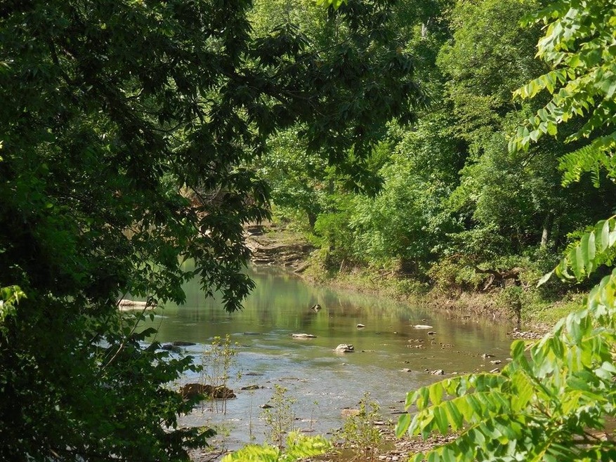
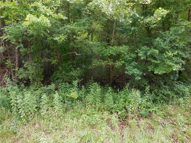
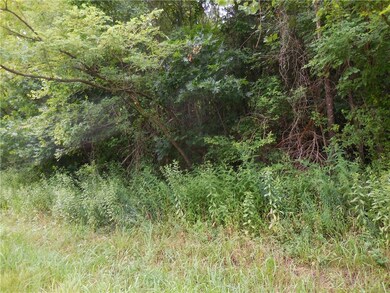
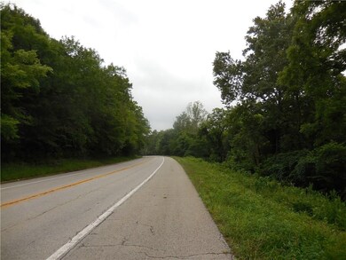
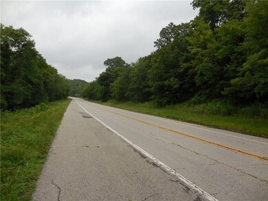
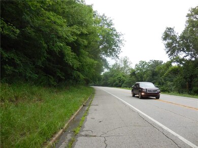
8 acres offers more than a wooded elevated building site! The land crosses the highway to include river frontage for your recreational enjoyment. Washington Water Authority has committed to a water tap for purchase. Perfect combination for your future cabin and your fishing and floating opportunities.

Last Agent to Sell the Property

Jan Newlin

Newlin Realty Company License #PB00008437 Listed on: 02/23/2017

Last Buyer's Agent

Marcia Finley

Newlin Realty Company

Property Details

Property Type

  • Land

Est. Annual Taxes

  • $1,663

Lot Details

  • 8 Acre Lot
  • River Front
  • Property fronts a highway
  • Creek or Stream
  • Rural Setting
  • Sloped Lot
  • Wooded Lot
  • Zoning described as Agricultural

Outdoor Features

  • Pond

Location

  • Flood Zone Lot
  • Outside City Limits

Utilities

  • Natural Gas Not Available
  • Septic Needed

Additional Features

  • Property Views

Property Details

Property Type

Land

Est. Annual Taxes

$1,663

Lot Details

0

Listing Details

  • Property Sub Type: Residential
  • Prop. Type: Land
  • Lot Size Acres: 8.0
  • Lot Size: .
  • Road Frontage Type: Highway
  • Road Surface Type: Paved
  • Subdivision Name: .
  • Directions: Hwy 71 south of West Fork 71/170 Junction 4.2 miles on right and left.
  • ResoPropertyType: Land
  • Property Sub Type Additional: Residential
  • Special Features: None

Interior Features

  • Possible Use: Recreational

Exterior Features

  • Fencing: None
  • Lot Features: Outside City Limits, Recreational, Rural Lot, Sloped, Views, Waterfront, Flood Zone, Pond, Stream/Creek, Wooded
  • Topography: Sloping
  • View: Yes
  • Waterfront Features: River Front
  • Waterfront: Yes
  • Disclosures: Flood Plain Disclosure

Utilities

  • Sewer: Septic Needed
  • Utilities: Natural Gas Not Available, Electricity Available
  • Water Source: Not Connected (nearby), Public

Schools

  • Junior High Dist: West Fork

Lot Info

  • Zoning Description: Agricultural
  • Zoning: N
  • ResoLotSizeUnits: Acres

Tax Info

  • Tax Annual Amount: 11.0
  • Tax Block: .
  • Tax Lot: .

Ownership History

Date Name Owned For Owner Type

Purchase Details

Closed on
Jan 1, 1985
Bought by
Clark Thomas Lester and Clark Norma J
Current Estimated Value
$345,078
Source: Public Records

Range of Values:

Collateral Analytics

Collateral Analytics Collateral Analytics AVMs (Automated Valuation Model) employ a number of statistical approaches combined with neighborhood-specific comparable selection guarantees the most up-to-date and precise valuations.

Not Available

Collateral Analytics does not have data for the current month. Please view the chart for historical values.

ICE

ICE Mortgage Technology ICE Mortgage Technology’s AVM (Automated Valuation Model) is a state-of-the-art online residential property valuation tool that provides a quick and accurate estimate of the value of almost any home in the U.S.

Not Available

ICE Mortgage Technology does not have data for the current month. Please view the chart for historical values.

First American

First American First American Data & Analytics’ next-generation AVM combines unrivaled data assets with a blended ensemble of valuation models to produce highly accurate, reliable valuations you can trust.

Not Available

First American does not have data for the current month. Please view the chart for historical values.

Quantarium

Quantarium Quantarium’s valuation service, repeatedly proven the industry’s most accurate and comprehensive, is supercharged with a self-learning and auto-tuning AI engine that continually becomes smarter and more accurate as it processes daily inputs from the industry’s leading RE data lake.

Not Available

Quantarium does not have data for the current month. Please view the chart for historical values.

Average Value
Not Available
List Price
Sold Price
Create a Home Valuation Report for This Property
The Home Valuation Report is an in-depth analysis detailing your home's value as well as a comparison with similar homes in the area

Home Values in the Area

Source: Public Records

Average Home Value in this Area


Source: Public Records

Purchase History

Date Buyer Sale Price Title Company
Clark Thomas Lester -- --
Source: Public Records

Property History

Date Event Price Change Sq Ft Price
03/03/2017 03/03/17 Sold $32,000 -5.9% --
02/23/2017 02/23/17 For Sale $34,000 -- --
Source: Northwest Arkansas Board of REALTORS®

Tax History Compared to Growth

Source: Public Records

Tax History

Year Tax Paid Tax Assessment Tax Assessment Total Assessment is a certain percentage of the fair market value that is determined by local assessors to be the total taxable value of land and additions on the property. Land Improvement
2024 $1,663 $36,340 $4,550 $31,790
2023 $1,531 $36,340 $4,550 $31,790
2022 $1,443 $28,930 $3,550 $25,380
2021 $1,443 $28,930 $3,550 $25,380
2020 $10 $170 $170 $0
2019 $11 $190 $190 $0
2018 $11 $190 $190 $0
2017 $9 $190 $190 $0
2016 $10 $190 $190 $0
2015 $10 $190 $190 $0
2014 $11 $210 $210 $0
Source: Public Records

Agents Affiliated with this Home

  • Section Image
  • Section Image
See All Agents

Map

Source: Northwest Arkansas Board of REALTORS®

MLS Number: 1039806

Northwest Arkansas Board of REALTORS®

APN: 001-03520-000