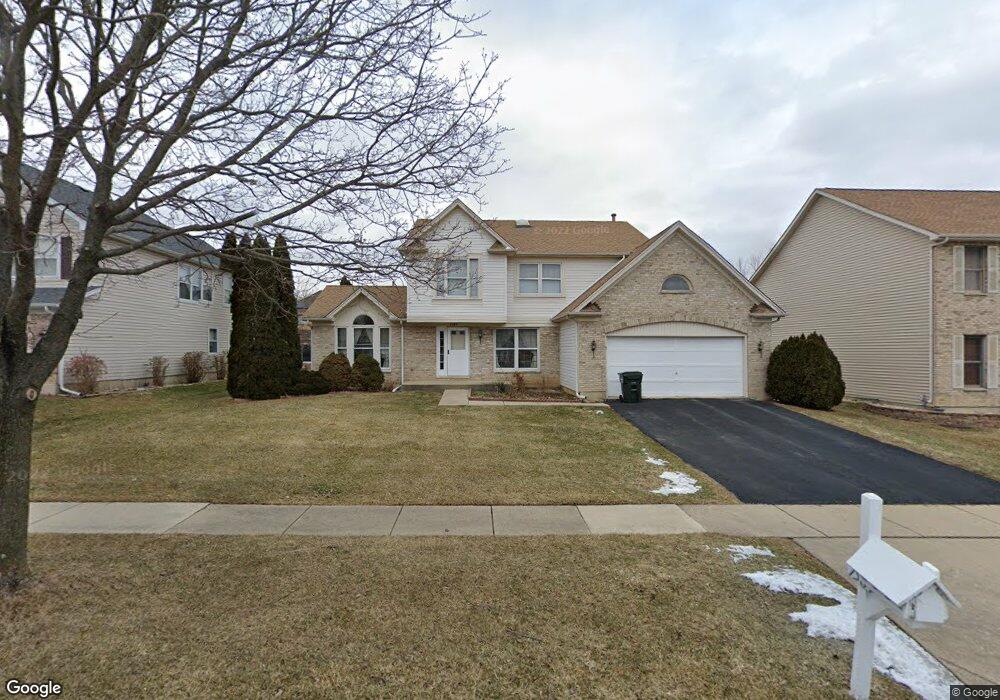
1584 Crowfoot Cir N Hoffman Estates, IL 60169
South Hoffman Estates NeighborhoodEstimated Value: $598,861 - $686,000
4
Beds
3
Baths
2,444
Sq Ft
$262/Sq Ft
Est. Value
About This Home
This home is located at 1584 Crowfoot Cir N, Hoffman Estates, IL 60169 and is currently estimated at $639,715, approximately $261 per square foot. 1584 Crowfoot Cir N is a home located in Cook County with nearby schools including Hoover Math And Science Academy, Helen Keller Junior High School, and Hoffman Estates High School.
Ownership History
Date
Name
Owned For
Owner Type
Purchase Details
Closed on
Jul 25, 1994
Sold by
Young Kent P and Young Sui F
Bought by
Cho Moon Tack and Cho Hyun Soon
Current Estimated Value
Home Financials for this Owner
Home Financials are based on the most recent Mortgage that was taken out on this home.
Original Mortgage
$128,000
Interest Rate
8.38%
Create a Home Valuation Report for This Property
The Home Valuation Report is an in-depth analysis detailing your home's value as well as a comparison with similar homes in the area
Home Values in the Area
Average Home Value in this Area
Purchase History
| Date | Buyer | Sale Price | Title Company |
|---|---|---|---|
| Cho Moon Tack | $258,500 | Intercounty Title |
Source: Public Records
Mortgage History
| Date | Status | Borrower | Loan Amount |
|---|---|---|---|
| Closed | Cho Moon Tack | $128,000 |
Source: Public Records
Tax History
| Year | Tax Paid | Tax Assessment Tax Assessment Total Assessment is a certain percentage of the fair market value that is determined by local assessors to be the total taxable value of land and additions on the property. | Land | Improvement |
|---|---|---|---|---|
| 2025 | $11,978 | $57,000 | $13,560 | $43,440 |
| 2024 | $11,978 | $45,001 | $12,713 | $32,288 |
| 2023 | $11,536 | $45,001 | $12,713 | $32,288 |
| 2022 | $11,536 | $45,001 | $12,713 | $32,288 |
| 2021 | $10,447 | $37,176 | $11,229 | $25,947 |
| 2020 | $10,337 | $37,176 | $11,229 | $25,947 |
| 2019 | $10,663 | $42,593 | $11,229 | $31,364 |
| 2018 | $10,735 | $39,106 | $9,534 | $29,572 |
| 2017 | $10,579 | $39,106 | $9,534 | $29,572 |
| 2016 | $11,275 | $42,127 | $9,534 | $32,593 |
| 2015 | $10,056 | $35,806 | $8,263 | $27,543 |
| 2014 | $9,908 | $35,806 | $8,263 | $27,543 |
| 2013 | $10,405 | $38,350 | $8,263 | $30,087 |
Source: Public Records
Map
Nearby Homes
- 845 Harmon Blvd
- 775 Harmon Blvd
- 1708 Southbridge Ct
- 1975 Leiter Way Unit 12002
- 1982 Leiter Way Unit 13004
- 1985 Leiter Way Unit 1102
- 1988 Leiter Way Unit 13001
- 1979 Leiter Way Unit 12004
- 1981 Leiter Way Unit 12005
- 1994 Leiter Way Unit 14003
- 1977 Leiter Way Unit 12003
- 1986 Leiter Way Unit 13002
- 1989 Leiter Way Unit 11004
- 1190 Woodcreek Ln
- 1026 Denham Place Unit 1
- 1300 Chatsworth Ln
- 1365 Newcastle Ln
- 1355 Blair Ln
- 1975 Windsong Dr Unit 333E1
- 607 Wainsford Dr
- 1594 Crowfoot Cir N
- 945 Harmon Blvd
- 955 Harmon Blvd
- 1604 Crowfoot Cir N
- 1581 Crowfoot Cir N
- 935 Harmon Blvd
- 1571 Crowfoot Cir N
- 965 Harmon Blvd
- 1591 Crowfoot Cir N
- 1561 Crowfoot Cir N
- 1614 Crowfoot Cir N
- 1601 Crowfoot Cir N
- 925 Harmon Blvd
- 1560 Crowfoot Cir S
- 1551 Crowfoot Cir N
- 1611 Crowfoot Cir N
- 1550 Crowfoot Cir S
- 1570 Crowfoot Cir S
- 970 Harmon Blvd
- 1624 Crowfoot Cir N
Your Personal Tour Guide
Ask me questions while you tour the home.