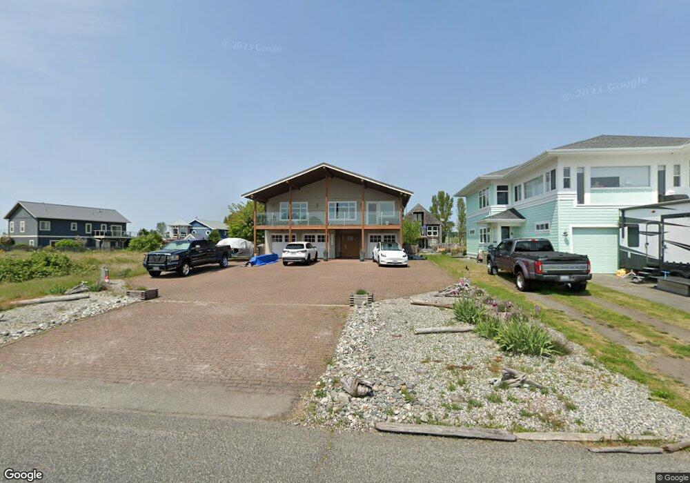
1584 Edwards Dr Point Roberts, WA 98281
Estimated Value: $794,841 - $945,000
3
Beds
3
Baths
3,120
Sq Ft
$273/Sq Ft
Est. Value
About This Home
This home is located at 1584 Edwards Dr, Point Roberts, WA 98281 and is currently estimated at $853,210, approximately $273 per square foot. 1584 Edwards Dr is a home located in Whatcom County with nearby schools including Point Roberts Primary School, Blaine Middle School, and Blaine High School.
Ownership History
Date
Name
Owned For
Owner Type
Purchase Details
Closed on
May 9, 2014
Sold by
Tuazon Jonathan and Tuazon Rosie Marr
Bought by
Rj3 Revocable Living Trust
Current Estimated Value
Purchase Details
Closed on
Aug 12, 2005
Sold by
Mcqueen Marie Annette Diane
Bought by
Tuazon Jonathan
Home Financials for this Owner
Home Financials are based on the most recent Mortgage that was taken out on this home.
Original Mortgage
$311,200
Interest Rate
4.96%
Mortgage Type
Purchase Money Mortgage
Create a Home Valuation Report for This Property
The Home Valuation Report is an in-depth analysis detailing your home's value as well as a comparison with similar homes in the area
Home Values in the Area
Average Home Value in this Area
Purchase History
| Date | Buyer | Sale Price | Title Company |
|---|---|---|---|
| Rj3 Revocable Living Trust | -- | None Available | |
| Tuazon Jonathan | $389,280 | Whatcom Land Title |
Source: Public Records
Mortgage History
| Date | Status | Borrower | Loan Amount |
|---|---|---|---|
| Previous Owner | Tuazon Jonathan | $311,200 |
Source: Public Records
Tax History Compared to Growth
Tax History
| Year | Tax Paid | Tax Assessment Tax Assessment Total Assessment is a certain percentage of the fair market value that is determined by local assessors to be the total taxable value of land and additions on the property. | Land | Improvement |
|---|---|---|---|---|
| 2024 | $5,529 | $726,206 | $301,125 | $425,081 |
| 2023 | $5,529 | $698,831 | $273,750 | $425,081 |
| 2022 | $4,667 | $638,202 | $250,000 | $388,202 |
| 2021 | $4,647 | $487,111 | $180,576 | $306,535 |
| 2020 | $4,619 | $451,023 | $167,198 | $283,825 |
| 2019 | $4,269 | $432,632 | $160,380 | $272,252 |
| 2018 | $4,244 | $388,931 | $144,180 | $244,751 |
| 2017 | $3,675 | $371,451 | $137,700 | $233,751 |
| 2016 | $3,848 | $364,168 | $135,000 | $229,168 |
| 2015 | $4,095 | $370,690 | $144,915 | $225,775 |
| 2014 | -- | $387,528 | $151,500 | $236,028 |
| 2013 | -- | $370,735 | $145,500 | $225,235 |
Source: Public Records
Map
Nearby Homes
- 1561 Edwards Dr
- 1587 Harbor Seal Dr
- Lot 3 Edwards Dr
- 19 Harbor Seal Dr
- 1477 Edwards Dr
- 1453 Edwards Dr
- 0 Edwards Dr Unit Lot 2 11256474
- 1561 Ocean View Ln
- 1920 Patos Way
- 1927 Orcas View Way
- 1881 Edwards Dr
- 1438 Gulf Rd
- 631 Freemans Ln
- 1361 Peltier Dr
- 1379 Gulf Rd
- 581 Marine Dr
- 698 Kendor Dr
- 634 S Beach Rd
- 661 Driftwood Ln
- 1542 Columbia Vista Dr
- 1588 Edwards Dr
- 1594 Edwards Dr
- 1583 Harbor Seal Dr
- 1579 Harbor Seal Dr
- 764 Marina Dr
- 764 Marine Dr
- 2 Harbor Seal Drive - Lot 2
- 1570 Edwards Dr
- 1571 Harbor Seal Dr
- 1585 Edwards Dr
- 1587 Edwards Dr
- 1575 Edwards Dr
- 1608 Edwards Dr
- 1603 Edwards Dr
- 1567 Edwards Dr
- 1563 Edwards Dr
- 1607 Edwards Dr
- 0 Lot 19 Harbor Seal Dr
- 0 Lot 10 Harbor Seal Dr
- Lot 9 Harbor Seal Dr