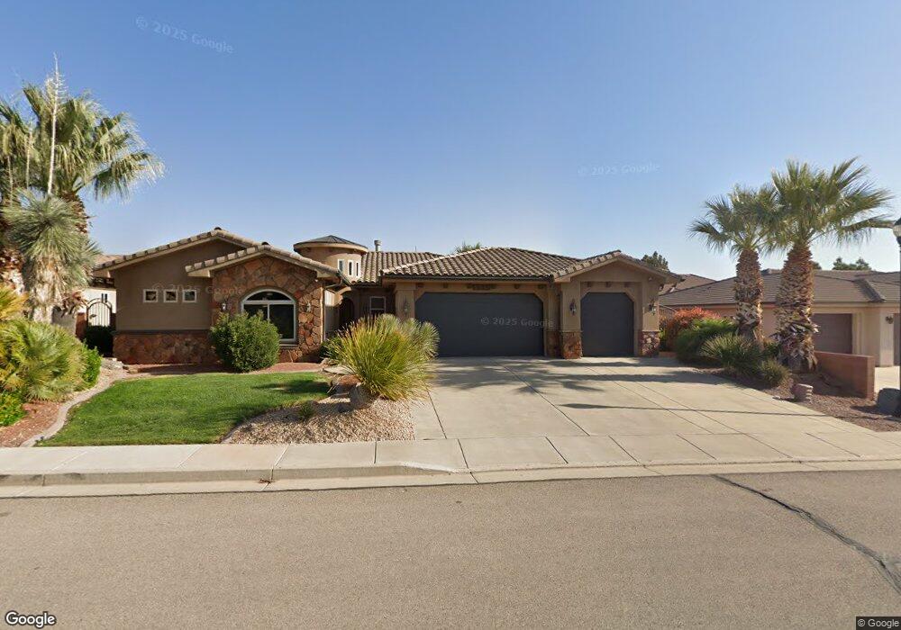
1585 E 50 S Saint George, UT 84790
Estimated Value: $710,418 - $848,000
4
Beds
3
Baths
2,416
Sq Ft
$318/Sq Ft
Est. Value
About This Home
This home is located at 1585 E 50 S, Saint George, UT 84790 and is currently estimated at $768,105, approximately $317 per square foot. 1585 E 50 S is a home located in Washington County with nearby schools including Heritage School, Dixie Middle School, and Dixie Intermediate School.
Ownership History
Date
Name
Owned For
Owner Type
Purchase Details
Closed on
Dec 15, 2014
Sold by
Noorda Christian L and Noorda Jodie Ann
Bought by
Olson Melissa and Noorda Family Asset Protection Trust
Current Estimated Value
Purchase Details
Closed on
May 21, 2007
Sold by
Noorda Chris and Noorda Christian L
Bought by
Noorda Christian L and Noorda Jodie A
Home Financials for this Owner
Home Financials are based on the most recent Mortgage that was taken out on this home.
Original Mortgage
$398,600
Outstanding Balance
$258,493
Interest Rate
6.62%
Mortgage Type
Construction
Estimated Equity
$509,612
Purchase Details
Closed on
Mar 6, 2007
Sold by
Covenant Investments Llc
Bought by
Noorda Chris
Home Financials for this Owner
Home Financials are based on the most recent Mortgage that was taken out on this home.
Original Mortgage
$155,922
Interest Rate
6.23%
Mortgage Type
Unknown
Create a Home Valuation Report for This Property
The Home Valuation Report is an in-depth analysis detailing your home's value as well as a comparison with similar homes in the area
Home Values in the Area
Average Home Value in this Area
Purchase History
| Date | Buyer | Sale Price | Title Company |
|---|---|---|---|
| Olson Melissa | -- | None Available | |
| Noorda Christian L | -- | Southern Utah Title Co | |
| Noorda Chris | -- | First Title Of Utah |
Source: Public Records
Mortgage History
| Date | Status | Borrower | Loan Amount |
|---|---|---|---|
| Open | Noorda Christian L | $398,600 | |
| Closed | Noorda Chris | $155,922 |
Source: Public Records
Tax History Compared to Growth
Tax History
| Year | Tax Paid | Tax Assessment Tax Assessment Total Assessment is a certain percentage of the fair market value that is determined by local assessors to be the total taxable value of land and additions on the property. | Land | Improvement |
|---|---|---|---|---|
| 2025 | $5,008 | $750,500 | $200,000 | $550,500 |
| 2023 | $4,924 | $735,700 | $200,000 | $535,700 |
| 2022 | $6,397 | $737,200 | $200,000 | $537,200 |
| 2021 | $4,605 | $530,700 | $110,000 | $420,700 |
| 2020 | $4,227 | $458,800 | $110,000 | $348,800 |
| 2019 | $4,342 | $460,400 | $110,000 | $350,400 |
| 2018 | $3,888 | $387,000 | $0 | $0 |
| 2017 | $3,812 | $368,400 | $0 | $0 |
| 2016 | $2,077 | $185,625 | $0 | $0 |
| 2015 | $2,140 | $183,535 | $0 | $0 |
| 2014 | $2,130 | $183,810 | $0 | $0 |
Source: Public Records
Map
Nearby Homes
- 110 S Eastridge Dr
- 1646 E 90 Cir S
- 84 N Eastridge Dr
- 1684 E 290 S
- 145 N Mall Dr Unit 33
- 145 N Mall Dr Unit 59
- 145 N Mall Dr Unit 57
- 5409 S Aquamarine Ln
- 5394 S Aquamarine Ln
- 5931 S Orchid Cove
- 5416 S Aquamarine Ln
- 5401 S Aquamarine Ln
- 5409 S Aquamarine Ln Unit 257
- 5398 S Aquamarine Ln
- 0 Null Unit 25-258376
- 232 S Acantilado Cir
- 301 S 1200 E Unit 47
- 301 S 1200 E Unit 89
- 301 S 1200 E Unit 112
- 301 S 1200 E Unit 52
- 1599 E 50 S
- 110011 Adjacent To S End of Ridge E
- 1573 E 50 S
- 1588 E 10 St S
- 1588 E 10 S
- 1604 E 10 S
- 0 E Ridge Phase 6 Unit 11-130198
- 0 E Ridge Phase 6 Unit 9-115979
- 0 E Ridge Phase 6 Unit 11-129000
- 0 E Ridge Phase 6 Unit 10-121235
- 0 E Ridge Phase 6 Unit LOT 13 10-124058
- 0 E Ridge Phase 6 Unit LOT 2 10-124055
- 0 E Ridge Phase 6 Unit LOT 14 10-124060
- 0 E Ridge Phase 6 Unit Lot 12
- 1611 E 50 S
- 1611 E 50 S Unit LOT 8
- 1594 E 50 St S
- 1594 E 50 S
- 1580 E 50 S
- 1580 E 50 St S