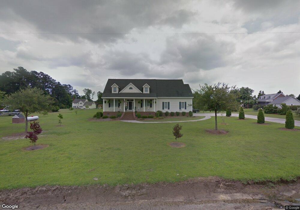
1585 Garrett Rd Williamston, NC 27892
Estimated Value: $235,000 - $345,841
3
Beds
3
Baths
2,160
Sq Ft
$142/Sq Ft
Est. Value
About This Home
This home is located at 1585 Garrett Rd, Williamston, NC 27892 and is currently estimated at $305,947, approximately $141 per square foot. 1585 Garrett Rd is a home located in Martin County with nearby schools including Williamston Primary School, E.J. Hayes Elementary School, and Riverside Middle School.
Ownership History
Date
Name
Owned For
Owner Type
Purchase Details
Closed on
Sep 8, 2017
Sold by
Harrison Asa M and Harrison Deborah E
Bought by
Curtis Richard E and Curtis Patsy B
Current Estimated Value
Purchase Details
Closed on
Nov 1, 2001
Bought by
Harrison Asa M
Create a Home Valuation Report for This Property
The Home Valuation Report is an in-depth analysis detailing your home's value as well as a comparison with similar homes in the area
Home Values in the Area
Average Home Value in this Area
Purchase History
| Date | Buyer | Sale Price | Title Company |
|---|---|---|---|
| Curtis Richard E | $257,500 | None Available | |
| Curtis Richard E | $257,500 | None Available | |
| Harrison Asa M | $23,500 | -- | |
| Harrison Asa M | $23,500 | -- |
Source: Public Records
Tax History
| Year | Tax Paid | Tax Assessment Tax Assessment Total Assessment is a certain percentage of the fair market value that is determined by local assessors to be the total taxable value of land and additions on the property. | Land | Improvement |
|---|---|---|---|---|
| 2025 | $2,787 | $360,030 | $65,460 | $294,570 |
| 2024 | $2,347 | $265,720 | $59,770 | $205,950 |
| 2023 | $2,334 | $265,720 | $59,770 | $205,950 |
| 2022 | $2,334 | $265,720 | $0 | $0 |
| 2021 | $2,334 | $265,720 | $59,770 | $205,950 |
| 2020 | $2,324 | $265,720 | $59,770 | $205,950 |
| 2019 | $2,324 | $265,720 | $0 | $0 |
| 2018 | $2,271 | $265,720 | $0 | $0 |
| 2017 | $2,036 | $235,990 | $0 | $0 |
| 2015 | $1,973 | $244,980 | $0 | $0 |
| 2014 | $2,132 | $244,980 | $0 | $0 |
| 2012 | $1,999 | $244,980 | $0 | $0 |
Source: Public Records
Map
Nearby Homes
- 1020 Dixie Trail
- 00 Santree Dr
- 107 S McCaskey Rd
- 1111 Prison Camp Rd
- 212 Sunset Dr
- 1420 Lum Brown Rd
- 200 1st St
- 106 Carolina Ave
- 1005 Pinecrest St
- 1046 Mockingbird Rd
- 303 Roberson Dr
- 203 Faulk St
- 3 Planters Ln
- 1089 White Oak Dr
- Lot 1 & 2 White Oak Dr
- 817 W Main St
- 803 W Church St
- 401 Jamesville Rd
- 8001 W Main St
- 607 W Main St
- 1559 Garrett Rd
- 1011 Cedar Hill Dr
- 1045 Cedar Hill Dr
- 1065 Oakdale Dr
- 1071 Cedar Hill Dr
- 1105 Oakdale Dr
- 1010 Cedar Hill Dr
- 1046 Cedar Hill Dr
- 1111 Cedar Hill Dr
- 1072 Cedar Hill Dr
- 1100 Oakdale Dr
- 1090 Cedar Hill Dr
- 1045 Hillcrest Dr
- 1141 Cedar Hill Dr
- 1124 Cedar Hill Dr
- 1474 Garrett Rd
- 1150 Oakdale Dr
- 1439 Garrett Rd
- 1023 Wt Ross Rd
- 1049 Wt Ross Rd
Your Personal Tour Guide
Ask me questions while you tour the home.