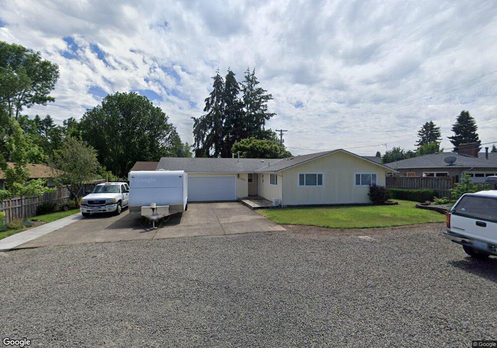
1585 Long Island Dr Eugene, OR 97401
Cal Young NeighborhoodEstimated Value: $430,000 - $470,451
3
Beds
2
Baths
1,246
Sq Ft
$356/Sq Ft
Est. Value
About This Home
This home is located at 1585 Long Island Dr, Eugene, OR 97401 and is currently estimated at $443,613, approximately $356 per square foot. 1585 Long Island Dr is a home located in Lane County with nearby schools including Willagillespie Elementary School, Monroe Middle School, and Sheldon High School.
Ownership History
Date
Name
Owned For
Owner Type
Purchase Details
Closed on
Jun 27, 2016
Sold by
Neu Sondra Gail
Bought by
Weaver Philip D
Current Estimated Value
Purchase Details
Closed on
Nov 19, 1997
Sold by
Neu Sondra Gail and Weaver Sondra Gail
Bought by
Neu Sondra Gail and Neu Norman Duane
Home Financials for this Owner
Home Financials are based on the most recent Mortgage that was taken out on this home.
Original Mortgage
$70,000
Interest Rate
7.23%
Create a Home Valuation Report for This Property
The Home Valuation Report is an in-depth analysis detailing your home's value as well as a comparison with similar homes in the area
Home Values in the Area
Average Home Value in this Area
Purchase History
| Date | Buyer | Sale Price | Title Company |
|---|---|---|---|
| Weaver Philip D | $225,000 | Fidelity Natl Title Co Of Or | |
| Neu Sondra Gail | -- | Fidelity Natl Title Co Of Or | |
| Neu Sondra Gail | -- | Title Guaranty Co |
Source: Public Records
Mortgage History
| Date | Status | Borrower | Loan Amount |
|---|---|---|---|
| Previous Owner | Neu Sondra Gail | $70,000 |
Source: Public Records
Tax History
| Year | Tax Paid | Tax Assessment Tax Assessment Total Assessment is a certain percentage of the fair market value that is determined by local assessors to be the total taxable value of land and additions on the property. | Land | Improvement |
|---|---|---|---|---|
| 2025 | $4,684 | $240,407 | -- | -- |
| 2024 | $4,626 | $233,405 | -- | -- |
| 2023 | $4,626 | $226,607 | $0 | $0 |
| 2022 | $4,015 | $203,834 | $0 | $0 |
| 2021 | $3,771 | $197,898 | $0 | $0 |
| 2020 | $3,784 | $192,134 | $0 | $0 |
| 2019 | $3,655 | $186,538 | $0 | $0 |
| 2018 | $3,440 | $175,830 | $0 | $0 |
| 2017 | $3,286 | $175,830 | $0 | $0 |
| 2016 | $3,141 | $170,709 | $0 | $0 |
| 2015 | $3,012 | $165,737 | $0 | $0 |
| 2014 | $2,910 | $160,910 | $0 | $0 |
Source: Public Records
Map
Nearby Homes
- 1632 Larkspur Loop
- 0 Cal Young Rd Unit Lot 4
- 1500 Norkenzie Rd Unit 12
- 1500 Norkenzie Rd Unit 43
- 1328 Spyglass Dr
- 1440 Amberland Ave
- 1750 Tabor St
- 0 Piper Ln Unit Lot 1
- 0 Piper Ln Unit Lot 3
- 0 Piper Ln Unit Lot 2
- 0 Piper Ln Unit Lot 5
- 1376 Brickley Rd
- 1332 Jeppesen Ave
- 863 Fairway View Dr
- 410 Spyglass Dr
- 1193 Rio Glen Dr
- 516 Spyglass Dr
- 0 Crenshaw Rd Unit 740506614
- 1810 Happy Ln
- 1230 Debrick Rd
- 1591 Long Island Dr
- 1575 Long Island Dr
- 1595 Long Island Dr
- 1545 Long Island Dr
- 1580 Long Island Dr
- 1574 Long Island Dr
- 1780 Monterey Ln
- 1570 Diane St
- 1509 Long Island Dr
- 1538 Long Island Dr
- 1810 Carmel Ave
- 1728 Monterey Ln
- 1860 Carmel Ave
- 1575 Larkspur Loop
- 1795 Monterey Ln
- 1506 Long Island Dr
- 1580 Diane St
- 1493 Long Island Dr
- 1589 Larkspur Loop
Your Personal Tour Guide
Ask me questions while you tour the home.