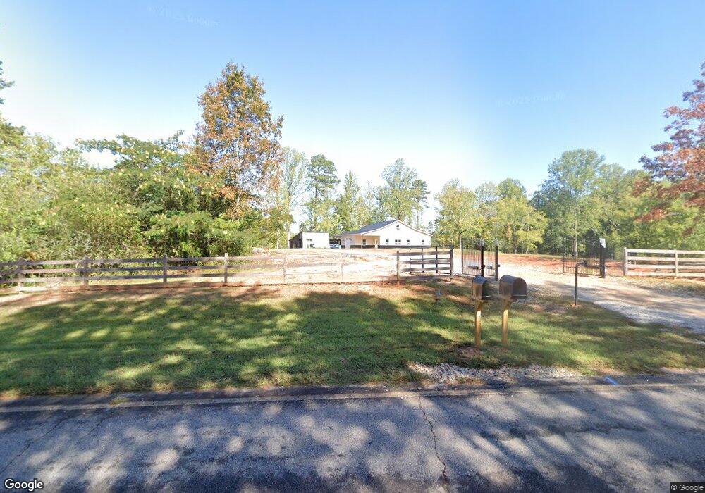
1585 Smith Loop Demorest, GA 30535
Estimated Value: $364,000 - $2,333,284
1
Bed
1
Bath
802
Sq Ft
$1,682/Sq Ft
Est. Value
About This Home
This home is located at 1585 Smith Loop, Demorest, GA 30535 and is currently estimated at $1,348,642, approximately $1,681 per square foot. 1585 Smith Loop is a home located in Habersham County with nearby schools including Fairview Elementary School, South Habersham Middle School, and Habersham Success Academy.
Ownership History
Date
Name
Owned For
Owner Type
Purchase Details
Closed on
Feb 22, 2019
Sold by
Trotter Farms Llc
Bought by
Mcdaniel Danny L and Mcdaniel Ernestine
Current Estimated Value
Purchase Details
Closed on
Sep 24, 2018
Sold by
Trotter Farms Llc
Bought by
Funderburk Jerry W and Funderburk Sandra L
Purchase Details
Closed on
Nov 6, 2017
Sold by
Trotter Farms Llc
Bought by
Grant Reeves Vfw
Purchase Details
Closed on
Oct 1, 2007
Sold by
Not Provided
Bought by
Trotter Farms Llc
Create a Home Valuation Report for This Property
The Home Valuation Report is an in-depth analysis detailing your home's value as well as a comparison with similar homes in the area
Home Values in the Area
Average Home Value in this Area
Purchase History
| Date | Buyer | Sale Price | Title Company |
|---|---|---|---|
| Mcdaniel Danny L | $357,500 | -- | |
| Funderburk Jerry W | $17,004 | -- | |
| Grant Reeves Vfw | $117,000 | -- | |
| Trotter Farms Llc | -- | -- |
Source: Public Records
Tax History Compared to Growth
Tax History
| Year | Tax Paid | Tax Assessment Tax Assessment Total Assessment is a certain percentage of the fair market value that is determined by local assessors to be the total taxable value of land and additions on the property. | Land | Improvement |
|---|---|---|---|---|
| 2025 | $10,207 | $686,136 | $138,160 | $547,976 |
| 2024 | -- | $602,552 | $113,752 | $488,800 |
| 2023 | $8,709 | $503,500 | $113,752 | $389,748 |
| 2022 | $8,652 | $402,884 | $73,376 | $329,508 |
| 2021 | $4,719 | $181,804 | $70,020 | $111,784 |
| 2020 | $1,904 | $70,788 | $70,020 | $768 |
| 2019 | $1,483 | $50,860 | $50,092 | $768 |
| 2018 | $1,537 | $57,536 | $52,916 | $4,620 |
| 2017 | $1,257 | $46,800 | $42,332 | $4,468 |
| 2016 | $1,220 | $117,000 | $42,332 | $4,468 |
| 2015 | $1,206 | $117,000 | $42,332 | $4,468 |
| 2014 | $1,223 | $116,470 | $42,332 | $4,256 |
| 2013 | -- | $46,588 | $42,332 | $4,256 |
Source: Public Records
Map
Nearby Homes
- 8.5 +/- Smith Loop
- 155 Brentwood Dr
- 183 Golden Valley Dr
- 264 Canyon Point Dr
- 240 Canyon Point Dr
- 500 Cross Creek Trail
- 329 Twisting Ridge Trail
- 161 Twisting Ridge Trail
- 699 Cobblestone Ln
- 268 Jud Tench Rd
- 274 Hopes Cir
- 3750 Old Cleveland Rd
- 512 Olde Rockhouse Ln
- LOT 4 Olde Rockhouse Ln
- 0 N Falling Waters Dr Unit LOT 32B
- 950 Hancock Rd
- 186 Sweetbriar Dr Unit LOT 10
- 186 Sweetbriar Dr
- 1177 Twin River Orchard Rd
- 0 Twin River Orchard Rd Unit 7194756
- 1722 Smith Loop
- 290 Family Ties Ln
- 226 Brentwood Dr
- Lot 41 Smith Loop Rd
- 700 Canyon Point Dr
- 1395 Smith Loop
- 203 Brentwood Dr
- 0 Maple Ridge Dr
- 0 Maple Ridge Dr Unit 7232580
- 220 Brentwood Dr
- 287 Can-Trail Dr
- 191 Brentwood Dr
- 192 Brentwood Dr
- 160 Family Ties Ln
- 1358 Smith Loop
- 179 Brentwood Dr Unit 12
- 179 Brentwood Dr
- 5.96 ACRES Canyon Point Dr
- 178 Brentwood Dr
- 739 Canyon Point Dr