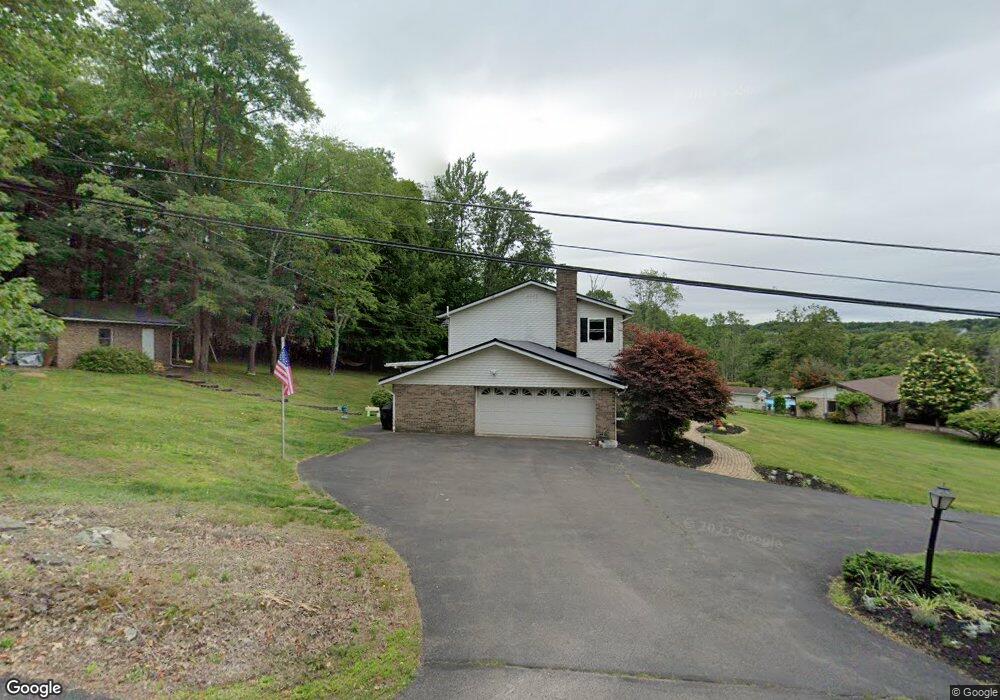
1585 Sutton Rd Shavertown, PA 18708
Estimated Value: $454,000 - $615,000
5
Beds
3
Baths
4,017
Sq Ft
$134/Sq Ft
Est. Value
About This Home
This home is located at 1585 Sutton Rd, Shavertown, PA 18708 and is currently estimated at $537,279, approximately $133 per square foot. 1585 Sutton Rd is a home located in Luzerne County with nearby schools including Cornerstone Christian Academy.
Ownership History
Date
Name
Owned For
Owner Type
Purchase Details
Closed on
Dec 10, 2021
Sold by
Millington Marilyn and Estate Of Patrick J Degennaro
Bought by
Shissler Ryan Daniel and Shissler Ashley Lynn
Current Estimated Value
Home Financials for this Owner
Home Financials are based on the most recent Mortgage that was taken out on this home.
Original Mortgage
$225,000
Outstanding Balance
$206,885
Interest Rate
3.09%
Mortgage Type
New Conventional
Estimated Equity
$330,394
Purchase Details
Closed on
Feb 24, 1975
Bought by
Degennaro Patrick J and Degennaro Lois
Create a Home Valuation Report for This Property
The Home Valuation Report is an in-depth analysis detailing your home's value as well as a comparison with similar homes in the area
Home Values in the Area
Average Home Value in this Area
Purchase History
| Date | Buyer | Sale Price | Title Company |
|---|---|---|---|
| Shissler Ryan Daniel | $325,000 | First American Mortgage Sln | |
| Degennaro Patrick J | $80,000 | -- |
Source: Public Records
Mortgage History
| Date | Status | Borrower | Loan Amount |
|---|---|---|---|
| Open | Shissler Ryan Daniel | $225,000 |
Source: Public Records
Tax History Compared to Growth
Tax History
| Year | Tax Paid | Tax Assessment Tax Assessment Total Assessment is a certain percentage of the fair market value that is determined by local assessors to be the total taxable value of land and additions on the property. | Land | Improvement |
|---|---|---|---|---|
| 2025 | $8,617 | $388,400 | $67,200 | $321,200 |
| 2024 | $8,588 | $388,400 | $67,200 | $321,200 |
| 2023 | $8,540 | $388,400 | $67,200 | $321,200 |
| 2022 | $8,468 | $388,400 | $67,200 | $321,200 |
| 2021 | $8,143 | $388,400 | $67,200 | $321,200 |
| 2020 | $8,143 | $388,400 | $67,200 | $321,200 |
| 2019 | $7,469 | $388,400 | $67,200 | $321,200 |
| 2018 | $7,263 | $388,400 | $67,200 | $321,200 |
| 2017 | $7,098 | $388,400 | $67,200 | $321,200 |
| 2016 | -- | $388,400 | $67,200 | $321,200 |
| 2015 | -- | $388,400 | $67,200 | $321,200 |
| 2014 | -- | $388,400 | $67,200 | $321,200 |
Source: Public Records
Map
Nearby Homes
- 1312 Sutton Rd
- 325 Longmeadow Rd
- Lot 12 Cobblestone Ln
- 575 Deer Hill Rd
- 38 Forest Dr
- 98 Davis St
- 945 Lantern Hill Rd
- 59 Zinn St
- 307 Adj Overbrook Ave
- 3 N Pioneer Ave
- Lot # 4 Pioneer Ave
- 50 Evergreen St
- 175 N Pioneer Ave
- 70 Shaver Ave
- 7 Orchard St
- 747 Greens
- 125 N Lehigh St
- 217 Parrish St
- 65 E Overbrook Rd
- 5 Newberry Estates
- 1635 Sutton Rd
- 11 Bulford Rd
- 1530 Sutton Rd
- 1665 Sutton Rd
- 1495 Sutton Rd
- 1550 Sutton Rd
- 1691 Sutton Rd
- 86 Bulford Rd
- 10 Bulford Rd
- 1465 Sutton Rd
- 1600 Sutton Rd
- 1730 Sutton Rd
- 1470 Sutton Rd
- 1421 Sutton Rd
- 185 Bulford Rd
- 1420 Sutton Rd
- 40 Stoney Brook Rd
- 901 Stonington Rd
- 1760 Sutton Rd
- 470 Millington Rd