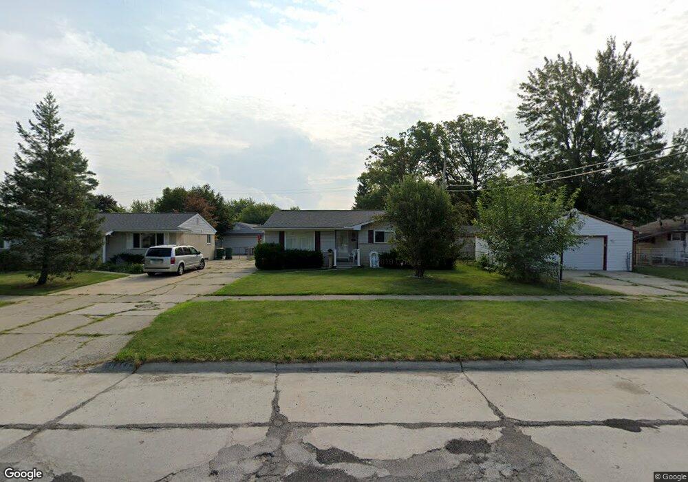
15859 Brandt St Romulus, MI 48174
Estimated Value: $166,000 - $192,000
3
Beds
2
Baths
1,002
Sq Ft
$182/Sq Ft
Est. Value
About This Home
This home is located at 15859 Brandt St, Romulus, MI 48174 and is currently estimated at $182,632, approximately $182 per square foot. 15859 Brandt St is a home with nearby schools including Halecreek Elementary School, Romulus Middle School, and Romulus Senior High School.
Ownership History
Date
Name
Owned For
Owner Type
Purchase Details
Closed on
Apr 14, 2023
Sold by
Patricia M Thorley Living Trust
Bought by
Smith Steven Dean
Current Estimated Value
Home Financials for this Owner
Home Financials are based on the most recent Mortgage that was taken out on this home.
Original Mortgage
$129,609
Outstanding Balance
$126,092
Interest Rate
6.73%
Mortgage Type
FHA
Estimated Equity
$56,540
Purchase Details
Closed on
Mar 30, 2006
Sold by
Thorley Patricia M
Bought by
Thorley Patricia M
Create a Home Valuation Report for This Property
The Home Valuation Report is an in-depth analysis detailing your home's value as well as a comparison with similar homes in the area
Home Values in the Area
Average Home Value in this Area
Purchase History
| Date | Buyer | Sale Price | Title Company |
|---|---|---|---|
| Smith Steven Dean | $132,000 | Liberty Title | |
| Smith Steven Dean | $132,000 | Liberty Title | |
| Thorley Patricia M | -- | None Available | |
| Thorley Patricia M | -- | None Available |
Source: Public Records
Mortgage History
| Date | Status | Borrower | Loan Amount |
|---|---|---|---|
| Open | Smith Steven Dean | $129,609 | |
| Closed | Smith Steven Dean | $129,609 |
Source: Public Records
Tax History
| Year | Tax Paid | Tax Assessment Tax Assessment Total Assessment is a certain percentage of the fair market value that is determined by local assessors to be the total taxable value of land and additions on the property. | Land | Improvement |
|---|---|---|---|---|
| 2025 | $3,245 | $81,400 | $0 | $0 |
| 2024 | $3,262 | $75,000 | $0 | $0 |
| 2023 | $1,825 | $66,700 | $0 | $0 |
| 2022 | $2,258 | $64,400 | $0 | $0 |
| 2021 | $1,931 | $49,900 | $0 | $0 |
| 2020 | $1,889 | $49,200 | $0 | $0 |
| 2019 | $1,888 | $41,800 | $0 | $0 |
| 2018 | $1,239 | $32,000 | $0 | $0 |
| 2017 | $913 | $31,500 | $0 | $0 |
| 2016 | $1,650 | $33,000 | $0 | $0 |
| 2015 | $3,200 | $32,000 | $0 | $0 |
| 2013 | $3,160 | $34,300 | $0 | $0 |
| 2012 | $959 | $32,700 | $5,100 | $27,600 |
Source: Public Records
Map
Nearby Homes
- 30058 Halecreek St
- 30771 Halecreek St
- 15520 Brandt St
- 15900 Sandburg St
- 15447 Anthony St
- 30455 Cherry Ave
- 16068 Middlebelt Rd
- 15715 Merriman Rd
- 16110 Farnum St
- 30620 Pennsylvania Rd
- 30930 Pennsylvania Rd Unit 8
- 00000 Pennsylvania Rd
- 00 Eureka Rd
- 29067 Cullen Dr Unit BLDG8
- 15654 Isabelle St
- 28567 Forest Dale St
- 28510 Halecreek St
- 16913 Aberdeen Dr Unit 220
- 4444 Eureka Rd
- 27597 Eureka Rd
- 15847 Brandt St
- 30436 Leroy St
- 30422 Leroy St
- 15835 Brandt St
- 15826 Anthony St
- 30509 Halecreek St
- 15812 Anthony St
- 15823 Brandt St
- 15840 Anthony St Unit 83
- 30508 Leroy St
- 15766 Anthony St
- 30522 Leroy St
- 30523 Halecreek St
- 15811 Brandt St
- 15822 Brandt St
- 15754 Anthony St
- 30437 Leroy St
- 30535 Halecreek St
- 30534 Leroy St
- 15810 Brandt St
Your Personal Tour Guide
Ask me questions while you tour the home.