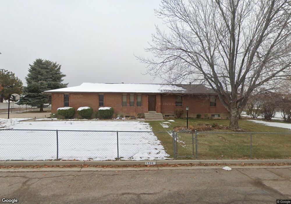
1586 N 1520 W Pleasant Grove, UT 84062
Estimated Value: $612,000 - $652,000
3
Beds
2
Baths
1,529
Sq Ft
$412/Sq Ft
Est. Value
About This Home
This home is located at 1586 N 1520 W, Pleasant Grove, UT 84062 and is currently estimated at $630,616, approximately $412 per square foot. 1586 N 1520 W is a home located in Utah County with nearby schools including Mount Mahogany School, Pleasant Grove Junior High School, and Pleasant Grove High School.
Ownership History
Date
Name
Owned For
Owner Type
Purchase Details
Closed on
May 29, 2014
Sold by
Best Daniel J
Bought by
Best Daniel J
Current Estimated Value
Home Financials for this Owner
Home Financials are based on the most recent Mortgage that was taken out on this home.
Original Mortgage
$100,000
Outstanding Balance
$31,211
Interest Rate
4.23%
Mortgage Type
New Conventional
Estimated Equity
$599,405
Purchase Details
Closed on
Jan 13, 2011
Sold by
Best Daniel J and Best Kirsten
Bought by
Best Daniel J
Purchase Details
Closed on
May 9, 1996
Sold by
Grange Gordon K and Grange Linda B
Bought by
Best Daniel J and Best Kirsten
Home Financials for this Owner
Home Financials are based on the most recent Mortgage that was taken out on this home.
Original Mortgage
$128,000
Interest Rate
7.68%
Create a Home Valuation Report for This Property
The Home Valuation Report is an in-depth analysis detailing your home's value as well as a comparison with similar homes in the area
Home Values in the Area
Average Home Value in this Area
Purchase History
| Date | Buyer | Sale Price | Title Company |
|---|---|---|---|
| Best Daniel J | -- | Integrated Title Ins Se | |
| Best Daniel J | -- | Accommodation | |
| Best Daniel J | -- | -- |
Source: Public Records
Mortgage History
| Date | Status | Borrower | Loan Amount |
|---|---|---|---|
| Open | Best Daniel J | $100,000 | |
| Closed | Best Daniel J | $128,000 |
Source: Public Records
Tax History Compared to Growth
Tax History
| Year | Tax Paid | Tax Assessment Tax Assessment Total Assessment is a certain percentage of the fair market value that is determined by local assessors to be the total taxable value of land and additions on the property. | Land | Improvement |
|---|---|---|---|---|
| 2025 | $2,525 | $309,320 | $291,000 | $271,400 |
| 2024 | $2,412 | $294,690 | $0 | $0 |
| 2023 | $2,412 | $294,635 | $0 | $0 |
| 2022 | $2,430 | $295,405 | $0 | $0 |
| 2021 | $2,037 | $377,000 | $182,700 | $194,300 |
| 2020 | $1,890 | $343,000 | $163,100 | $179,900 |
| 2019 | $1,782 | $334,400 | $154,500 | $179,900 |
| 2018 | $1,704 | $302,400 | $146,000 | $156,400 |
| 2017 | $1,542 | $145,640 | $0 | $0 |
| 2016 | $1,403 | $127,985 | $0 | $0 |
| 2015 | $1,356 | $117,150 | $0 | $0 |
| 2014 | $1,293 | $110,605 | $0 | $0 |
Source: Public Records
Map
Nearby Homes
- 1320 W 1340 N
- 1171 N 1430 W
- 1141 E 50 N
- Lytham Plan at Grove Acres
- 1498 W 1060 N Unit 5
- 1096 N 1420 St W Unit 27
- 980 W 1800 N
- 1065 N 1420 W
- 1541 W 1060 N
- 1515 W 1010 St N
- 1897 N 900 W
- 1491 W 1010 N
- 1443 W 1010 N
- 1879 W 1100 N
- 2254 N 1560 W
- 909 W 1180 N
- Konlee Plan at Makin Dreams
- Alexa Plan at Makin Dreams
- Callahan Plan at Makin Dreams
- Hailey Plan at Makin Dreams
- 1540 N 1520 W
- 1585 N 1520 W
- 1644 N 1520 W
- 1427 W 1620 N Unit 102
- 1545 N 1520 W
- 1631 Leslie Cir
- 1338 W 1620 N
- 1645 N 1520 W
- 1506 N 1520 W
- 1655 Leslie Cir
- 1626 Leslie Cir
- 1505 N 1520 W
- 1686 N 1520 W
- 1504 N 1430 W
- 1504 N 1430 W Unit 106
- 1685 N 1520 W
- 1697 Leslie Cir
- 1464 N 1520 W
- 1468 W 1440 N
- 1468 W 1440 N Unit 1