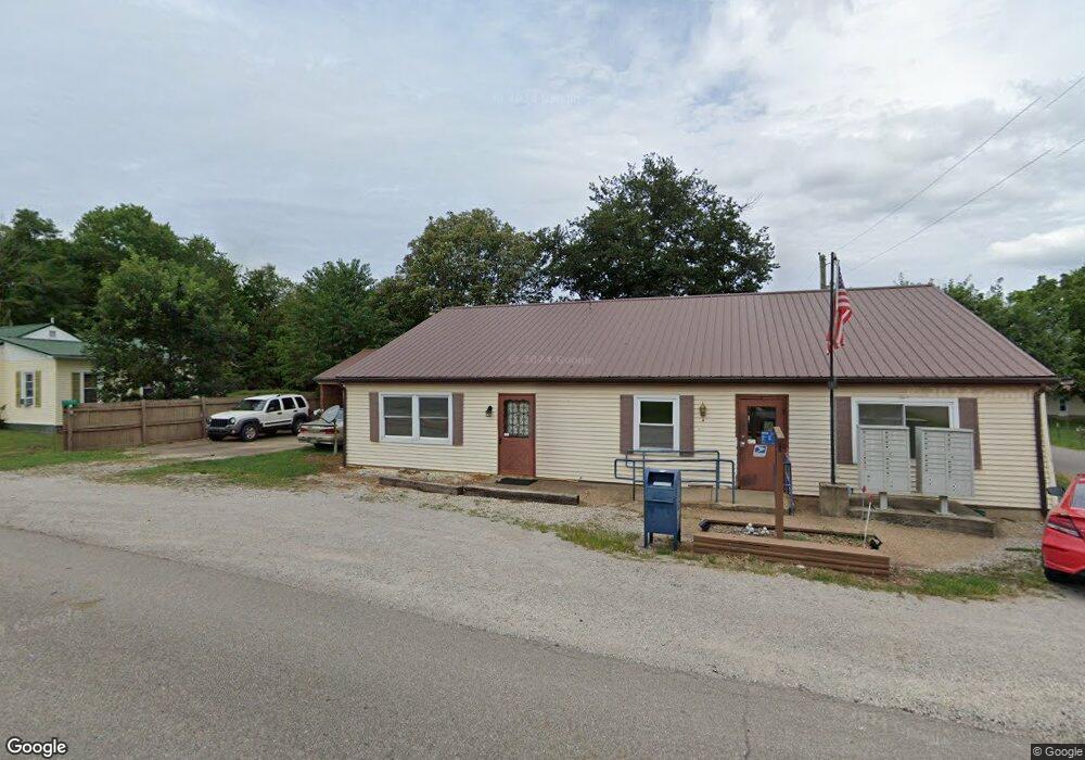
1586 Patriot Rd Patriot, OH 45658
Estimated Value: $59,000 - $162,000
4
Beds
4
Baths
2,268
Sq Ft
$41/Sq Ft
Est. Value
About This Home
This home is located at 1586 Patriot Rd, Patriot, OH 45658 and is currently estimated at $92,637, approximately $40 per square foot. 1586 Patriot Rd is a home with nearby schools including Southwestern Elementary School, River Valley Middle School, and River Valley High School.
Ownership History
Date
Name
Owned For
Owner Type
Purchase Details
Closed on
Apr 1, 2025
Sold by
Wood Scott
Bought by
Carpenter Jimmy W and Carpenter Kyla R
Current Estimated Value
Purchase Details
Closed on
Mar 18, 2020
Sold by
Wood Scott
Bought by
Carpenter Jimmy W and Carpenter Kyla R
Home Financials for this Owner
Home Financials are based on the most recent Mortgage that was taken out on this home.
Original Mortgage
$60,000
Interest Rate
3.2%
Mortgage Type
Land Contract Argmt. Of Sale
Purchase Details
Closed on
May 30, 2019
Sold by
Burnett Marshalline M
Bought by
Wood Scott
Purchase Details
Closed on
Jun 22, 2004
Sold by
Wood Scott
Bought by
Wood Scott
Create a Home Valuation Report for This Property
The Home Valuation Report is an in-depth analysis detailing your home's value as well as a comparison with similar homes in the area
Home Values in the Area
Average Home Value in this Area
Purchase History
| Date | Buyer | Sale Price | Title Company |
|---|---|---|---|
| Carpenter Jimmy W | $60,000 | None Listed On Document | |
| Carpenter Jimmy W | $60,000 | None Listed On Document | |
| Carpenter Jimmy W | $5,000 | None Available | |
| Wood Scott | -- | None Available | |
| Wood Scott | -- | -- |
Source: Public Records
Mortgage History
| Date | Status | Borrower | Loan Amount |
|---|---|---|---|
| Previous Owner | Carpenter Jimmy W | $60,000 |
Source: Public Records
Tax History Compared to Growth
Tax History
| Year | Tax Paid | Tax Assessment Tax Assessment Total Assessment is a certain percentage of the fair market value that is determined by local assessors to be the total taxable value of land and additions on the property. | Land | Improvement |
|---|---|---|---|---|
| 2024 | $1,101 | $31,950 | $1,800 | $30,150 |
| 2023 | $1,188 | $31,950 | $1,800 | $30,150 |
| 2022 | $1,007 | $26,680 | $1,520 | $25,160 |
| 2021 | $987 | $26,680 | $1,520 | $25,160 |
| 2020 | $1,005 | $26,680 | $1,520 | $25,160 |
| 2019 | $575 | $24,460 | $1,380 | $23,080 |
| 2018 | $575 | $24,460 | $1,380 | $23,080 |
| 2017 | $571 | $24,460 | $1,380 | $23,080 |
| 2016 | $511 | $22,940 | $1,380 | $21,560 |
| 2015 | $511 | $22,940 | $1,380 | $21,560 |
| 2013 | $492 | $22,300 | $1,380 | $20,920 |
| 2012 | $492 | $22,300 | $1,380 | $20,920 |
Source: Public Records
Map
Nearby Homes
- 1963 Patriot Rd
- 2077 Patriot Rd
- 2265 Patriot
- 11097 State Route 141
- 5188 Ohio 775
- 2988 Smokey Row Rd
- 6200 Ohio 775
- 1975 Boggs Rd
- 5188 State Route 775
- 6023 State Route 141
- 0 Mudsoc Rd
- 1669 Ohio 233
- 742 Peters Cave Rd
- 0 Blessing Unit 2433719
- Ohio 233
- Sr 141
- 438 Hidden Hills Rd
- 0 Johnson Ridge Rd
- 1190 Starcher Rd
- 2035 Graham School Rd
- 62 Village St
- 62 Village St
- 1570 Patriot Rd
- 1587 Patriot Rd
- 1552 Patriot Rd
- 1552 Patriot Rd
- 1563 Patriot Rd
- 1630 Patriot Rd
- 48 Cricket Trail
- 1539 Patriot Rd
- 1496 Patriot Rd
- 1532 Patriot Rd
- 75 Kiser St
- 1518 Patriot Rd
- 76 Kiser St
- 1519 Patriot Rd
- 1686 Patriot Rd
- 35 Dundee Rd
- 1564 Gage Rd
- 260 Cricket Trail