Estimated Value: $268,894 - $470,000
--
Bed
--
Bath
1,296
Sq Ft
$284/Sq Ft
Est. Value
About This Home
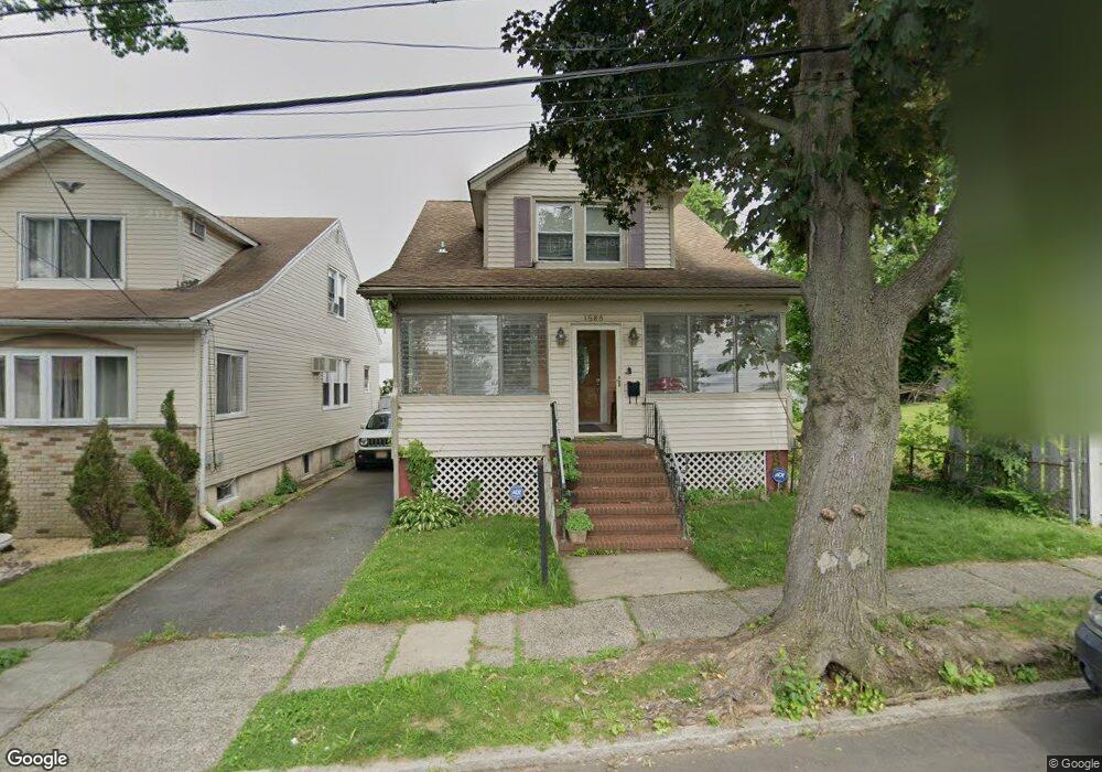
This home is located at 1586 Porter Rd, Union, NJ 07083 and is currently estimated at $368,474, approximately $284 per square foot. 1586 Porter Rd is a home located in Union County with nearby schools including Franklin Elementary School, Burnet Middle School, and Union High School.
Ownership History
Date
Name
Owned For
Owner Type
Purchase Details
Closed on
Feb 10, 2023
Sold by
Dunn Howard and Dunn Audrey T
Bought by
Jones-Dunn Audrey T
Current Estimated Value
Purchase Details
Closed on
Jan 24, 2001
Sold by
Dunn Howard and Jones Audrey T
Bought by
Dunn Howard and Dunn Audrey T Jones
Home Financials for this Owner
Home Financials are based on the most recent Mortgage that was taken out on this home.
Original Mortgage
$117,062
Interest Rate
7.13%
Purchase Details
Closed on
Jun 15, 1997
Sold by
Matloob Donna Luizza and Luizza Donna L
Bought by
Dunn Howard and Jones Audrey T
Home Financials for this Owner
Home Financials are based on the most recent Mortgage that was taken out on this home.
Original Mortgage
$104,000
Interest Rate
7.87%
Create a Home Valuation Report for This Property
The Home Valuation Report is an in-depth analysis detailing your home's value as well as a comparison with similar homes in the area
Home Values in the Area
Average Home Value in this Area
Purchase History
| Date | Buyer | Sale Price | Title Company |
|---|---|---|---|
| Jones-Dunn Audrey T | $78,000 | -- | |
| Jones-Dunn Audrey T | $78,000 | None Listed On Document | |
| Dunn Howard | -- | -- | |
| Dunn Howard | $130,000 | First American |
Source: Public Records
Mortgage History
| Date | Status | Borrower | Loan Amount |
|---|---|---|---|
| Previous Owner | Dunn Howard | $117,062 | |
| Previous Owner | Dunn Howard | $104,000 |
Source: Public Records
Tax History Compared to Growth
Tax History
| Year | Tax Paid | Tax Assessment Tax Assessment Total Assessment is a certain percentage of the fair market value that is determined by local assessors to be the total taxable value of land and additions on the property. | Land | Improvement |
|---|---|---|---|---|
| 2025 | $8,493 | $38,000 | $16,000 | $22,000 |
| 2024 | $8,234 | $38,000 | $16,000 | $22,000 |
| 2023 | $8,234 | $38,000 | $16,000 | $22,000 |
| 2022 | $7,948 | $38,000 | $16,000 | $22,000 |
| 2021 | $7,755 | $38,000 | $16,000 | $22,000 |
| 2020 | $7,601 | $38,000 | $16,000 | $22,000 |
| 2019 | $7,499 | $38,000 | $16,000 | $22,000 |
| 2018 | $7,371 | $38,000 | $16,000 | $22,000 |
| 2017 | $7,262 | $38,000 | $16,000 | $22,000 |
| 2016 | $7,085 | $38,000 | $16,000 | $22,000 |
| 2015 | $6,967 | $38,000 | $16,000 | $22,000 |
| 2014 | $6,811 | $38,000 | $16,000 | $22,000 |
Source: Public Records
Map
Nearby Homes
- 1584 Andrew St
- 1589 Edmund Terrace
- 1630 Andrew St
- 1672 Edmund Terrace
- 1683 Van Ness Terrace
- 2105 Melrose Pkwy
- 6 Field Rd
- 2043-2045 Ostwood Terrace
- 2220 Morrison Ave
- 29 Schaefer Rd
- 1396 Orange Ave
- 2225 Stecher Ave
- 1481 Walker Ave
- 74 Hughes St
- 188 Burnett Ave
- 1707 Burnet Ave
- 1517 Lindy Terrace
- 1552 Elaine Terrace
- 37 Menzel Ave
- 61 Concord Ave
- 1584 Porter Rd
- 1582 Porter Rd
- 1596 Porter Rd
- 2090 Stanley Terrace
- 1587 Andrew St
- 2094 Stanley Terrace
- 1585 Andrew St
- 1580 Porter Rd
- 1580 Porter Rd Unit one
- 1587 Andrew St
- 1583 Andrew St
- 2074 Stanley Terrace
- 1578 Porter Rd
- 1581 Andrew St
- 1589 Porter Rd
- 1585 Porter Rd
- 2072 Stanley Terrace
- 1575 Andrew St
- 1576 Porter Rd
- 1579 Porter Rd