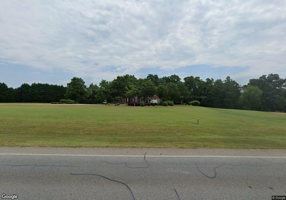
1586 State Highway 11 Social Circle, GA 30025
Estimated Value: $667,000 - $707,454
6
Beds
7
Baths
4,036
Sq Ft
$172/Sq Ft
Est. Value
About This Home
This home is located at 1586 State Highway 11, Social Circle, GA 30025 and is currently estimated at $692,864, approximately $171 per square foot. 1586 State Highway 11 is a home located in Newton County with nearby schools including Flint Hill Elementary School, Cousins Middle School, and Eastside High School.
Ownership History
Date
Name
Owned For
Owner Type
Purchase Details
Closed on
May 19, 2025
Sold by
Byrd Larry
Bought by
Ramsey Keenan
Current Estimated Value
Purchase Details
Closed on
Jun 27, 2022
Sold by
Byrd Larry
Bought by
Byrd Larry and Byrd Rebecca
Home Financials for this Owner
Home Financials are based on the most recent Mortgage that was taken out on this home.
Original Mortgage
$638,000
Interest Rate
5.1%
Mortgage Type
VA
Purchase Details
Closed on
Jul 10, 2017
Sold by
Thomas Robert B
Bought by
Byrd Larry
Home Financials for this Owner
Home Financials are based on the most recent Mortgage that was taken out on this home.
Original Mortgage
$481,025
Interest Rate
3.89%
Mortgage Type
VA
Purchase Details
Closed on
Mar 27, 2000
Sold by
Thomas Robert B
Bought by
Thomas Jean S
Home Financials for this Owner
Home Financials are based on the most recent Mortgage that was taken out on this home.
Original Mortgage
$400,000
Interest Rate
8.29%
Mortgage Type
New Conventional
Purchase Details
Closed on
Mar 17, 2000
Sold by
Thomas Jean S
Bought by
Thomas Robert B
Home Financials for this Owner
Home Financials are based on the most recent Mortgage that was taken out on this home.
Original Mortgage
$400,000
Interest Rate
8.29%
Mortgage Type
New Conventional
Purchase Details
Closed on
May 7, 1998
Sold by
Richardson Myrtle and Richardson Paul Duncan
Bought by
Thomas Robert B
Create a Home Valuation Report for This Property
The Home Valuation Report is an in-depth analysis detailing your home's value as well as a comparison with similar homes in the area
Home Values in the Area
Average Home Value in this Area
Purchase History
| Date | Buyer | Sale Price | Title Company |
|---|---|---|---|
| Ramsey Keenan | $668,450 | -- | |
| Byrd Larry | -- | -- | |
| Byrd Larry | $500,000 | -- | |
| Thomas Robert Bryant | -- | -- | |
| Thomas Jean S | -- | -- | |
| Thomas Robert B | -- | -- | |
| Thomas Robert B | $54,300 | -- |
Source: Public Records
Mortgage History
| Date | Status | Borrower | Loan Amount |
|---|---|---|---|
| Previous Owner | Byrd Larry | $638,000 | |
| Previous Owner | Thomas Robert Bryant | $481,025 | |
| Previous Owner | Thomas Robert B | $400,000 |
Source: Public Records
Tax History Compared to Growth
Tax History
| Year | Tax Paid | Tax Assessment Tax Assessment Total Assessment is a certain percentage of the fair market value that is determined by local assessors to be the total taxable value of land and additions on the property. | Land | Improvement |
|---|---|---|---|---|
| 2025 | $4,638 | $314,200 | $32,160 | $282,040 |
| 2024 | $4,485 | $294,080 | $32,160 | $261,920 |
| 2023 | $4,665 | $281,920 | $32,160 | $249,760 |
| 2022 | $3,515 | $231,280 | $16,080 | $215,200 |
| 2021 | $3,524 | $217,120 | $10,720 | $206,400 |
| 2020 | $3,613 | $197,920 | $17,680 | $180,240 |
| 2019 | $3,620 | $191,760 | $17,680 | $174,080 |
| 2018 | $3,891 | $194,400 | $17,680 | $176,720 |
| 2017 | $5,299 | $158,240 | $17,680 | $140,560 |
| 2016 | $5,207 | $155,560 | $10,720 | $144,840 |
| 2015 | $5,181 | $154,800 | $10,720 | $144,080 |
| 2014 | $5,165 | $154,800 | $0 | $0 |
Source: Public Records
Map
Nearby Homes
- 582 S Cherokee Rd
- 45 Carolyn Ct Unit 1
- 178 Elder Dr SE Unit 103
- 178 Elder Dr SE
- 45 Surrey Chase Dr
- 494 Spring St
- 241 E Ash St
- 177 E Orwell Dr
- 177 ORWELL Drive
- 152 Orwell Dr
- 164 Orwell Dr
- 164 Orwell Dr Unit 104
- 217 Orwell Dr
- 231 Orwell Dr
- Adrian Plan at Conner Springs
- Mira Plan at Conner Springs
- Tucker Front Porch Plan at Conner Springs
- Shiloh Plan at Conner Springs
- Sinclair Plan at Conner Springs
- Harding Plan at Conner Springs
- 1143 Social Circle Rd
- 1548 Highway 11 N
- 1553 Highway 11 N
- 1510 State Highway 11 Unit 7
- 1510 State Highway 11
- 1510 Highway 11 N Unit 7
- 1510 Highway 11 N
- 1101 Social Circle Rd Unit 3
- 1101 Social Circle Rd
- 1633 Highway 11 N
- 1061 Social Circle Rd
- 1571 Highway 11 N
- 1000 Social Circle Rd
- 1571 State Highway 11
- 1074 Barbara Trail
- 1480 Highway 11 N
- 25 Scott Terrace
- 1011 Social Circle Rd
- 985 Social Circle Rd
- 47 Scott Terrace