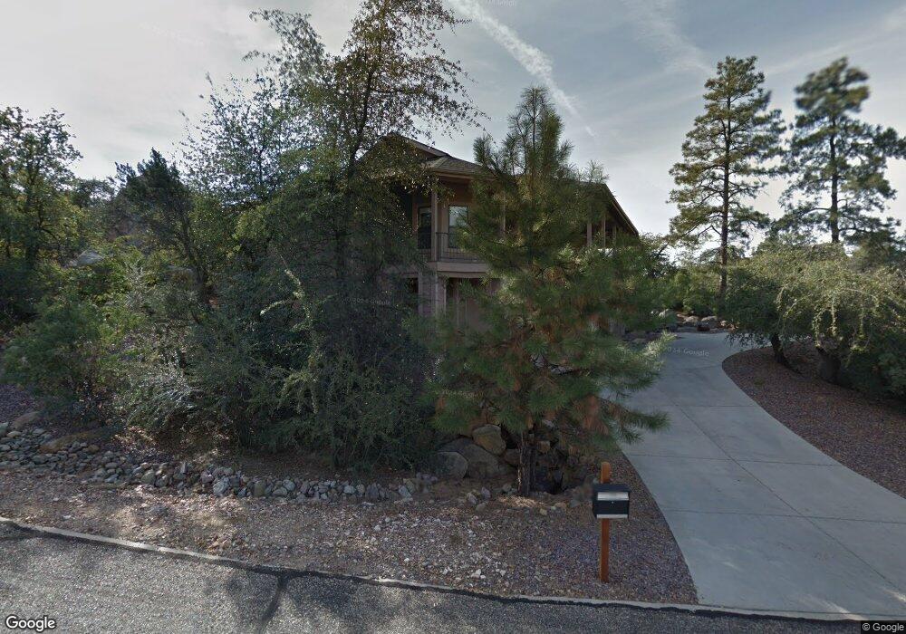
1586 Stone Trail Unit 1 Prescott, AZ 86305
Estimated Value: $728,000 - $786,000
--
Bed
3
Baths
1,891
Sq Ft
$403/Sq Ft
Est. Value
About This Home
This home is located at 1586 Stone Trail Unit 1, Prescott, AZ 86305 and is currently estimated at $762,325, approximately $403 per square foot. 1586 Stone Trail Unit 1 is a home located in Yavapai County with nearby schools including Granite Mountain Middle School, Lincoln Elementary School, and Prescott Mile High Middle School.
Ownership History
Date
Name
Owned For
Owner Type
Purchase Details
Closed on
Jul 11, 2022
Sold by
Robb Family Trust
Bought by
Delgadillo Tyrone L and Delgadillo Diana S
Current Estimated Value
Home Financials for this Owner
Home Financials are based on the most recent Mortgage that was taken out on this home.
Original Mortgage
$539,250
Outstanding Balance
$514,852
Interest Rate
5.51%
Mortgage Type
New Conventional
Estimated Equity
$247,473
Purchase Details
Closed on
Nov 9, 2021
Sold by
Robb John Edward and Robb Jodie Dolgin
Bought by
Robb John Edward and Robb Jodie Dolgin
Home Financials for this Owner
Home Financials are based on the most recent Mortgage that was taken out on this home.
Original Mortgage
$270,600
Interest Rate
3.01%
Mortgage Type
New Conventional
Purchase Details
Closed on
Dec 8, 2017
Sold by
Robb John and Robb Jodie
Bought by
Robb John Edward and Robb Jodie Dolgin
Home Financials for this Owner
Home Financials are based on the most recent Mortgage that was taken out on this home.
Original Mortgage
$283,800
Interest Rate
3.94%
Mortgage Type
New Conventional
Purchase Details
Closed on
Apr 23, 2015
Sold by
Robb John E and Robb Jodie D
Bought by
The Robb Family Trust and Robb Jodie Dolgin
Home Financials for this Owner
Home Financials are based on the most recent Mortgage that was taken out on this home.
Original Mortgage
$284,000
Interest Rate
3.64%
Mortgage Type
New Conventional
Purchase Details
Closed on
Dec 11, 2009
Sold by
Gregory Gayle Lake and Rowell Gayle L
Bought by
Mccormick Larry J
Home Financials for this Owner
Home Financials are based on the most recent Mortgage that was taken out on this home.
Original Mortgage
$225,000
Interest Rate
4.78%
Mortgage Type
New Conventional
Purchase Details
Closed on
Aug 15, 2002
Sold by
Miller Richard A and Miller Nona M
Bought by
Rowell Gayle L
Home Financials for this Owner
Home Financials are based on the most recent Mortgage that was taken out on this home.
Original Mortgage
$222,900
Interest Rate
5.25%
Mortgage Type
New Conventional
Create a Home Valuation Report for This Property
The Home Valuation Report is an in-depth analysis detailing your home's value as well as a comparison with similar homes in the area
Home Values in the Area
Average Home Value in this Area
Purchase History
| Date | Buyer | Sale Price | Title Company |
|---|---|---|---|
| Delgadillo Tyrone L | $719,000 | Landmark Title | |
| Robb John Edward | -- | Amrock Inc | |
| Robb John Edward | -- | Amrock Inc | |
| Robb John Edward | -- | Lawyers Title Navajo Apache | |
| Robb John | -- | Lawyers Title Navajo Apache | |
| The Robb Family Trust | -- | Yavapai Title | |
| Robb John E | $355,000 | Yavapai Title | |
| Mccormick Larry J | $300,000 | First American Title Ins Co | |
| Rowell Gayle L | $50,000 | First American Title Ins Co |
Source: Public Records
Mortgage History
| Date | Status | Borrower | Loan Amount |
|---|---|---|---|
| Open | Delgadillo Tyrone L | $539,250 | |
| Previous Owner | Robb John Edward | $270,600 | |
| Previous Owner | Robb John | $283,800 | |
| Previous Owner | Robb John E | $284,000 | |
| Previous Owner | Mccormick Larry J | $225,000 | |
| Previous Owner | Rowell Gayle L | $222,900 |
Source: Public Records
Tax History Compared to Growth
Tax History
| Year | Tax Paid | Tax Assessment Tax Assessment Total Assessment is a certain percentage of the fair market value that is determined by local assessors to be the total taxable value of land and additions on the property. | Land | Improvement |
|---|---|---|---|---|
| 2026 | $2,405 | $70,004 | -- | -- |
| 2024 | $1,918 | $66,305 | -- | -- |
| 2023 | $1,918 | $52,614 | $9,929 | $42,685 |
| 2022 | $1,892 | $43,948 | $7,940 | $36,008 |
| 2021 | $2,030 | $42,498 | $7,027 | $35,471 |
| 2020 | $2,039 | $0 | $0 | $0 |
| 2019 | $2,024 | $0 | $0 | $0 |
| 2018 | $1,934 | $0 | $0 | $0 |
| 2017 | $1,864 | $0 | $0 | $0 |
| 2016 | $1,856 | $0 | $0 | $0 |
| 2015 | $1,800 | $0 | $0 | $0 |
| 2014 | -- | $0 | $0 | $0 |
Source: Public Records
Map
Nearby Homes
- 1966 Lower Crestview
- 1507 Sierry Springs Dr
- 1991 Forest View
- 1962 Forest View
- 8 Lots Shannon Ln
- 1940 W Rock Castle
- 1492 Forest View W
- 2349 Loma Vista Dr
- 1790 N Holiday
- 2022 Shannon Ln
- 2023 Shannon Ln
- 2024 Shannon Ln
- 1944 Forest View
- 1377 Dalke Point
- 1466 Sierry Springs Dr
- 2025 Shannon Ln
- 1464 Sierry Springs Dr
- 1849 Enchanted Canyon Way
- 2301 Loma Vista Dr
- 1462 Sierry Springs Dr
- 1586 Stone Trail
- 1955 Crossroads
- 0 Crossroads
- 1910 Crossroads Unit 2
- 1910 Crossroads
- 1583 Stone Trail Unit 1
- 1940 Crossroads
- 1950 Crossroads
- 1950 Crossroads Unit 1
- 1579 Stone Trail
- 1930 Crossroads
- 1930 Crossroads Unit 4
- 1960 Crossroads
- 1915 Crossroads Unit 1
- 1574 Stone Trail
- 1967 Crossroads
- 1920 Crossroads
- 1920 Crossroads Unit 1
- 1969 Crossroads
- 1583 Sierry Peaks Dr