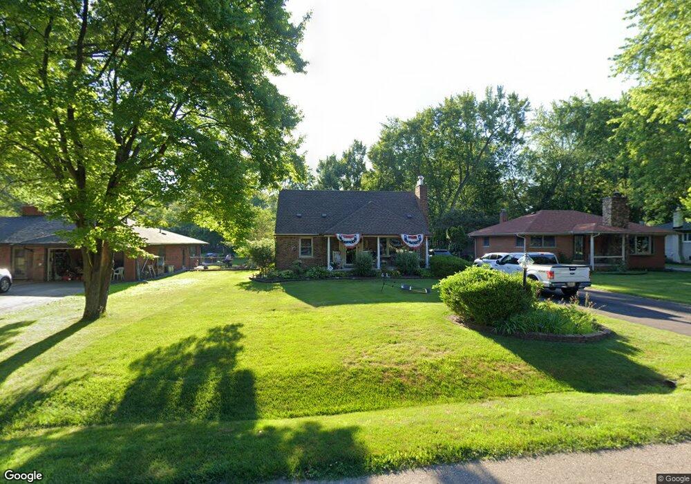
15860 Foch St Livonia, MI 48154
Estimated Value: $261,000 - $331,000
3
Beds
3
Baths
1,544
Sq Ft
$198/Sq Ft
Est. Value
About This Home
This home is located at 15860 Foch St, Livonia, MI 48154 and is currently estimated at $305,653, approximately $197 per square foot. 15860 Foch St is a home located in Wayne County with nearby schools including Riley Upper Elementary School, Buchanan Elementary School, and Holmes Middle School.
Ownership History
Date
Name
Owned For
Owner Type
Purchase Details
Closed on
Jun 14, 2005
Sold by
Mcdaniels Donnie Joe and Mcdaniels Catherine M
Bought by
Langley Steven M
Current Estimated Value
Purchase Details
Closed on
Jun 8, 2002
Sold by
Mcdaniels Catherine M
Bought by
Mcdaniels Donnie J
Purchase Details
Closed on
Dec 6, 1994
Sold by
Wagner Lawrence A
Bought by
Donnie J and Mc Daniels Catherine M
Home Financials for this Owner
Home Financials are based on the most recent Mortgage that was taken out on this home.
Original Mortgage
$120,000
Interest Rate
9.24%
Mortgage Type
New Conventional
Create a Home Valuation Report for This Property
The Home Valuation Report is an in-depth analysis detailing your home's value as well as a comparison with similar homes in the area
Home Values in the Area
Average Home Value in this Area
Purchase History
| Date | Buyer | Sale Price | Title Company |
|---|---|---|---|
| Langley Steven M | $225,000 | Multiple | |
| Mcdaniels Donnie J | -- | -- | |
| Donnie J | $135,000 | -- |
Source: Public Records
Mortgage History
| Date | Status | Borrower | Loan Amount |
|---|---|---|---|
| Previous Owner | Donnie J | $120,000 |
Source: Public Records
Tax History Compared to Growth
Tax History
| Year | Tax Paid | Tax Assessment Tax Assessment Total Assessment is a certain percentage of the fair market value that is determined by local assessors to be the total taxable value of land and additions on the property. | Land | Improvement |
|---|---|---|---|---|
| 2025 | $1,766 | $160,800 | $0 | $0 |
| 2024 | $1,766 | $137,500 | $0 | $0 |
| 2023 | $1,684 | $118,100 | $0 | $0 |
| 2022 | $2,958 | $103,200 | $0 | $0 |
| 2021 | $2,873 | $99,100 | $0 | $0 |
| 2019 | $2,756 | $90,800 | $0 | $0 |
| 2018 | $1,424 | $85,900 | $0 | $0 |
| 2017 | $2,521 | $84,900 | $0 | $0 |
| 2016 | $2,417 | $82,700 | $0 | $0 |
| 2015 | $5,852 | $67,730 | $0 | $0 |
| 2012 | -- | $56,700 | $14,060 | $42,640 |
Source: Public Records
Map
Nearby Homes
- 15681 Foch St
- 27416 Sunnydale St
- 27480 5 Mile Rd
- 15660 Meadowbrook Rd
- 27510 Five Mile Rd
- 14920 Taylor Blvd
- 14907 Taylor Blvd
- 28692 Bayberry Park Dr
- 14844 Inkster Rd
- 15988 Delaware Ave
- 27427 Vargo St
- 27030 W 6 Mile Rd
- 27674 Western Golf Dr
- 26610 W 6 Mile Rd
- 15433 Norborne
- 15608 Hidden Ln
- 18001 Floral St
- 14328 Brook Dr
- 15389 Centralia
- 18071 Floral St
- 15872 Foch St
- 15852 Foch St
- 15840 Foch St
- 15894 Foch St
- 15836 Foch St
- 15805 Green Lane Ave
- 15825 Green Lane Ave
- 15841 Green Lane Ave
- 15828 Foch St
- 15775 Green Lane Ave
- 15845 Green Lane Ave
- 15861 Foch St
- 15853 Foch St
- 15873 Foch St
- 15837 Foch St
- 15918 Foch St
- 15745 Green Lane Ave
- 15895 Green Lane Ave
- 15735 Green Lane Ave
- MILFORD Green Lane Ave