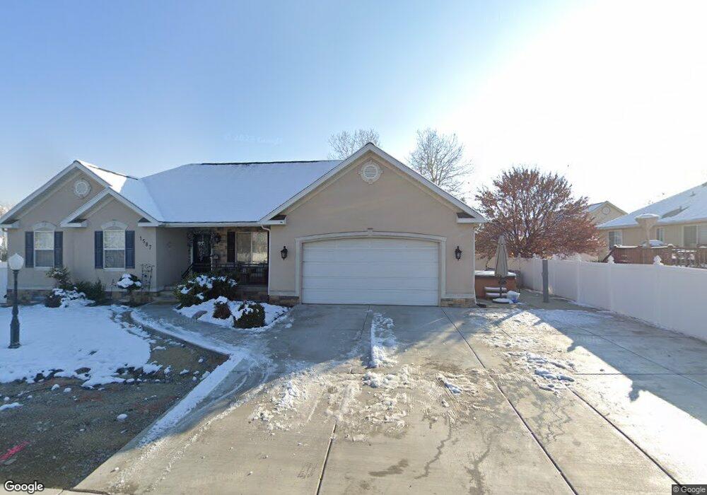
1587 W 1010 N Pleasant Grove, UT 84062
Estimated Value: $591,000 - $670,000
6
Beds
3
Baths
3,016
Sq Ft
$208/Sq Ft
Est. Value
About This Home
This home is located at 1587 W 1010 N, Pleasant Grove, UT 84062 and is currently estimated at $626,844, approximately $207 per square foot. 1587 W 1010 N is a home located in Utah County with nearby schools including Mount Mahogany School, Pleasant Grove Junior High School, and Pleasant Grove High School.
Ownership History
Date
Name
Owned For
Owner Type
Purchase Details
Closed on
Jan 8, 2019
Sold by
Snyder Paul A and Snyder Ginnie Z
Bought by
Jackman Rachel Christine
Current Estimated Value
Purchase Details
Closed on
Jul 1, 2014
Sold by
Snyder Paul and Snyder Ginnie
Bought by
Paul A Snyder Family Trust and Snyder Paul A
Home Financials for this Owner
Home Financials are based on the most recent Mortgage that was taken out on this home.
Original Mortgage
$240,000
Interest Rate
4.09%
Mortgage Type
New Conventional
Purchase Details
Closed on
Jun 2, 2014
Sold by
Hammond Clark
Bought by
Hammond Shawna Lebaron
Home Financials for this Owner
Home Financials are based on the most recent Mortgage that was taken out on this home.
Original Mortgage
$240,000
Interest Rate
4.09%
Mortgage Type
New Conventional
Purchase Details
Closed on
Feb 2, 2011
Sold by
Hammond Clark
Bought by
Hammond Shawna Lebaron
Purchase Details
Closed on
Feb 9, 2006
Sold by
Hammond Shawna and Hammond Clark
Bought by
Hammond Clark and Hammond Shawna
Home Financials for this Owner
Home Financials are based on the most recent Mortgage that was taken out on this home.
Original Mortgage
$228,000
Interest Rate
6.16%
Mortgage Type
New Conventional
Purchase Details
Closed on
Jun 18, 2004
Sold by
Jolley Sean Gibson and Jolley Molly Brock
Bought by
Hammond Shawna and Hammond Clark
Purchase Details
Closed on
Mar 26, 2003
Sold by
Marlowe David V and Marlowe Emily D
Bought by
Jolley Sean Gibson and Jolley Molly Brock
Home Financials for this Owner
Home Financials are based on the most recent Mortgage that was taken out on this home.
Original Mortgage
$127,147
Interest Rate
5.79%
Purchase Details
Closed on
Mar 13, 1998
Sold by
Matthews Marshall E and Matthews Diane S
Bought by
Marlowe David and Marlowe Emily D
Home Financials for this Owner
Home Financials are based on the most recent Mortgage that was taken out on this home.
Original Mortgage
$174,572
Interest Rate
7.02%
Mortgage Type
VA
Purchase Details
Closed on
Jan 21, 1996
Sold by
Country Living Development L L C
Bought by
Matthews Marshall E and Matthews Diane S
Create a Home Valuation Report for This Property
The Home Valuation Report is an in-depth analysis detailing your home's value as well as a comparison with similar homes in the area
Home Values in the Area
Average Home Value in this Area
Purchase History
| Date | Buyer | Sale Price | Title Company |
|---|---|---|---|
| Jackman Rachel Christine | -- | Gt Title Services | |
| Paul A Snyder Family Trust | -- | Affiliated First Title Co | |
| Snyder Paul | -- | Title One | |
| Hammond Shawna Lebaron | -- | None Available | |
| Hammond Shawna Lebaron | -- | None Available | |
| Hammond Clark | -- | Utah Standard Title | |
| Hammond Shawna | -- | First American Title Co | |
| Jolley Sean Gibson | -- | Affiliated First Title | |
| Marlowe David | -- | -- | |
| Matthews Marshall E | -- | -- |
Source: Public Records
Mortgage History
| Date | Status | Borrower | Loan Amount |
|---|---|---|---|
| Previous Owner | Snyder Paul | $240,000 | |
| Previous Owner | Hammond Clark | $228,000 | |
| Previous Owner | Jolley Sean Gibson | $127,147 | |
| Previous Owner | Marlowe David | $174,572 |
Source: Public Records
Tax History Compared to Growth
Tax History
| Year | Tax Paid | Tax Assessment Tax Assessment Total Assessment is a certain percentage of the fair market value that is determined by local assessors to be the total taxable value of land and additions on the property. | Land | Improvement |
|---|---|---|---|---|
| 2025 | $2,380 | $304,920 | $192,600 | $361,800 |
| 2024 | $2,380 | $284,020 | $0 | $0 |
| 2023 | $2,331 | $284,790 | $0 | $0 |
| 2022 | $2,370 | $288,145 | $0 | $0 |
| 2021 | $2,114 | $391,200 | $129,000 | $262,200 |
| 2020 | $1,937 | $351,400 | $115,200 | $236,200 |
| 2019 | $1,655 | $310,500 | $111,700 | $198,800 |
| 2018 | $1,565 | $277,600 | $104,700 | $172,900 |
| 2017 | $1,576 | $148,830 | $0 | $0 |
| 2016 | $1,536 | $140,085 | $0 | $0 |
| 2015 | $1,544 | $133,320 | $0 | $0 |
| 2014 | $1,522 | $130,240 | $0 | $0 |
Source: Public Records
Map
Nearby Homes
- 1515 W 1010 St N
- 1491 W 1010 N
- 1541 W 1060 N
- 1443 W 1010 N
- 1498 W 1060 N Unit 5
- Lytham Plan at Grove Acres
- 1065 N 1420 W
- 1096 N 1420 St W Unit 27
- 1171 N 1430 W
- 1879 W 1100 N
- 759 W 930 N Unit 502
- 708 W 930 N Unit 505
- 734 W 930 N Unit 506
- 1598 W 220 N
- 1320 W 1340 N
- 1141 E 50 N
- 295 N 1580 W
- 293 N 1630 W
- 1525 W 300 N
- 1130 W State Rd