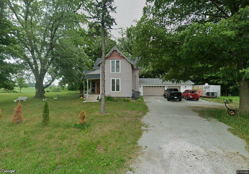
15878 Nutmeg Rd Plymouth, IN 46563
Estimated Value: $270,854 - $570,000
3
Beds
2
Baths
2,136
Sq Ft
$179/Sq Ft
Est. Value
About This Home
This home is located at 15878 Nutmeg Rd, Plymouth, IN 46563 and is currently estimated at $382,618, approximately $179 per square foot. 15878 Nutmeg Rd is a home located in Marshall County with nearby schools including Argos Community Elementary School and Argos Community Junior-Senior High School.
Ownership History
Date
Name
Owned For
Owner Type
Purchase Details
Closed on
Jul 25, 2024
Sold by
Ksf Farms Llc
Bought by
Baca Antonio and Garcia Miriam Martinez
Current Estimated Value
Purchase Details
Closed on
Mar 29, 2018
Sold by
Reiss Timothy and Reiss Jennifer L
Bought by
Ksf Farms Llc
Purchase Details
Closed on
Jun 5, 2006
Sold by
Reiss Timothy
Bought by
Reiss Timothy and Reiss Jennifer L
Home Financials for this Owner
Home Financials are based on the most recent Mortgage that was taken out on this home.
Original Mortgage
$71,550
Interest Rate
9.75%
Mortgage Type
Adjustable Rate Mortgage/ARM
Create a Home Valuation Report for This Property
The Home Valuation Report is an in-depth analysis detailing your home's value as well as a comparison with similar homes in the area
Home Values in the Area
Average Home Value in this Area
Purchase History
| Date | Buyer | Sale Price | Title Company |
|---|---|---|---|
| Baca Antonio | -- | None Listed On Document | |
| Ksf Farms Llc | $24,000 | None Available | |
| Reiss Timothy | -- | Mckesson Title Corp | |
| Reiss Timothy | -- | Mckesson Title Corp |
Source: Public Records
Mortgage History
| Date | Status | Borrower | Loan Amount |
|---|---|---|---|
| Previous Owner | Reiss Timothy | $71,550 |
Source: Public Records
Tax History Compared to Growth
Tax History
| Year | Tax Paid | Tax Assessment Tax Assessment Total Assessment is a certain percentage of the fair market value that is determined by local assessors to be the total taxable value of land and additions on the property. | Land | Improvement |
|---|---|---|---|---|
| 2024 | $1,394 | $188,400 | $41,400 | $147,000 |
| 2022 | $1,394 | $139,100 | $35,100 | $104,000 |
| 2021 | $746 | $36,600 | $30,500 | $6,100 |
| 2020 | $580 | $35,200 | $29,300 | $5,900 |
| 2019 | $572 | $34,000 | $28,400 | $5,600 |
| 2018 | $468 | $29,900 | $24,900 | $5,000 |
| 2017 | $953 | $58,500 | $24,700 | $33,800 |
| 2016 | $873 | $57,300 | $24,300 | $33,000 |
| 2014 | $879 | $59,200 | $26,800 | $32,400 |
Source: Public Records
Map
Nearby Homes
- 15871 18th Rd
- TBD Redwood Rd
- 16930 16c Rd
- 14990 Redwood Rd
- 735 Heritage St
- TBD Menominee Ln
- TBD 2 Menominee Ln
- * 16th Rd
- ** 16th Rd
- *** 16th Rd
- **** 16th Rd
- 14415 Lawrence Lake Dr
- 0 N Michigan Rd Unit 202531722
- 12628 Peach Rd
- 404 Yearick St
- 326 W Church St
- 204 Fawn Ct
- 15516 Menominee Dr
- 15560 Menominee Dr
- 333 Railroad St
- 15990 Nutmeg Rd
- 15855 Nutmeg Rd
- 16112 Nutmeg Rd
- 13588 15b Rd
- 14153 16th Rd
- 15408 Nutmeg Rd
- 13430 15b Rd
- 13634 Indiana 10
- 13716 State Road 10
- 13634 State Road 10
- 15283 Nutmeg Rd
- 13599 State Road 10
- 13719 State Road 10
- 15910 Olive Trail
- 15182 Nutmeg Rd
- 15179 Nutmeg Rd
- 13491 Sr 10
- 16035 Muckshaw Rd
- 16081 Muckshaw Rd
- 13491 State Road 10