15880 Brook Rd Lansing, MI 48906
Estimated Value: $242,000 - $288,000
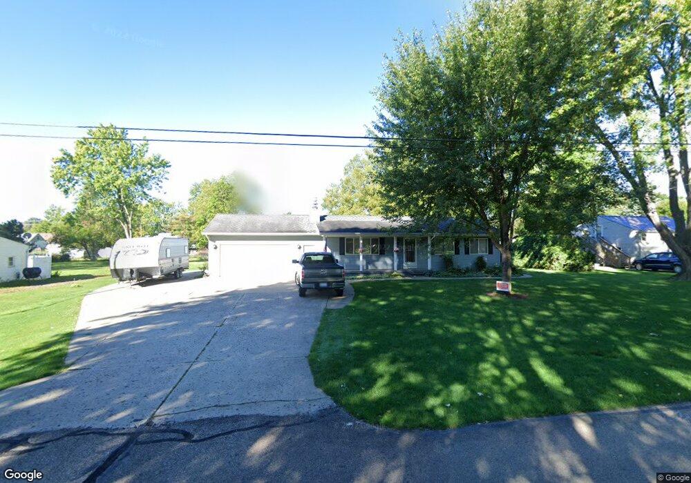
About This Home
This home is located at 15880 Brook Rd, Lansing, MI 48906 and is currently estimated at $271,519, approximately $237 per square foot. 15880 Brook Rd is a home located in Clinton County with nearby schools including Gier Park School, Pattengill Academy, and Eastern High School.
Ownership History
We collect this data history from publicly available records. To have your information removed, we recommend requesting removal directly through your county’s website.
Purchase Details
Purchase Details
Home Financials for this Owner
Home Financials are based on the most recent Mortgage that was taken out on this home.Home Values in the Area
Average Home Value in this Area
Purchase History
We collect this data history from publicly available records. To have your information removed, we recommend requesting removal directly through your county’s website.
| Date | Buyer | Sale Price | Title Company |
|---|---|---|---|
| -- | None Available | ||
| -- | None Available |
Mortgage History
We collect this data history from publicly available records. To have your information removed, we recommend requesting removal directly through your county’s website.
| Date | Status | Borrower | Loan Amount |
|---|---|---|---|
| Closed | $82,500 |
Tax History
We collect this data history from publicly available records. To have your information removed, we recommend requesting removal directly through your county’s website.
| Year | Tax Paid | Tax Assessment Tax Assessment Total Assessment is a certain percentage of the fair market value that is determined by local assessors to be the total taxable value of land and additions on the property. | Land | Improvement |
|---|---|---|---|---|
| 2026 | $1,801 | $136,500 | $24,700 | $111,800 |
| 2025 | $1,801 | $126,800 | $22,700 | $104,100 |
| 2024 | $17 | $117,800 | $21,300 | $96,500 |
| 2023 | $1,661 | $110,600 | $0 | $0 |
| 2022 | $2,406 | $98,200 | $18,900 | $79,300 |
| 2021 | $2,332 | $92,800 | $18,200 | $74,600 |
| 2020 | $2,305 | $90,200 | $17,200 | $73,000 |
| 2019 | $2,205 | $85,400 | $16,100 | $69,300 |
| 2018 | $1,928 | $73,200 | $17,100 | $56,100 |
| 2017 | $1,902 | $69,000 | $15,600 | $53,400 |
| 2016 | $1,884 | $63,600 | $14,700 | $48,900 |
| 2015 | $1,841 | $59,500 | $0 | $0 |
| 2011 | -- | $70,400 | $0 | $0 |
Map
- 15710 Oak Lane Dr
- 15791 Northward Dr
- 0 E State Rd Unit 297256
- 1064 Hannah Ave
- E State Rd
- 16124 Eskes St
- 15418 Chetwyn Dr
- 15178 Chetwyn Dr
- 15136 Via Carmella Dr
- 1345 W Stoll Rd
- 15089 Pinehurst Dr
- 605 Galahad Dr Unit 374
- 15100 Glencrest Dr
- 159 Donald Ave Unit 159
- 108 Normandy Dr Unit 77
- 107 Normandy Dr Unit 100
- 135 Desander Dr Unit 135
- 712 Sanford St
- 3425 Turner Rd
- 229 Cadgewith E
Ask me questions while you tour the home.