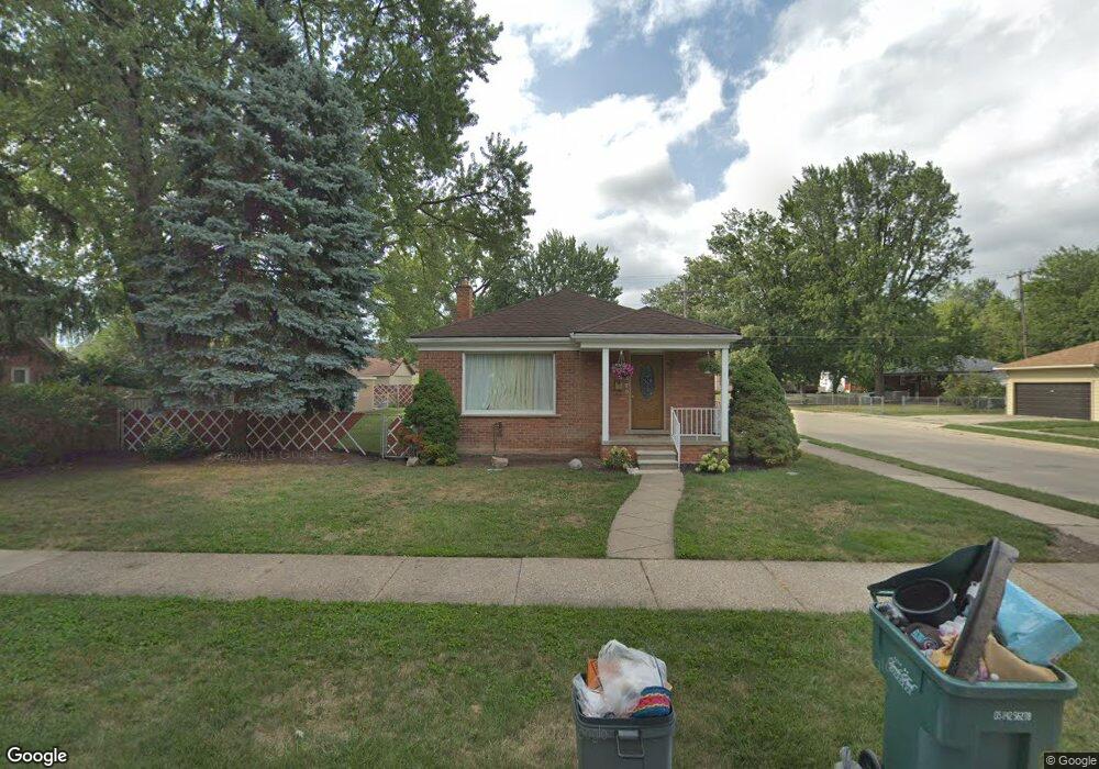
1589 London Ave Unit Bldg-Unit Lincoln Park, MI 48146
Estimated Value: $170,000 - $187,990
--
Bed
2
Baths
1,026
Sq Ft
$175/Sq Ft
Est. Value
About This Home
This home is located at 1589 London Ave Unit Bldg-Unit, Lincoln Park, MI 48146 and is currently estimated at $179,748, approximately $175 per square foot. 1589 London Ave Unit Bldg-Unit is a home located in Wayne County with nearby schools including James Foote School, Lincoln Park Middle School, and Lincoln Park High School.
Ownership History
Date
Name
Owned For
Owner Type
Purchase Details
Closed on
Feb 22, 2018
Sold by
Chamseddine Property Llc
Bought by
Demske Richard
Current Estimated Value
Purchase Details
Closed on
Jul 19, 2010
Sold by
Baadani Ashley
Bought by
Chamseddine Property Llc
Purchase Details
Closed on
Feb 17, 2010
Sold by
Kirkpatrick Dennis
Bought by
Wells Fargo Bank National Association
Purchase Details
Closed on
May 16, 1997
Sold by
Arthur E and Sonn Audrey A
Bought by
Dennis Kirkpatrick
Create a Home Valuation Report for This Property
The Home Valuation Report is an in-depth analysis detailing your home's value as well as a comparison with similar homes in the area
Home Values in the Area
Average Home Value in this Area
Purchase History
| Date | Buyer | Sale Price | Title Company |
|---|---|---|---|
| Demske Richard | $103,000 | Michigan Title Ins Agency In | |
| Chamseddine Property Llc | $16,500 | None Available | |
| Wells Fargo Bank National Association | $184,761 | None Available | |
| Dennis Kirkpatrick | $85,450 | -- |
Source: Public Records
Tax History Compared to Growth
Tax History
| Year | Tax Paid | Tax Assessment Tax Assessment Total Assessment is a certain percentage of the fair market value that is determined by local assessors to be the total taxable value of land and additions on the property. | Land | Improvement |
|---|---|---|---|---|
| 2025 | $2,036 | $82,800 | $0 | $0 |
| 2024 | $2,036 | $75,400 | $0 | $0 |
| 2023 | $1,930 | $71,300 | $0 | $0 |
| 2022 | $2,278 | $61,500 | $0 | $0 |
| 2021 | $2,231 | $46,800 | $0 | $0 |
| 2020 | $2,212 | $40,800 | $0 | $0 |
| 2019 | $1,749 | $39,800 | $0 | $0 |
| 2018 | $1,336 | $33,100 | $0 | $0 |
| 2017 | $963 | $33,300 | $0 | $0 |
| 2016 | $2,301 | $33,100 | $0 | $0 |
| 2015 | $3,190 | $31,900 | $0 | $0 |
| 2013 | $3,290 | $33,600 | $0 | $0 |
| 2012 | $2,757 | $35,400 | $7,200 | $28,200 |
Source: Public Records
Map
Nearby Homes
- 1554 London Ave
- 1565 Richmond Ave
- 1512 Richmond Ave
- 3134 Lafayette Blvd
- 1623 Mayflower Ave
- 1608 Stewart Ave
- 1706 Richmond Ave
- 1577 Pagel Ave
- 1424 Mayflower Ave
- 1665 Pagel Ave
- 1673 Pagel Ave
- 1532 Buckingham Ave
- 1571 Progress Ave
- 1771 Stewart Ave
- 2932 Green St
- 1453 Buckingham Ave
- 1820 Buckingham Ave
- 1837 Pagel Ave
- 1860 Pagel Ave
- 1805 Rose Ave
- 1589 London Ave
- 1575 London Ave
- 1603 London Ave
- 1590 Richmond Ave
- 1580 Richmond Ave
- 1573 London Ave
- 1582 Richmond Ave
- 1612 Richmond Ave
- 1578 Richmond Ave
- 1574 Richmond Ave
- 1588 London Ave
- 1569 London Ave
- 1578 London Ave
- 1568 London Ave
- 3134 Howard St
- 1615 London Ave
- 1566 Richmond Ave Unit Bldg-Unit
- 1566 Richmond Ave
- 1559 London Ave
- 1562 London Ave