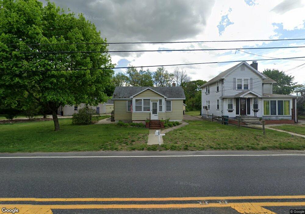
159 Berkley Rd Clarksboro, NJ 08020
East Greenwich Township NeighborhoodEstimated Value: $188,570 - $359,000
--
Bed
--
Bath
1,164
Sq Ft
$242/Sq Ft
Est. Value
About This Home
This home is located at 159 Berkley Rd, Clarksboro, NJ 08020 and is currently estimated at $281,643, approximately $241 per square foot. 159 Berkley Rd is a home located in Gloucester County with nearby schools including Jeffrey Clark School, Samuel Mickle School, and Kingsway Regional Middle School.
Ownership History
Date
Name
Owned For
Owner Type
Purchase Details
Closed on
Sep 24, 2023
Sold by
Carty Thomas and Carty Sandra
Bought by
Carty Sandra
Current Estimated Value
Purchase Details
Closed on
Jul 30, 2003
Sold by
Lippincott Joy F and Lippincott Joy Ford
Bought by
Lippincott Joy F
Purchase Details
Closed on
Jun 12, 2003
Sold by
Lippincott Joy Ford
Bought by
Lippincott Joy Ford
Create a Home Valuation Report for This Property
The Home Valuation Report is an in-depth analysis detailing your home's value as well as a comparison with similar homes in the area
Home Values in the Area
Average Home Value in this Area
Purchase History
| Date | Buyer | Sale Price | Title Company |
|---|---|---|---|
| Carty Sandra | -- | None Listed On Document | |
| Lippincott Joy F | -- | -- | |
| Lippincott Joy Ford | -- | -- |
Source: Public Records
Tax History Compared to Growth
Tax History
| Year | Tax Paid | Tax Assessment Tax Assessment Total Assessment is a certain percentage of the fair market value that is determined by local assessors to be the total taxable value of land and additions on the property. | Land | Improvement |
|---|---|---|---|---|
| 2025 | $4,241 | $133,400 | $52,700 | $80,700 |
| 2024 | $4,106 | $133,400 | $52,700 | $80,700 |
| 2023 | $4,106 | $133,400 | $52,700 | $80,700 |
| 2022 | $3,547 | $118,600 | $37,900 | $80,700 |
| 2021 | $3,571 | $118,600 | $37,900 | $80,700 |
| 2020 | $3,588 | $118,600 | $37,900 | $80,700 |
| 2019 | $3,551 | $118,600 | $37,900 | $80,700 |
| 2018 | $3,521 | $106,800 | $36,400 | $70,400 |
| 2017 | $3,475 | $106,800 | $36,400 | $70,400 |
| 2016 | $3,435 | $106,800 | $36,400 | $70,400 |
| 2015 | $3,292 | $106,800 | $36,400 | $70,400 |
| 2014 | $3,089 | $106,800 | $36,400 | $70,400 |
Source: Public Records
Map
Nearby Homes
- 1309 Kohana Dr
- 2804 Lamington Ct
- L5 Lodge Ave
- L8 Lodge Ave
- 0 Lodge Ave
- 8 S Delaware St
- 1224 Heddon Ave
- 1214 Walter Ave
- 1534 Pine St
- 322 Iannelli Rd
- 308 W Broad St
- 219 Vanneman Blvd
- 459 W Broad St
- L18 20 W Broad St
- 123 W Buck St
- 209 Charles Corliss Blvd
- 227 W Buck St
- 122 W Washington St
- 11 W Washington St
- 53 Currant Dr
- 161 Berkley Rd
- 178 W Cohawkin Rd
- 163 Berkley Rd
- 165 Berkley Rd
- 182 W Cohawkin Rd
- 164 Berkley Rd
- 180 W Cohawkin Rd
- 176 W Cohawkin Rd
- 174 W Cohawkin Rd
- 172 W Cohawkin Rd
- 170 W Cohawkin Rd
- 104 Robert Botto Way
- 108 Robert Botto Way
- 124 Robert Botto Way
- 120 Robert Botto Way
- 175 W Cohawkin Rd
- 185 W Cohawkin Rd
- 191 W Cohawkin Rd Unit A - DOWNSTAIRS
- 191 W Cohawkin Rd
- 191 W Cohawkin Rd Unit B- UPSTAIRS